Summaries of Kentucky Weather data are provided by the University of Kentucky, College of Agriculture, Ag. Weather Center. For raw data from the Kentucky Mesonet, contact the Kentucky Mesonet at: 270.745.4567 kymesonet@wku.edu
Kentucky Ag Models
A cooperation between the UK Ag Weather Center, Kentucky Mesonet, and the National Weather Service
Irrigation Manager:
Evapotranspiration is a general way to estimate how much moisture or water your farm is losing on a daily basis. Comparing this data to the daily rainfall totals can give an idea as to whether irrigation is necessary and if so, how much. This program was developed to aid the grower in this aspect of farm management, while at the same time, saving money. In this model, a grower can obtain a variety of information in relation to irrigation purposes ranging from evapotranspiration estimates, rainfall totals, to a generalized moisture surplus or deficit over a specific time period (Model).Plant Disease and Insect Prediction Models:
In cooperation with specialists across the College of Agriculture at the University of Kentucky, models were created to predict the onset of particular diseases and insects related to apples, pears, peaches, grapes, and turf grass. Each model contains a brief description of the disease or insect, in addition to the current risk for a certain location, preventative measures, and spraying applications (Model).Degree Day Models:
Models were developed to allow Kentucky growers to utilize the calculation of growing degree days (GDDs) in a variety of applications. This ranges from calculating the amount of GDDs accumulated since corn planting to estimating the onset of a particular pest. Maps are also included for comparison across the Commonwealth (Model).Burley Curing Model:
Proper curing of burley tobacco depends as much on management and facilities as it does on the weather. Each year there are good and poor periods of curing weather, but overall, the natural air curing in Kentucky and surrounding states produces high quality burley tobacco. The following model gives real time guidance on curing management based on real-time data from the Kentucky Mesonet and the UK Point Ag Forecast (Model).Residental Energy Model: Heating & Cooling Degree Days
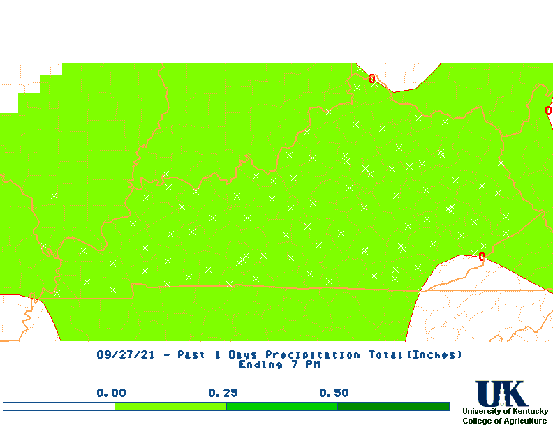
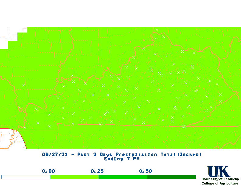
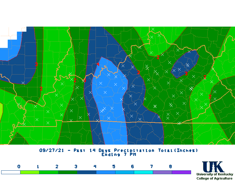
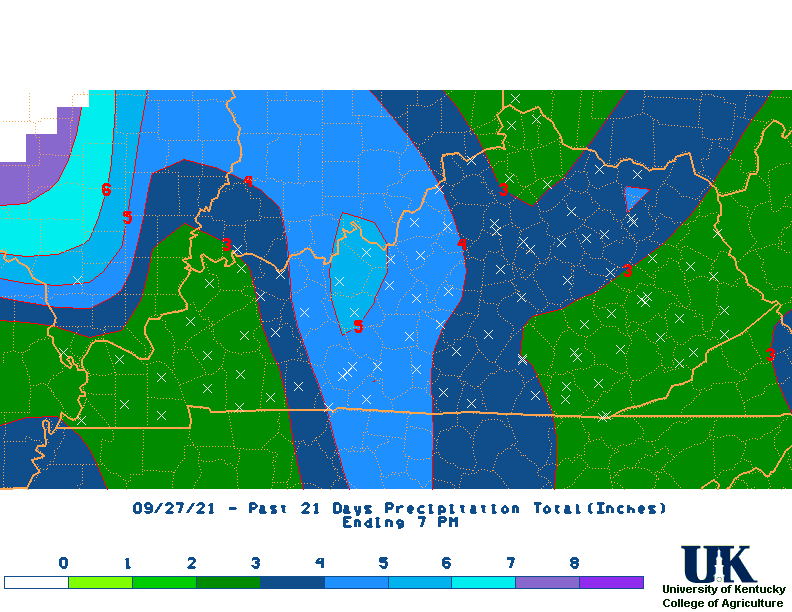
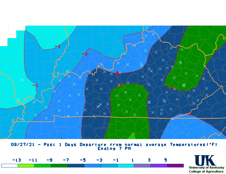
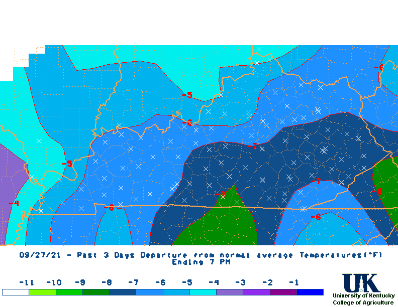
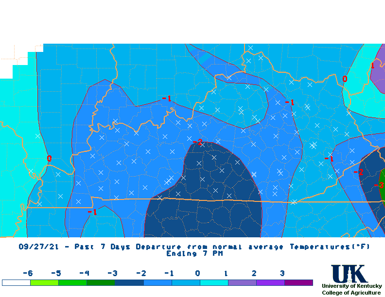
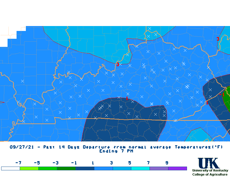
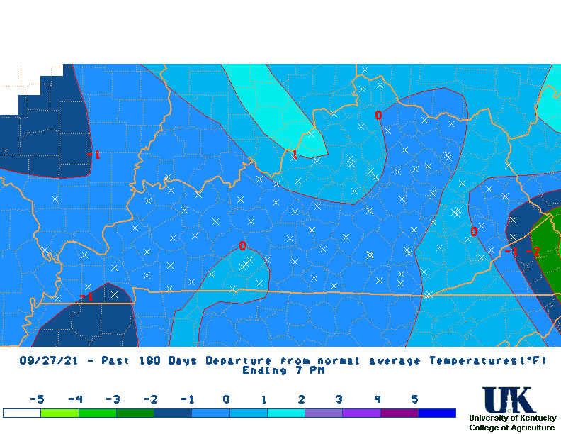
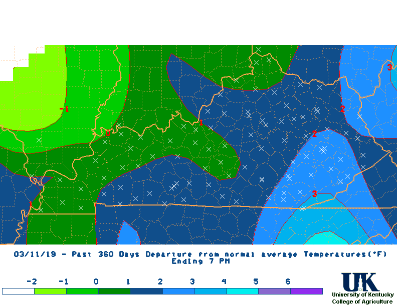
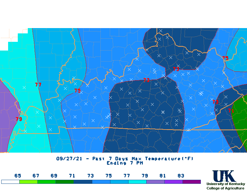
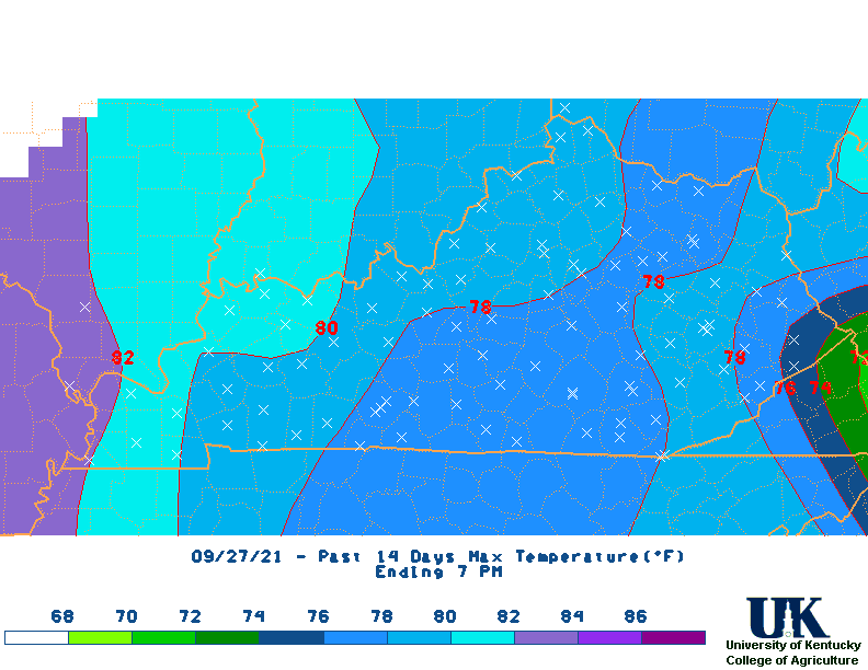
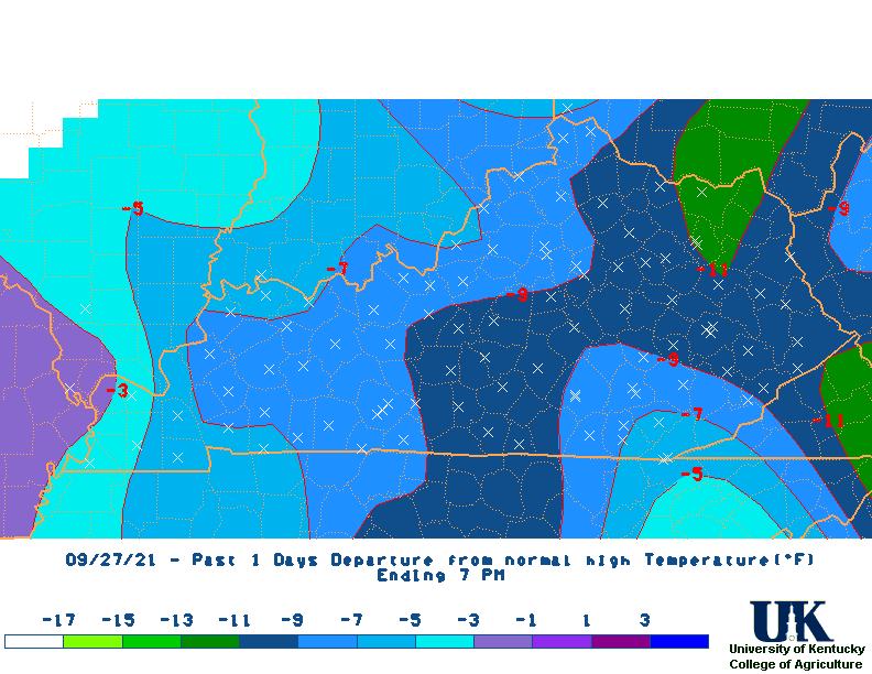
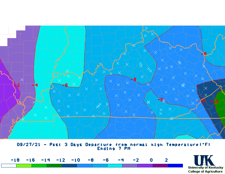
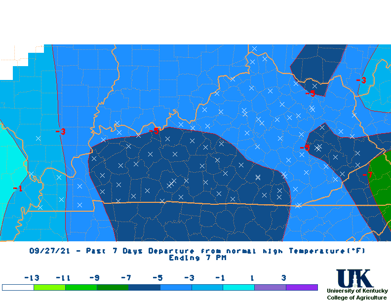
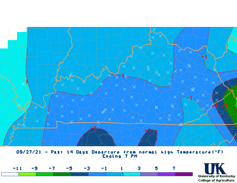
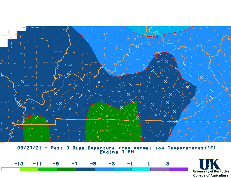
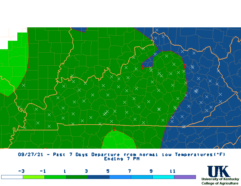
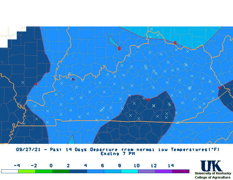
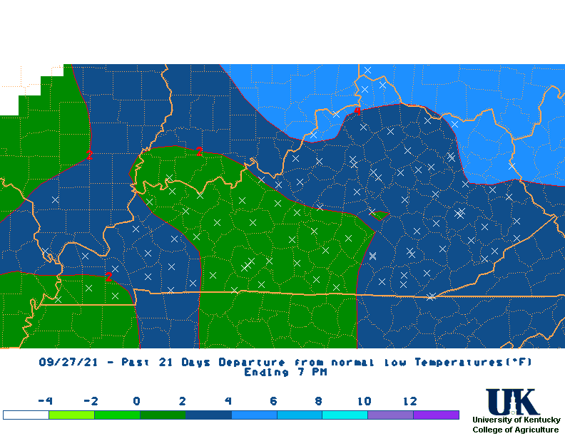
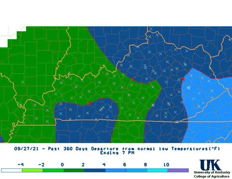
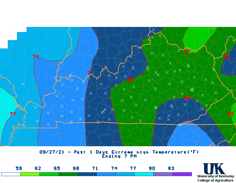
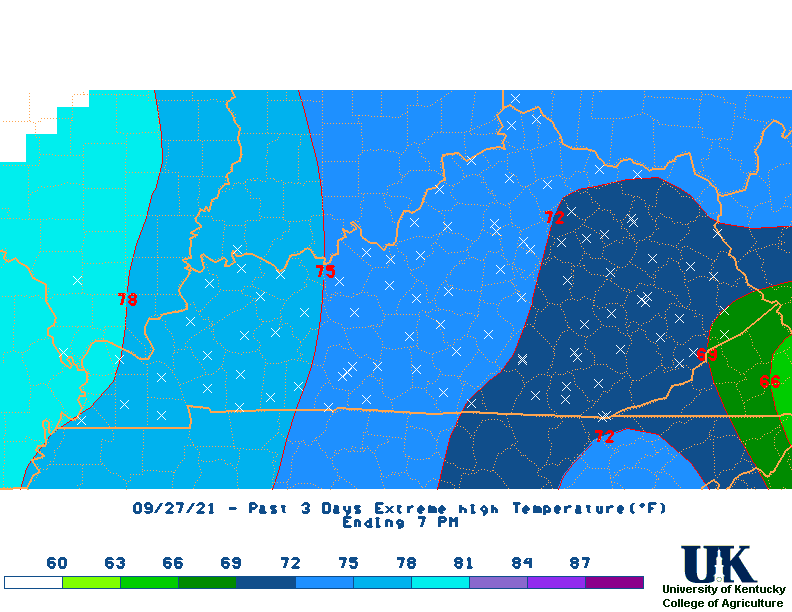
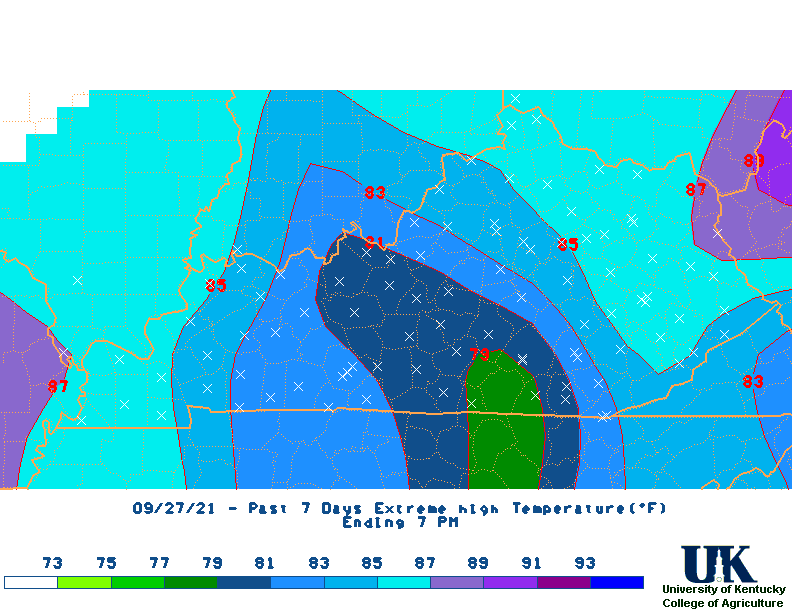
![]() Summary of Kentucky Mesonet & NWS Weather Stations for various time periods for entire state:(Updated daily - Based on PM Obs.)
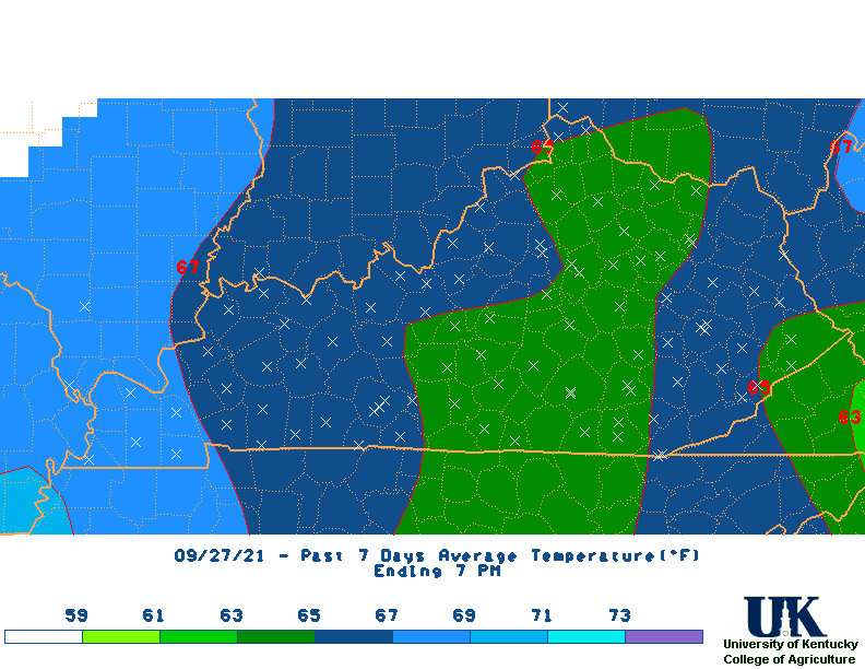
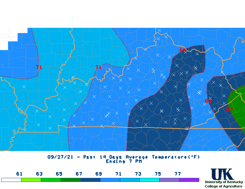
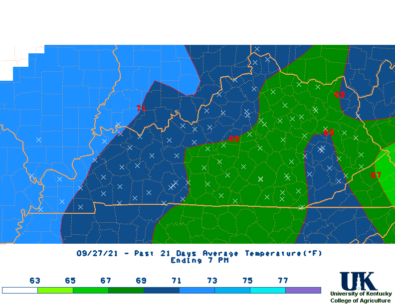
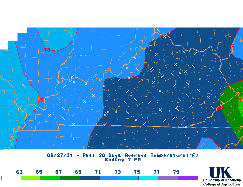
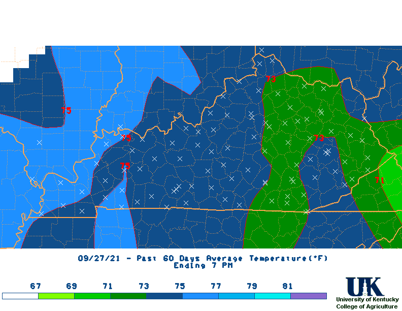
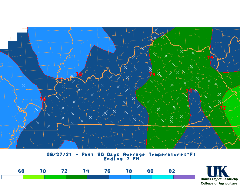
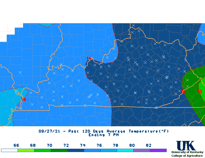
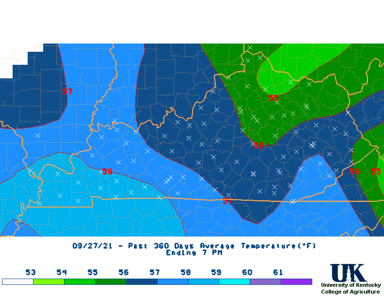
Summary of Kentucky Mesonet & NWS Weather Stations for various time periods for entire state:(Updated daily - Based on PM Obs.)
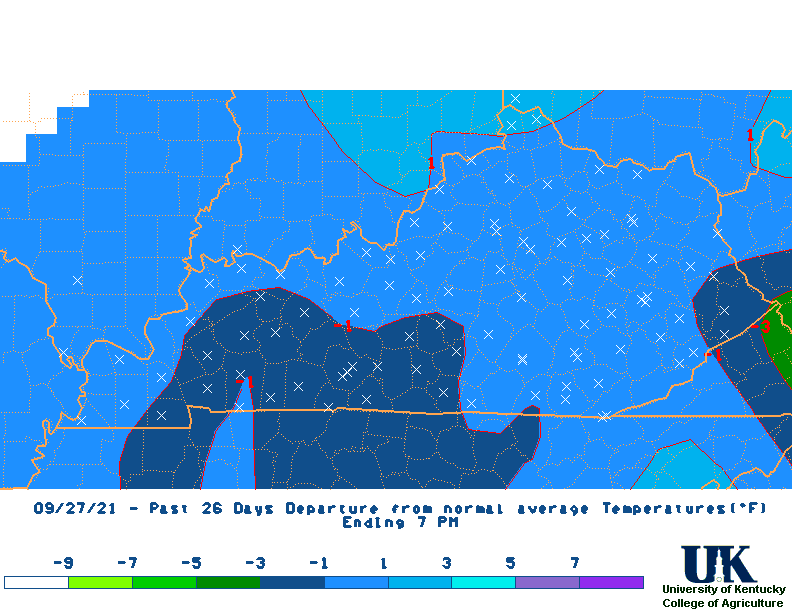
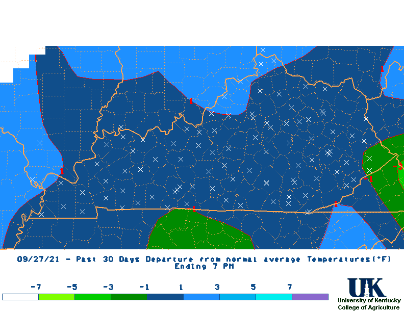
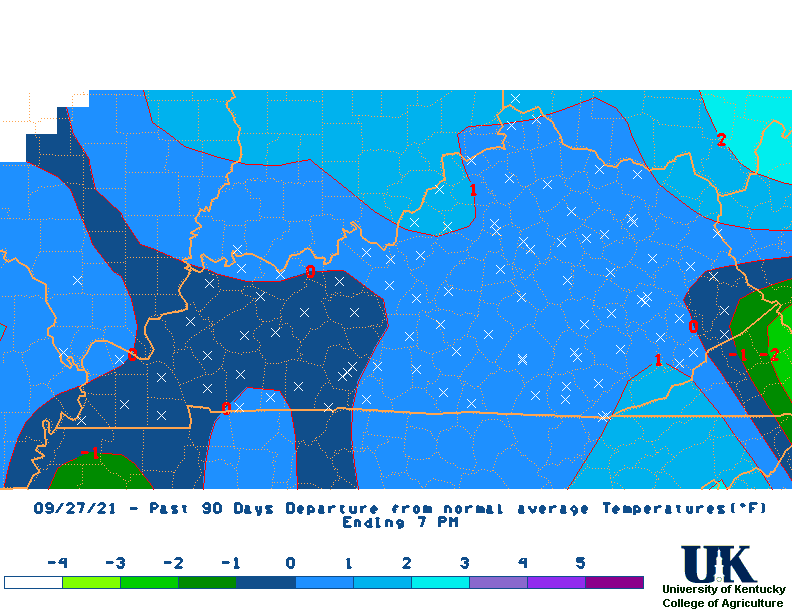
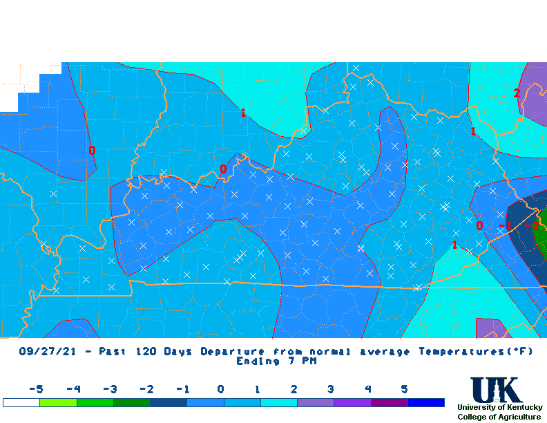
| LAST n DAYS | 1 | 3 | 7 | 14 | 21 | 30 | 60 | 90 | 120 | 180 | 360 |
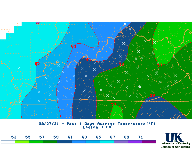
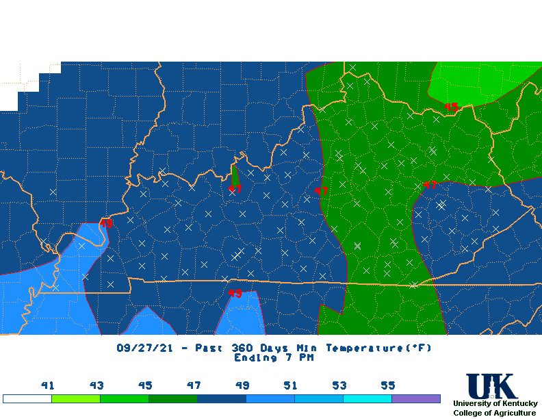
| AVE TEMP | 56 | 49 | 46 | 45 | 40 | 38 | 37 | 38 | 39 | 48 | 58 |
| DEPART. | 11 | 5 | 2 | 2 | -2 | -3 | -1 | 1 | 0 | 2 | 1 |
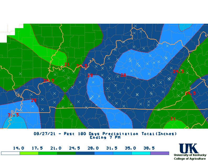
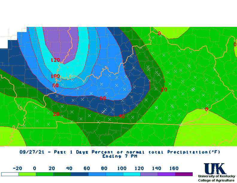
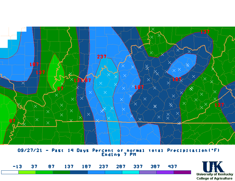
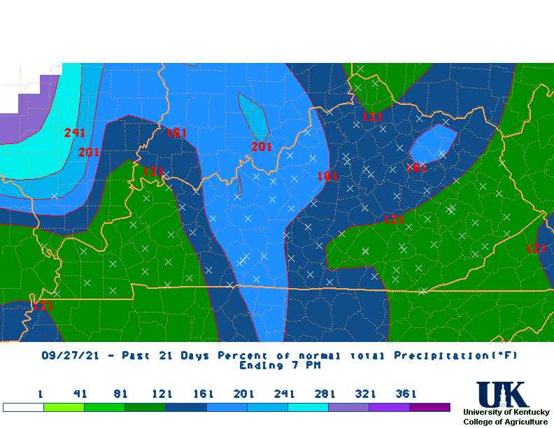
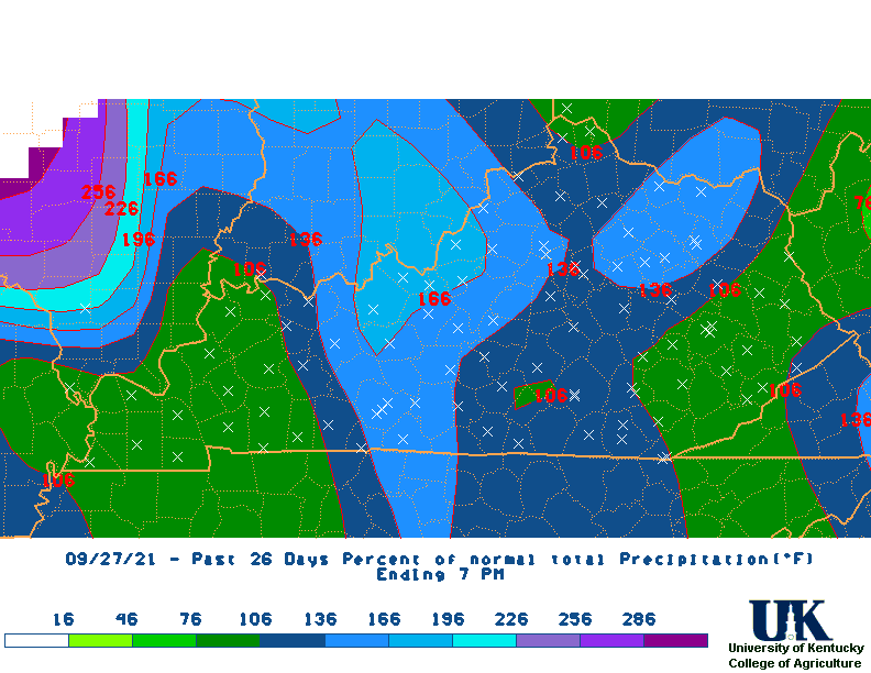
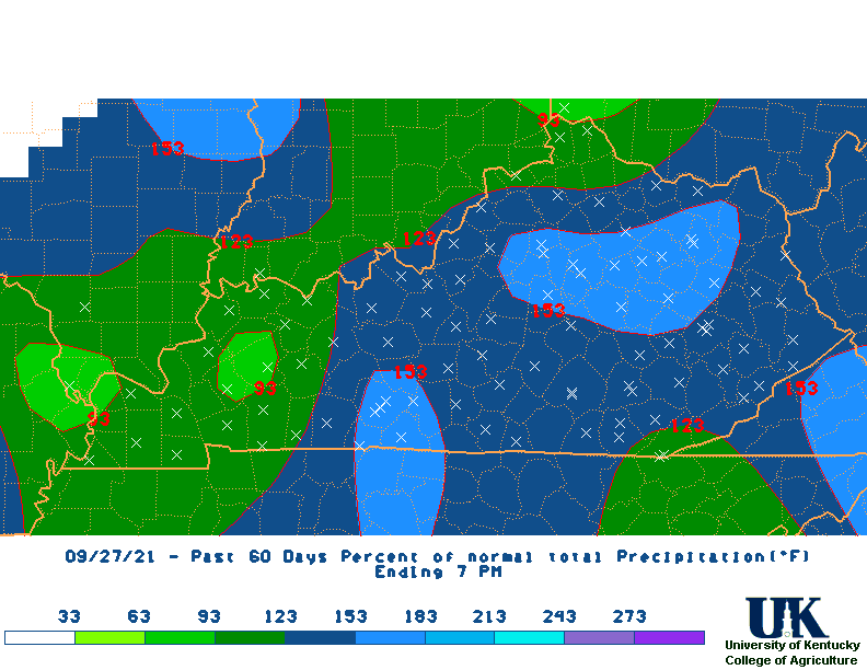
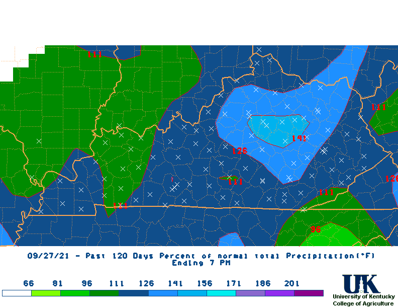
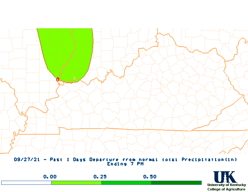
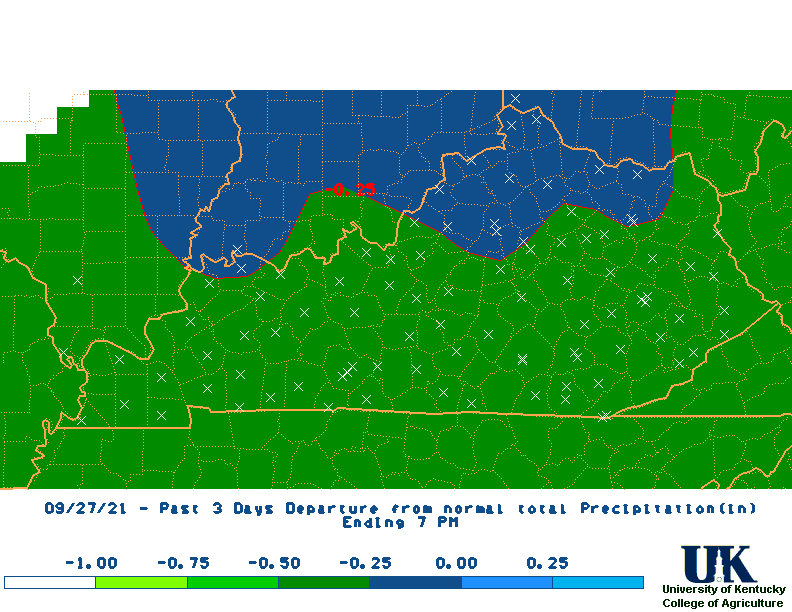
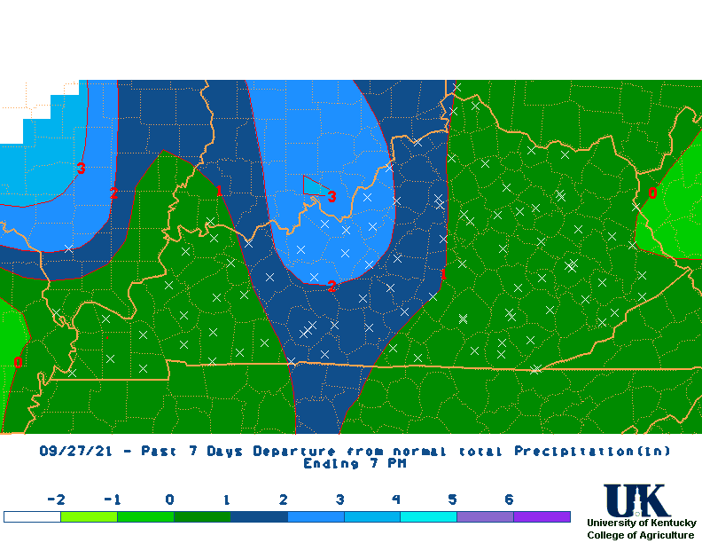
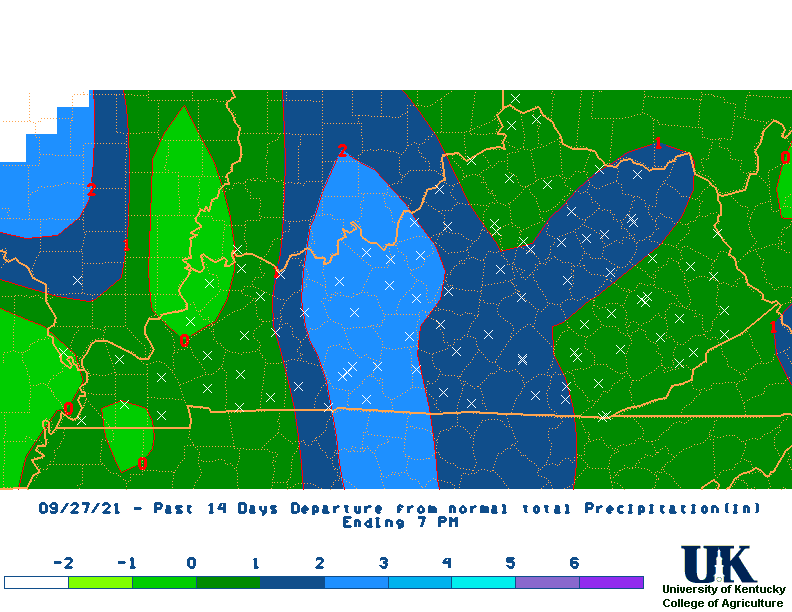
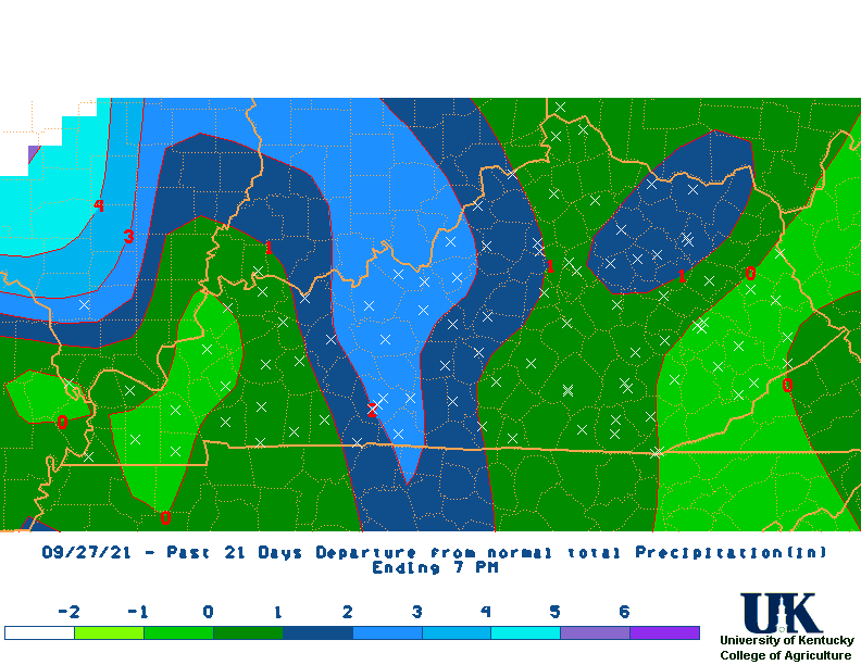
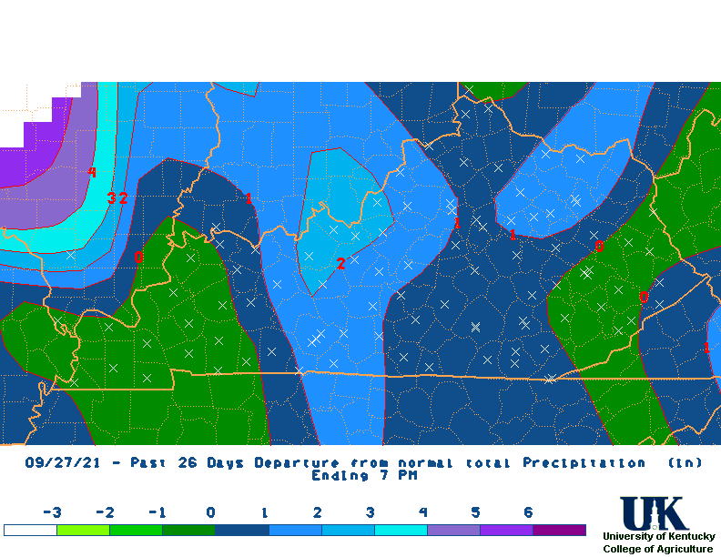
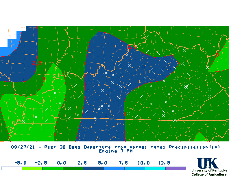
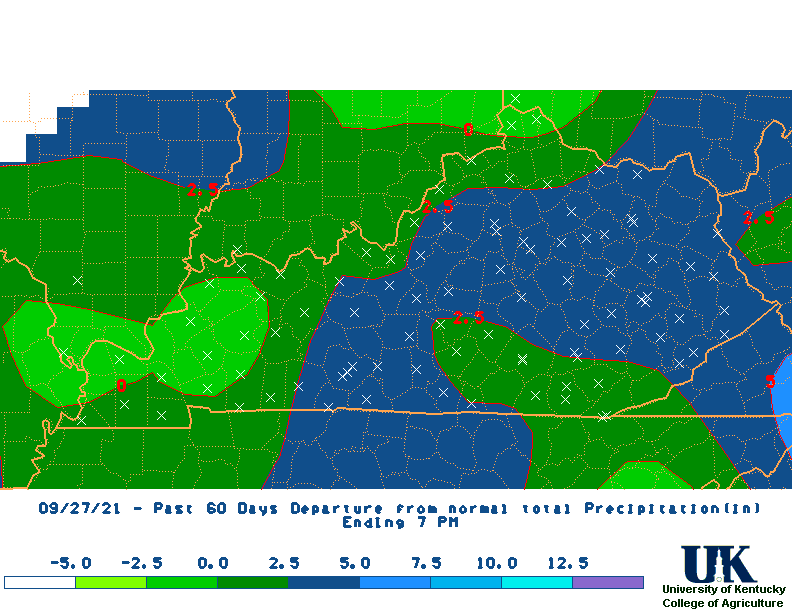
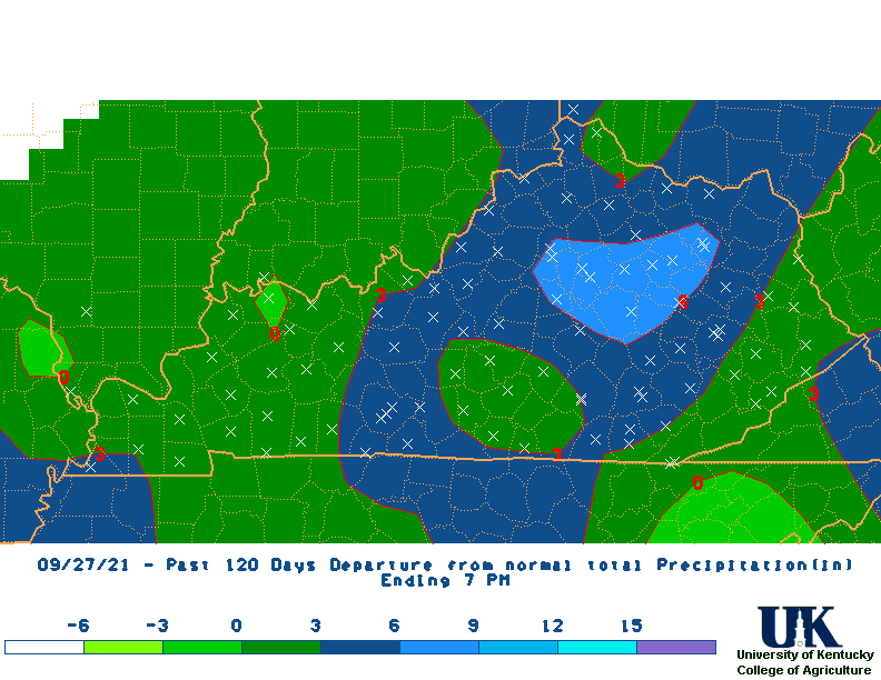
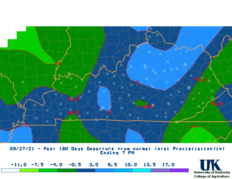
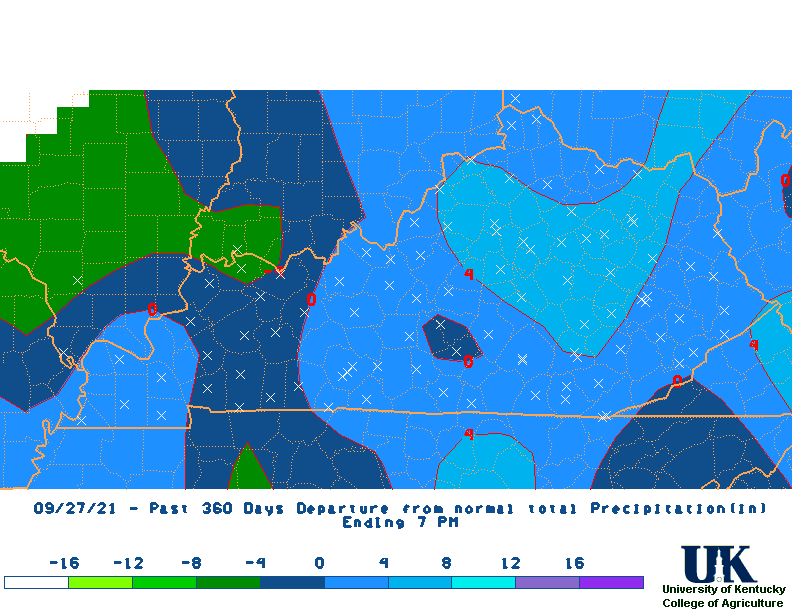
| PRECIP | 0.00 | 0.00 | 0.28 | 0.46 | 0.60 | 6.20 | 9.90 | 15.38 | 18.79 | 26.62 | 50.80 |
| DEPART. | -0.15 | -0.45 | -0.80 | -1.68 | -2.55 | 1.83 | 2.02 | 3.53 | 2.91 | 3.72 | 1.26 |
| %NORM | 0 | 0 | 26 | 22 | 19 | 142 | 126 | 130 | 118 | 116 | 103 |
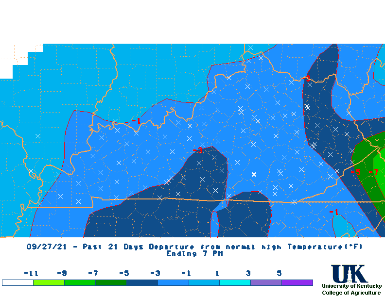
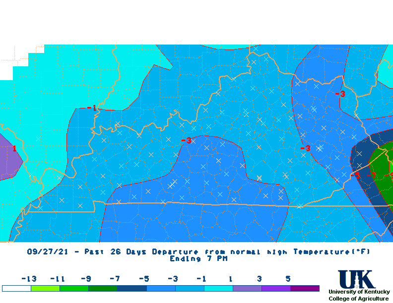
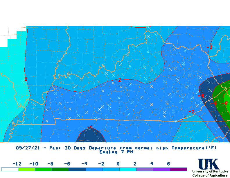
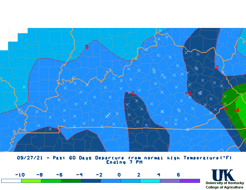
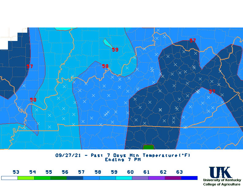
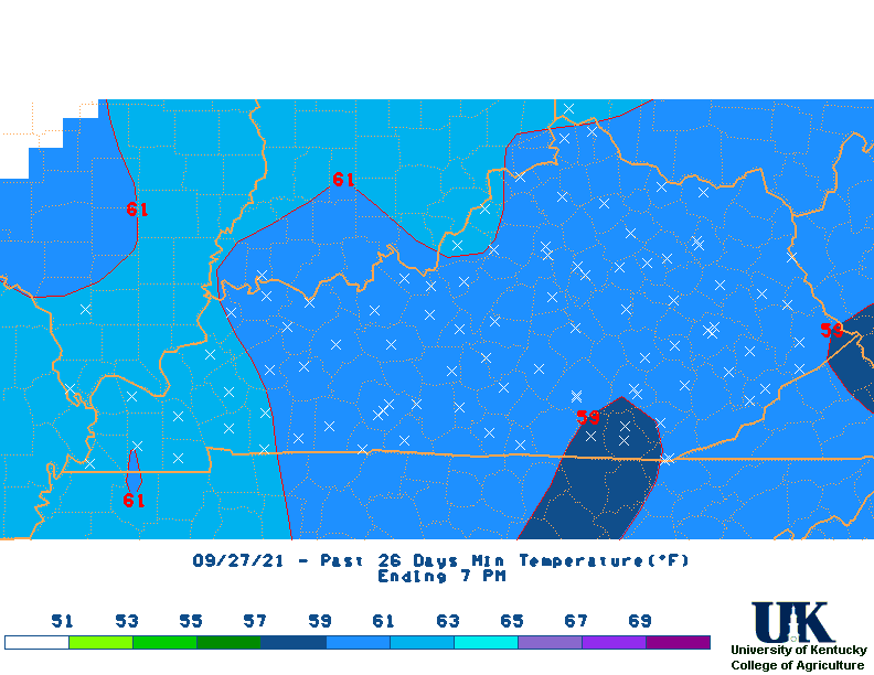
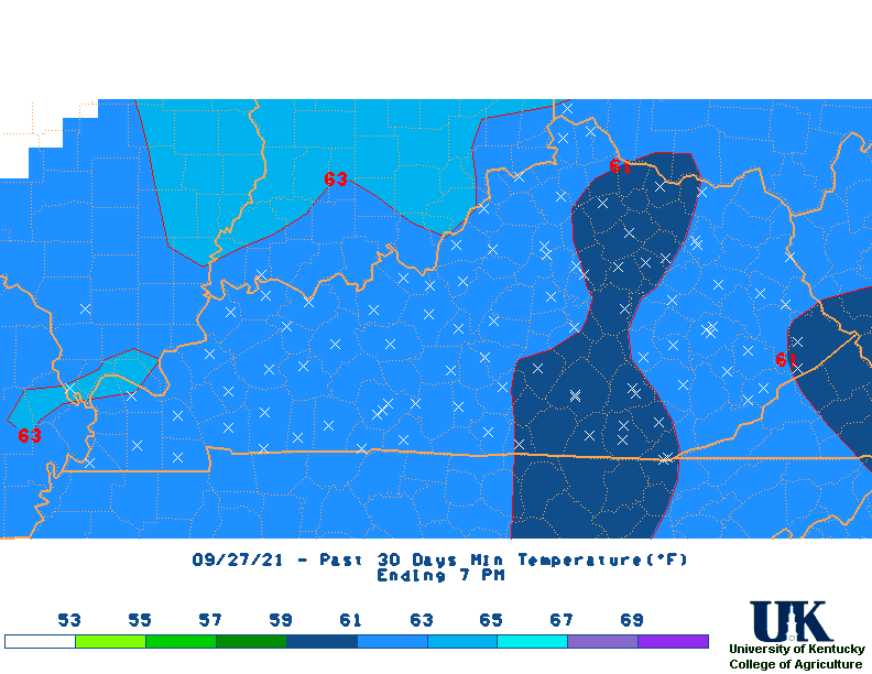
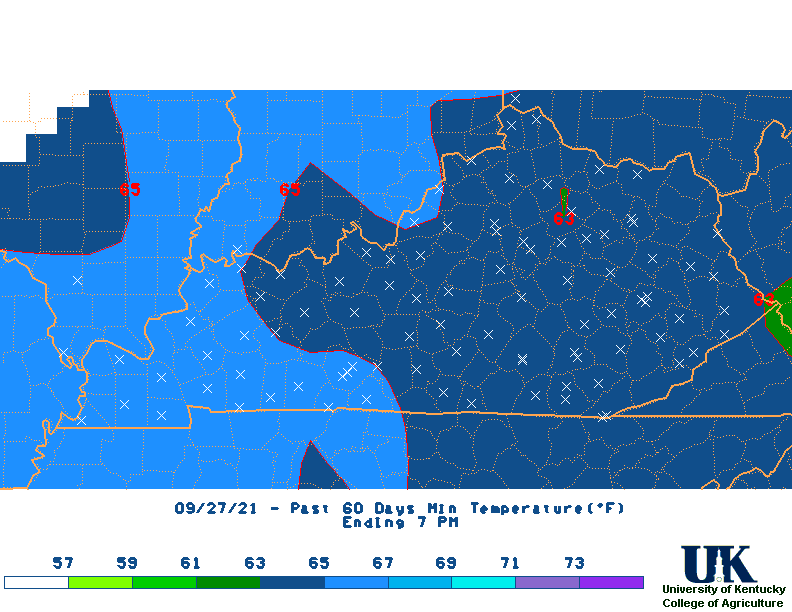
![]() Daily AM Data Summary Tables for Mesonet Sites and NWS Stations: (Departure from climate divisional normals recently added)
Daily AM Data Summary Tables for Mesonet Sites and NWS Stations: (Departure from climate divisional normals recently added)
last
3,
7,
14,
21,
30,
60,
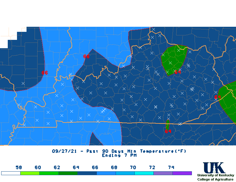
90,
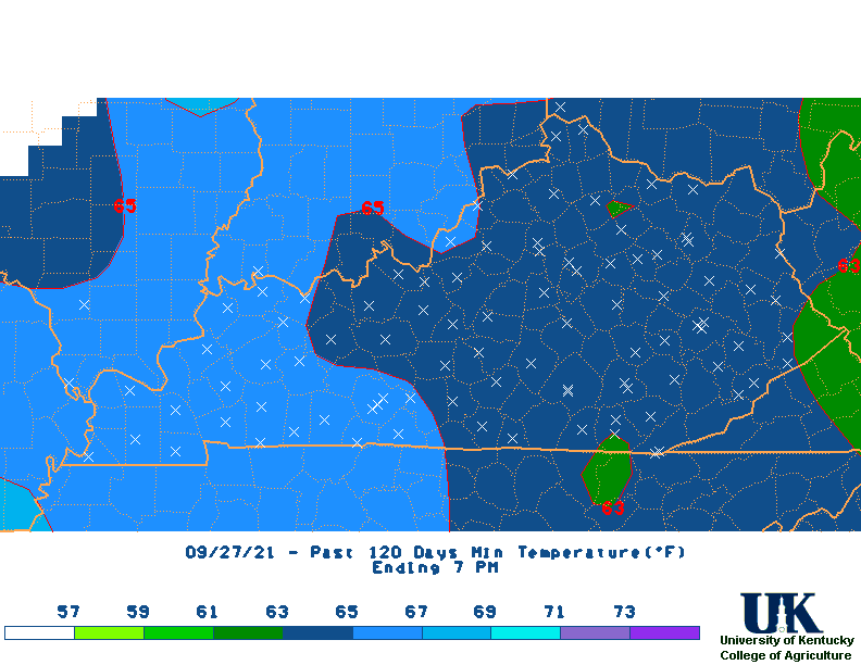
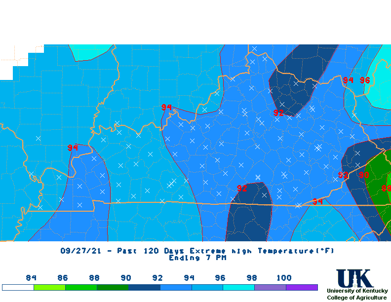
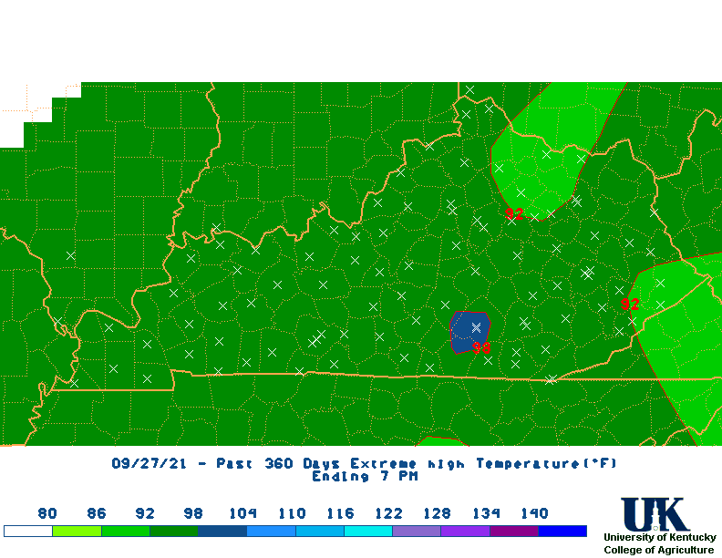
120,
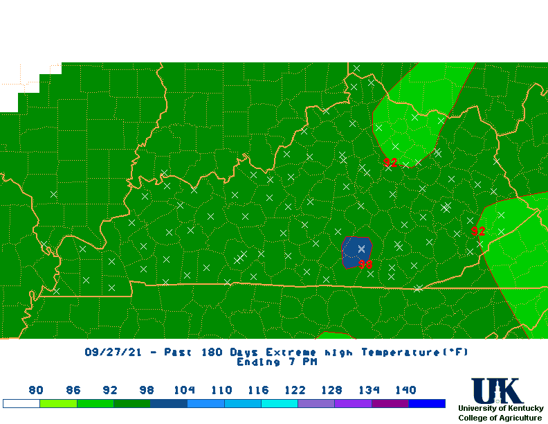
Kentucky Mesonet:
http://www.kymesonet.org
| Climate Tables | |||||||||||||
| Climate Narratives | |||||||||||||
| Rainfall Total Maps | |||||||||||||
| Percent of Normal Rainfall Maps | |||||||||||||
| Rainfall Departure Maps | |||||||||||||
| Average Temperature Maps | |||||||||||||
| Average Temperature Departure Maps | |||||||||||||
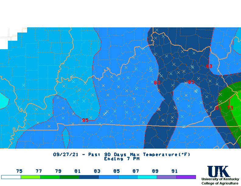
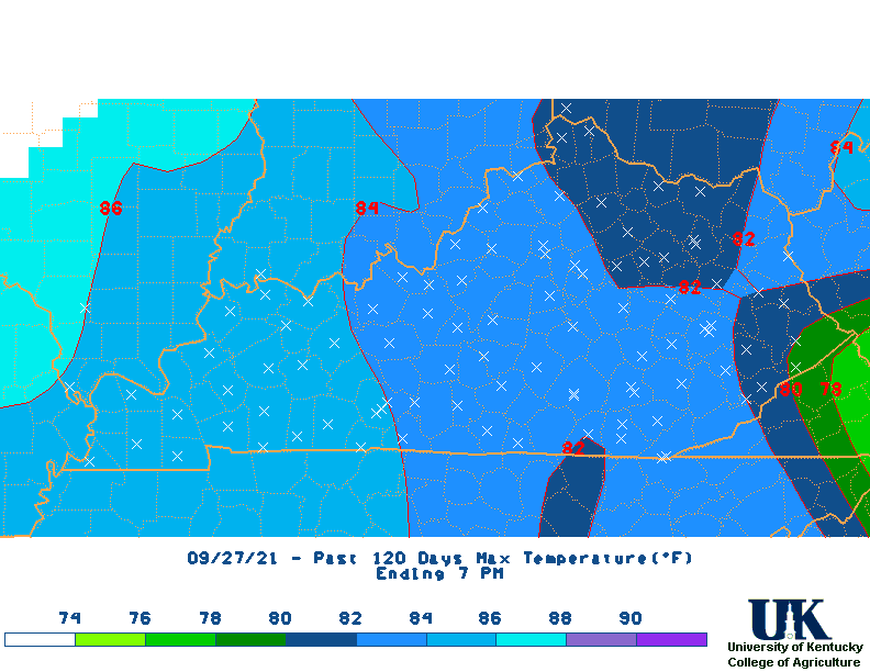
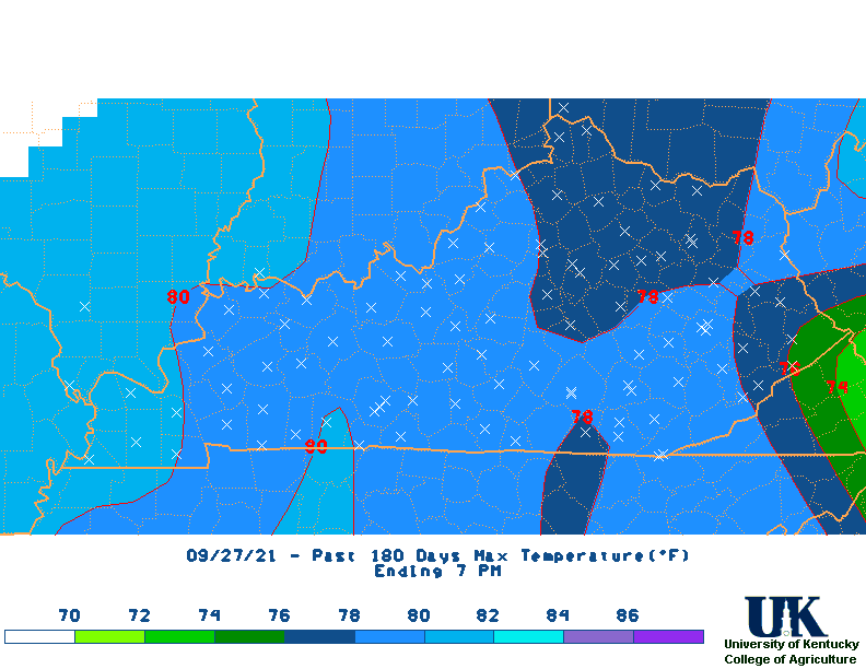
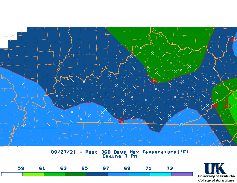
| Max Temperature Maps | |||||||||||||
| Max Temperature Departure Maps | |||||||||||||
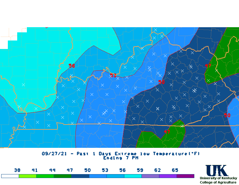
| Min Temperature Maps | |||||||||||||
| Min Temperature Departure Maps | |||||||||||||
| High Max Temperature Maps | |||||||||||||
| Low Min Temperature Maps | All Maps |
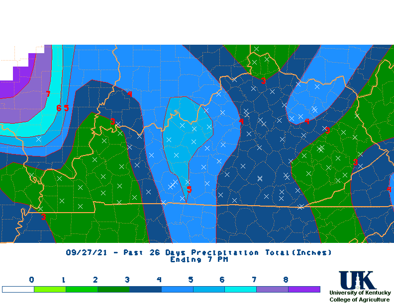
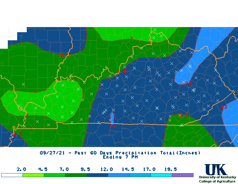
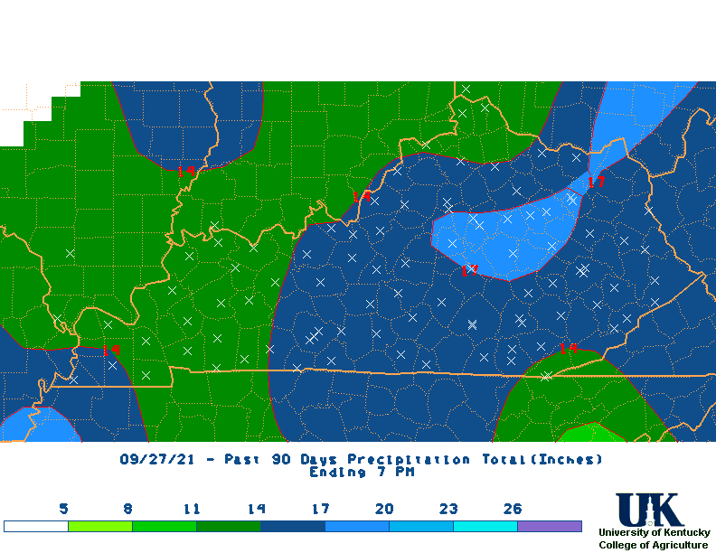
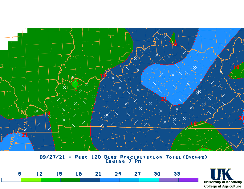
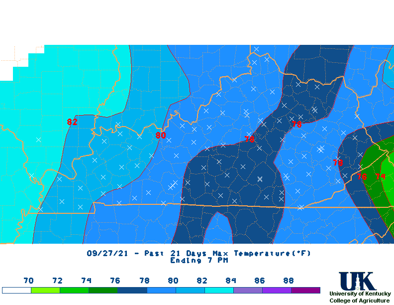
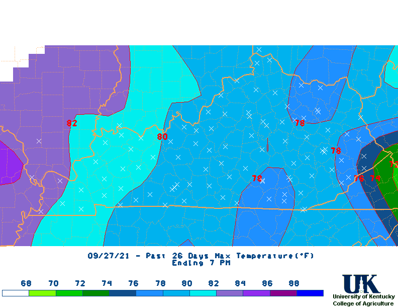
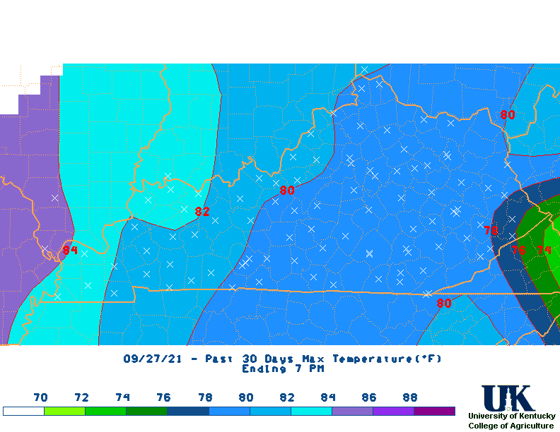
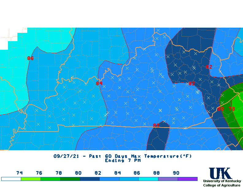
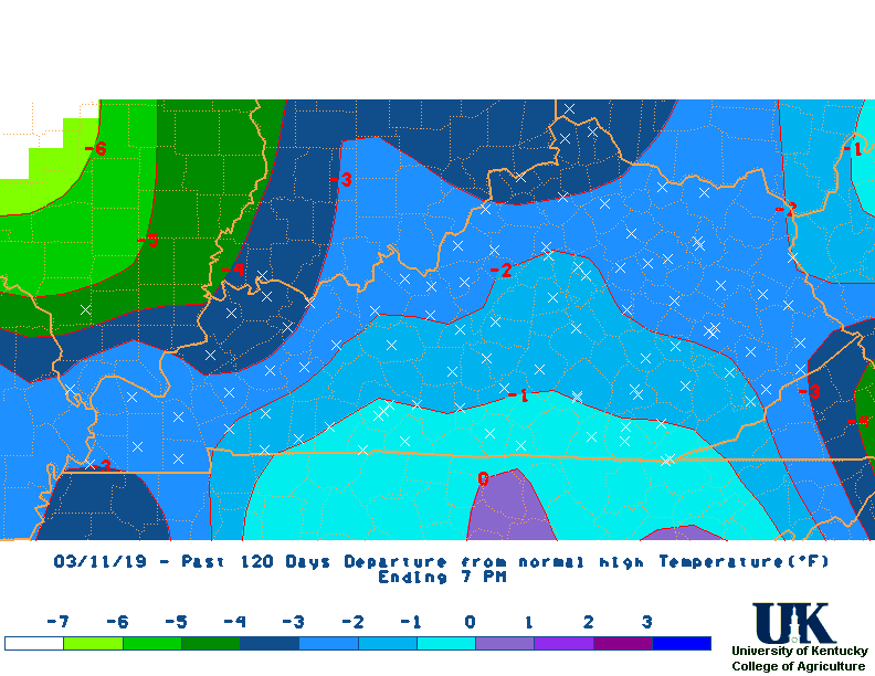
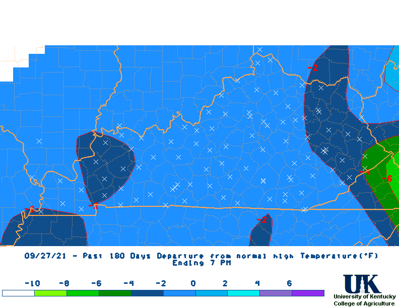
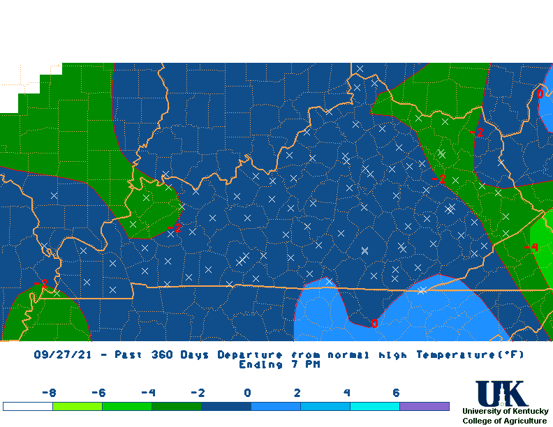
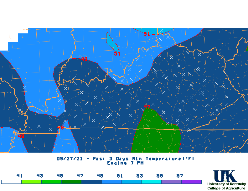
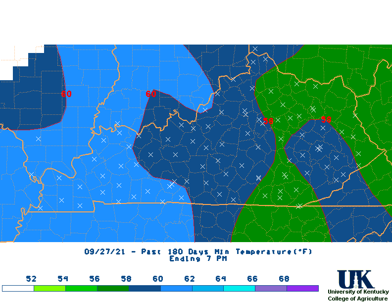
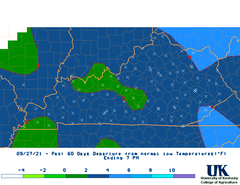
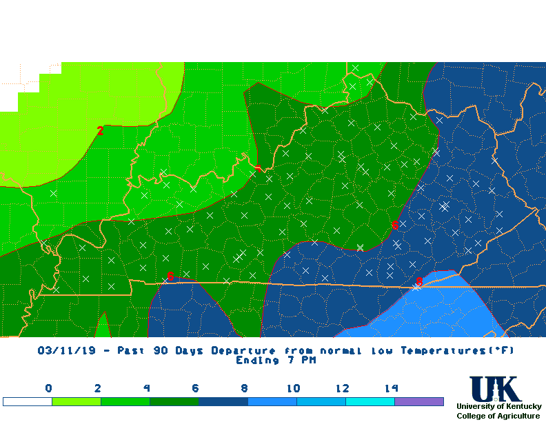
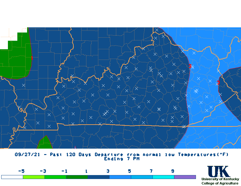
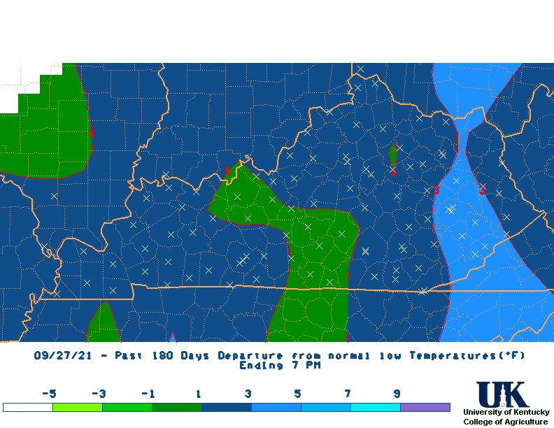
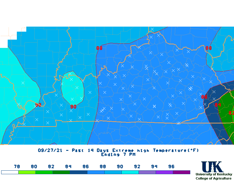
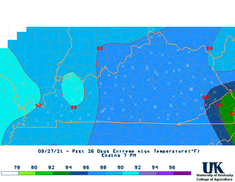
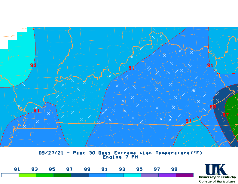
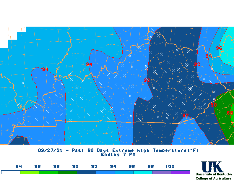
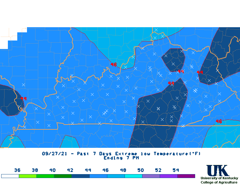
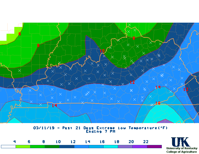
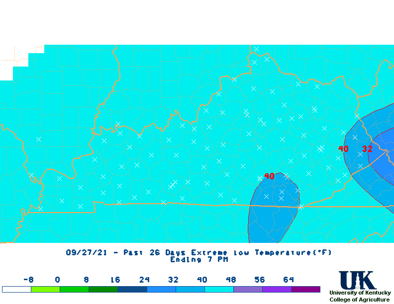
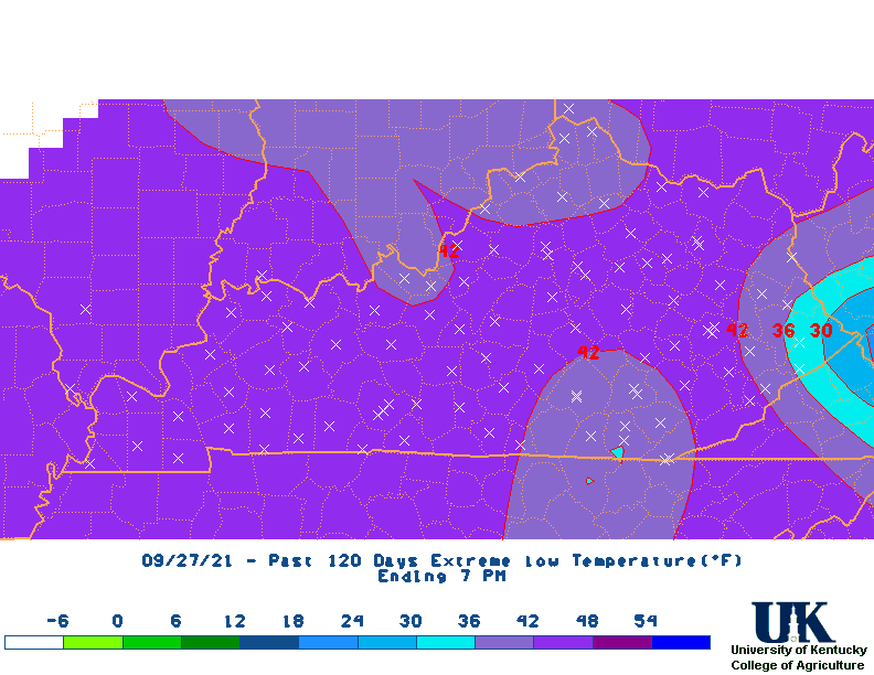
last 3, 7, 14, 21, 30, 60, 90, 120, 180 days.
last 3, 7, 14, 21, 30, 60, 90, 120, 180 days.
| Kentucky Monthly Statewide Data (1895 to Present) |
||
|---|---|---|
| Rainfall Totals | Temperature | Ranking |
| Kentucky Monthly Climate Division Data (1895 to Present) |
||||
|---|---|---|---|---|
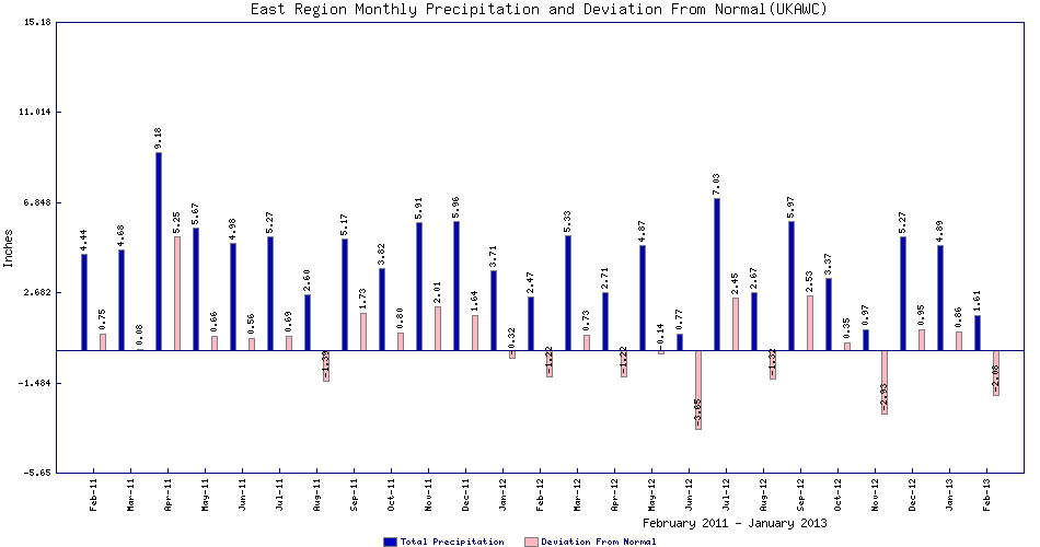
| 1895-Present Monthly Rainfall | West (CD-1), Graph | Central (CD-2),Graph | Bluegrass (CD-3),Graph | East (CD-4),Graph |
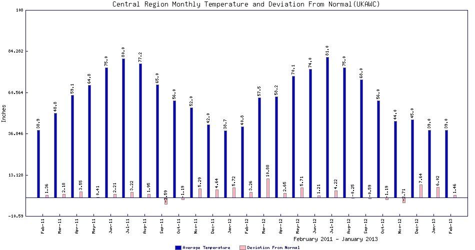
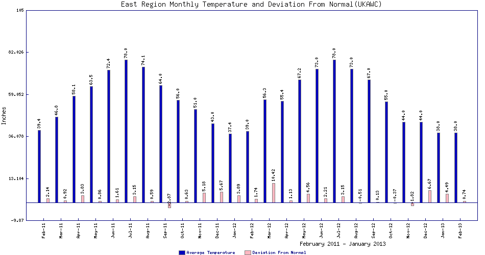
| 1895-Present Monthly Temperature | West (CD-1),Graph | Central (CD-2),Graph | Bluegrass (CD-3),Graph | East (CD-4),Graph |