| NWS forecast for any "City, St" or Zipcode | |
Current Conditions
Forecasts
Satellite Imagery
Radar Imagery
Winter Wx
Fire Weather
Long Range Outlooks
Other
Kentucky Climate
Climatology
Pests/Disease
Ag/Wx Calculators
Hydrology Info.
Other UKAWC Sites
Severe Wx
Tropical Wx
Kentucky Ag Wx
Drought
National Wx
International Wx
Learning About Wx
About UKAWC
Sun, Moon & Planets UKAWC Home
 |
Kentucky Climate Summaries |
Home| Current Conditions| Forecasts| Satellite| Radar| Media| Outlooks| Drought| Severe| Tropical Wx| Winter Wx| Climatology| Calc| Fire| NWS| Historical| About Us| Spring Ag-Update| Glance| GlanceClim
West Climate Division:
Central Climate Division:
Bluegrass Climate Division:
East Climate Division:
| Climate Tables | |||||||||||||
| Climate Narratives | |||||||||||||
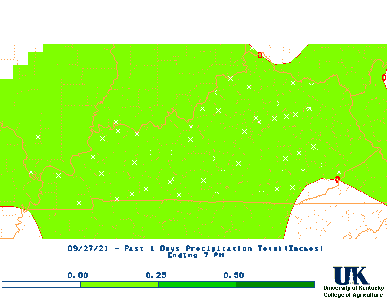
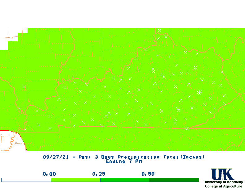
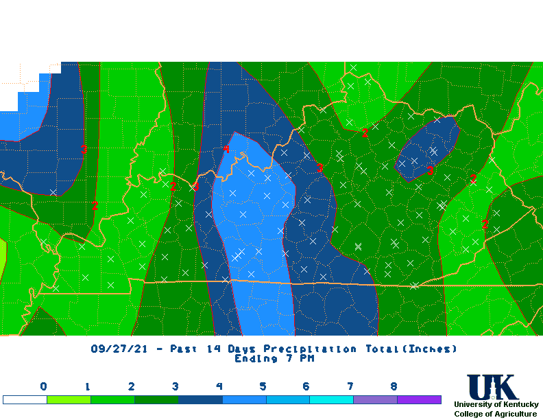
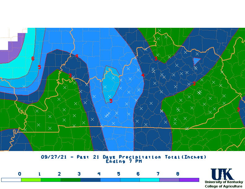
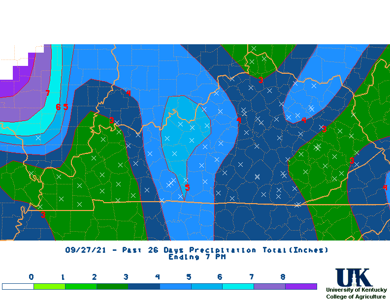
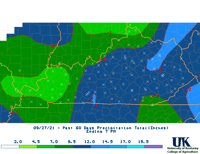
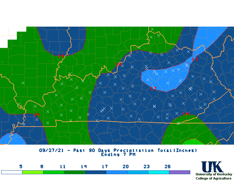
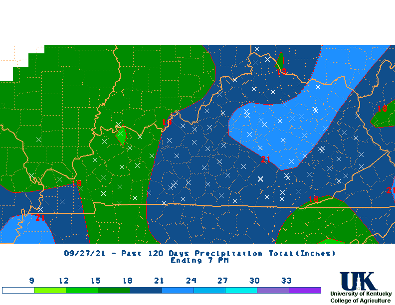
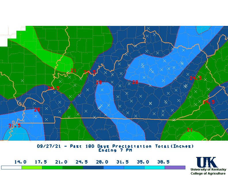
| Rainfall Total Maps | |||||||||||||
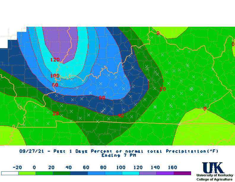
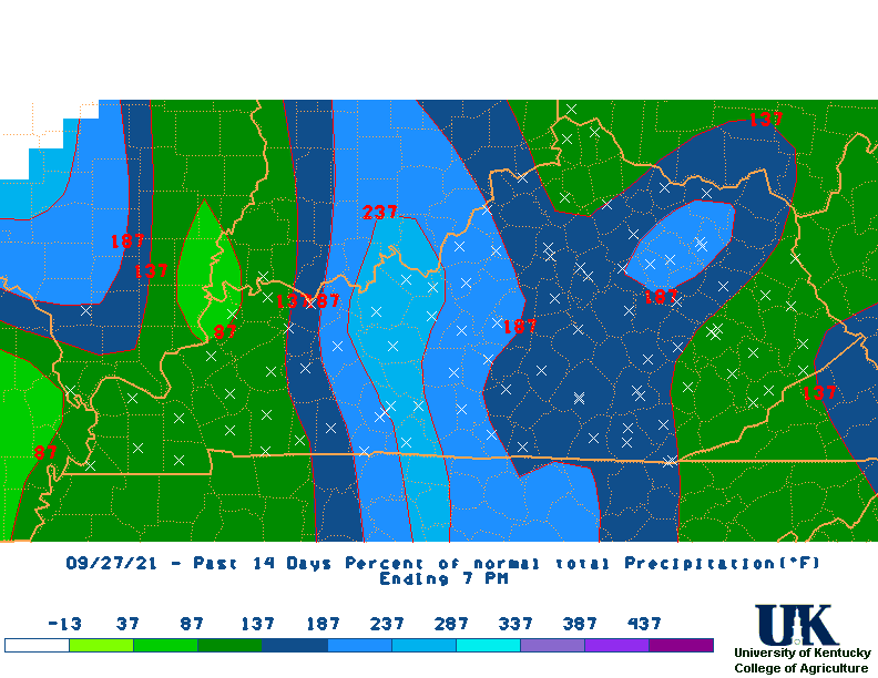
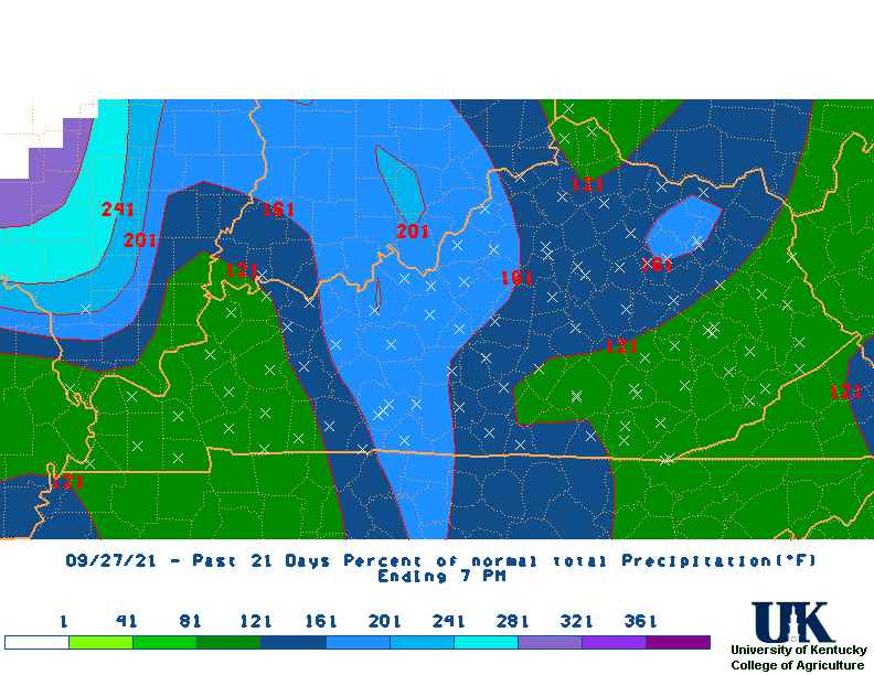
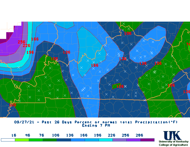
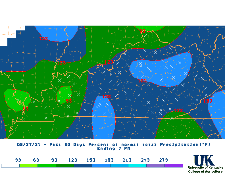
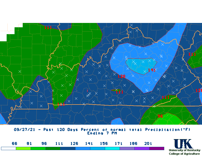
| Percent of Normal Rainfall Maps | |||||||||||||
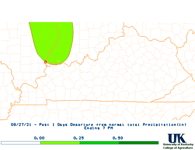
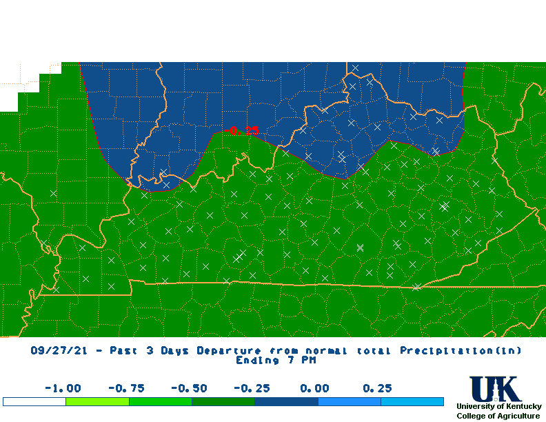
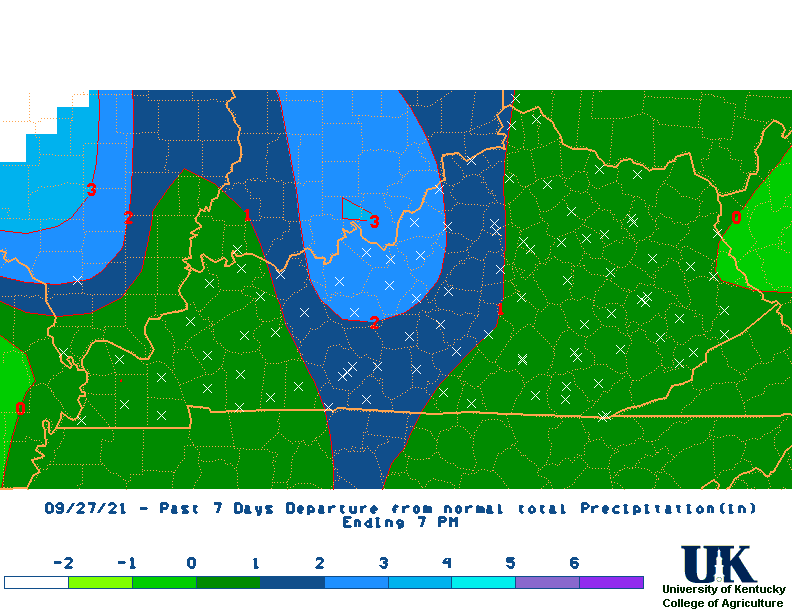
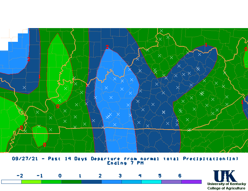
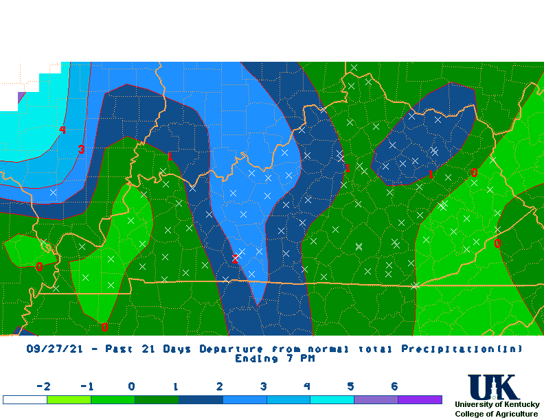
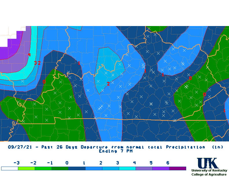
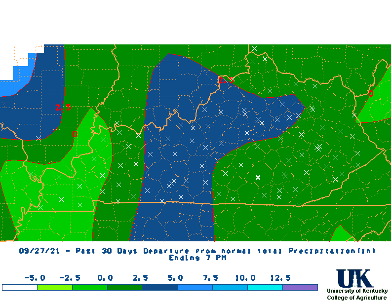
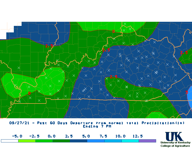
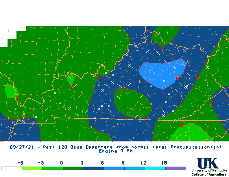
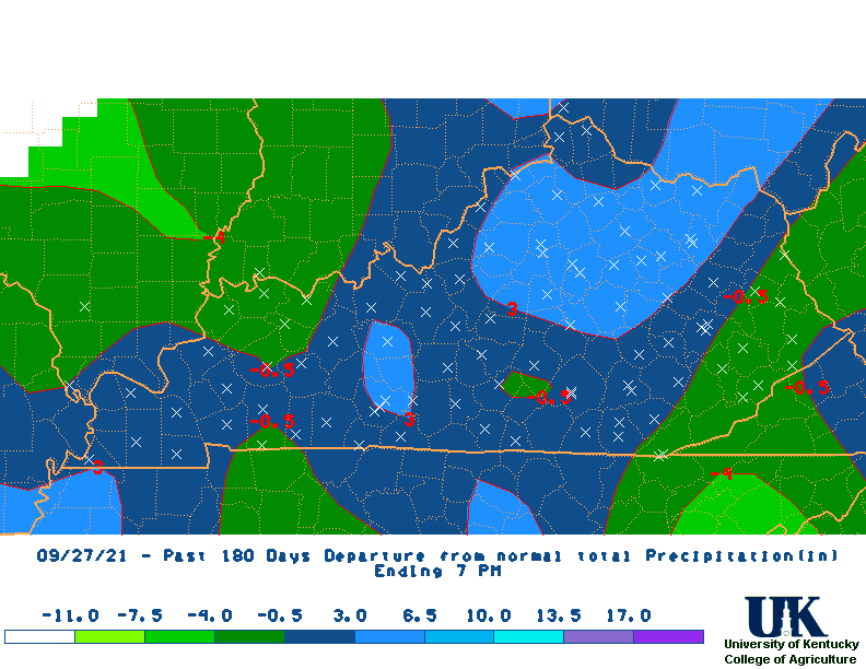
| Rainfall Departure Maps | |||||||||||||
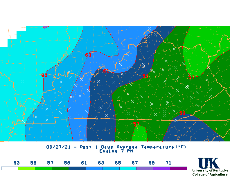
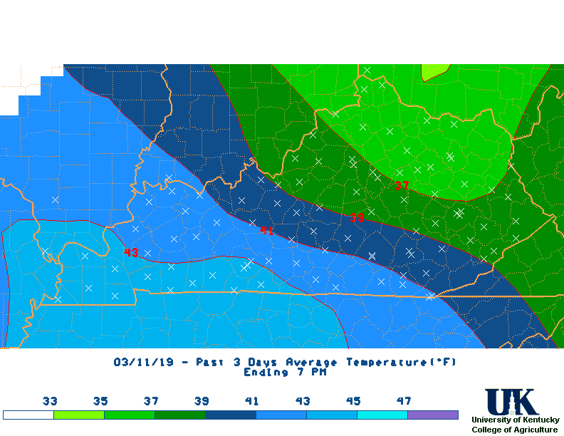
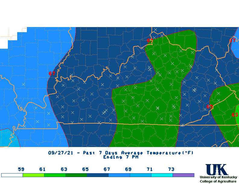
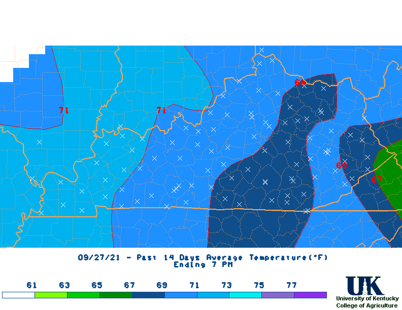
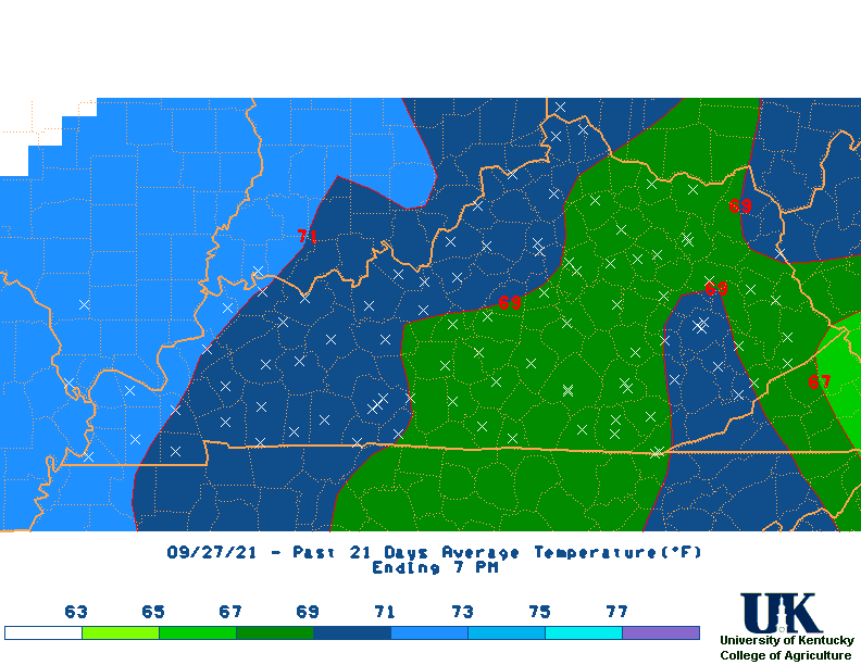
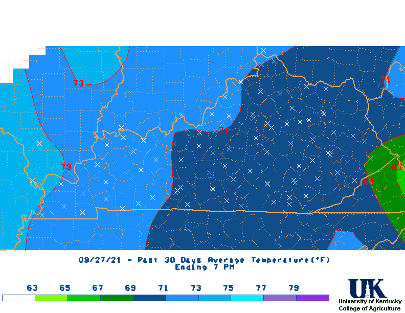
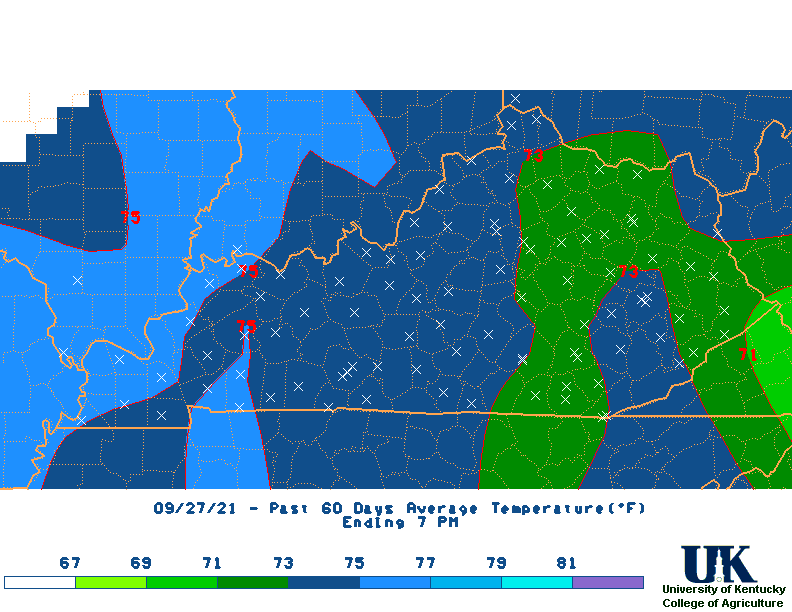
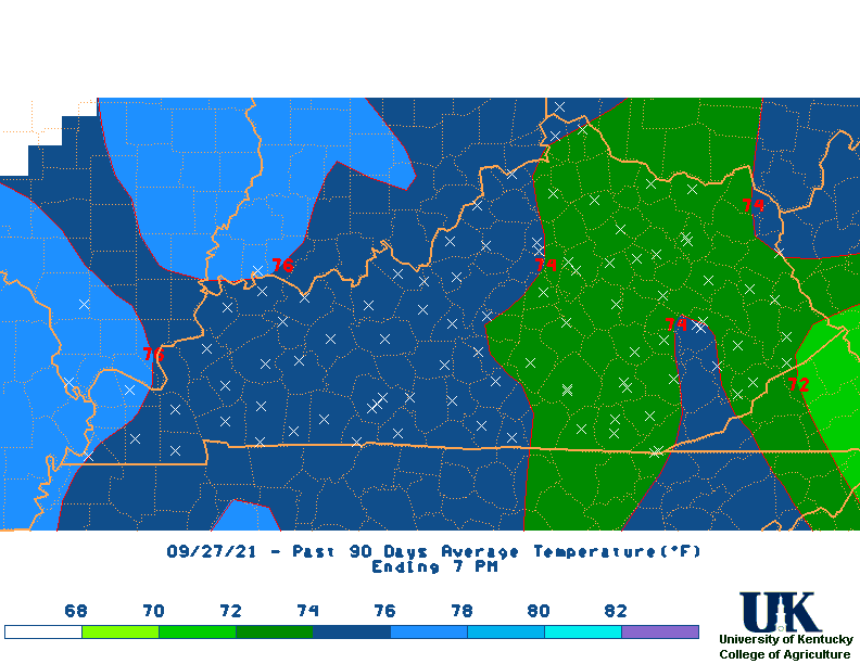
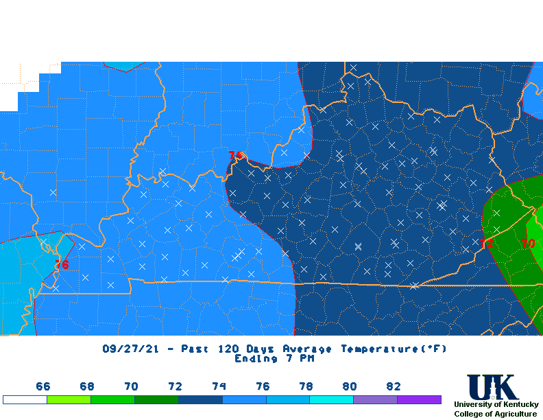
| Average Temperature Maps | |||||||||||||
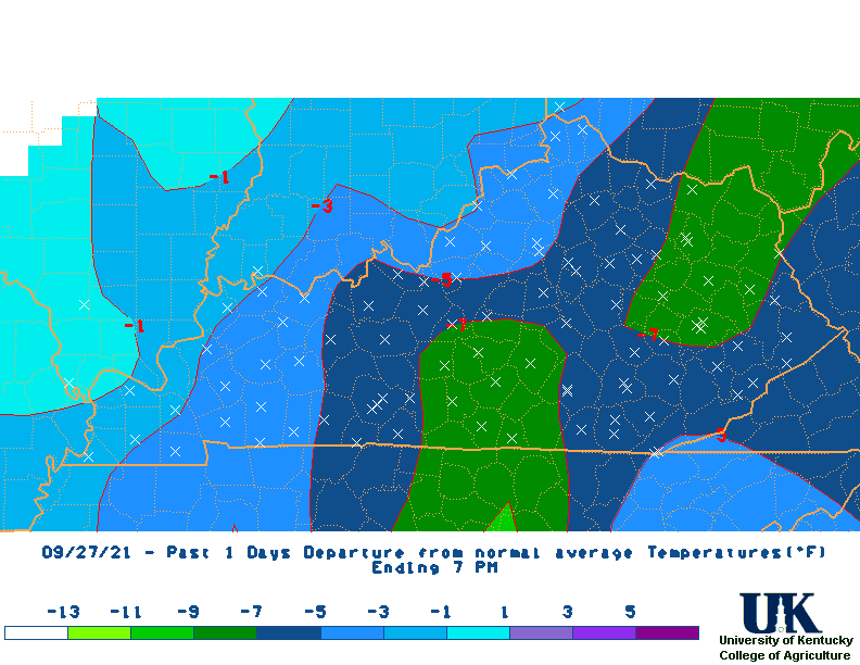
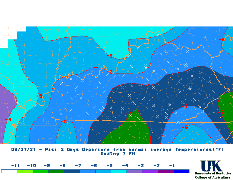
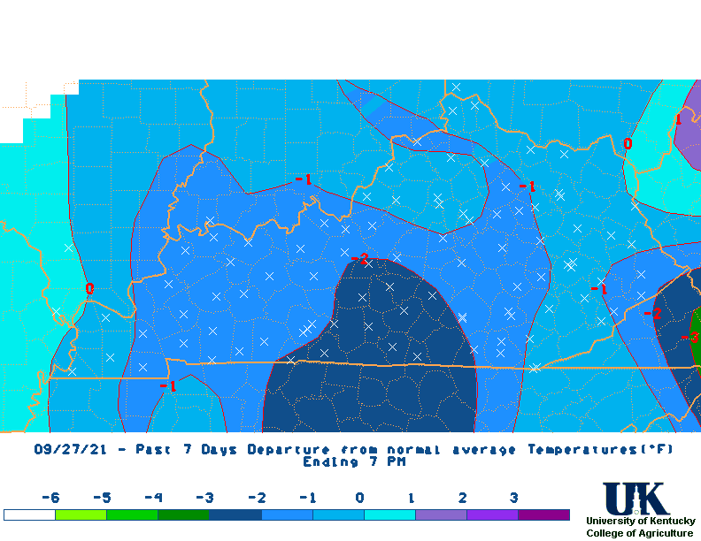
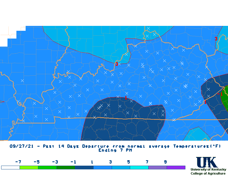
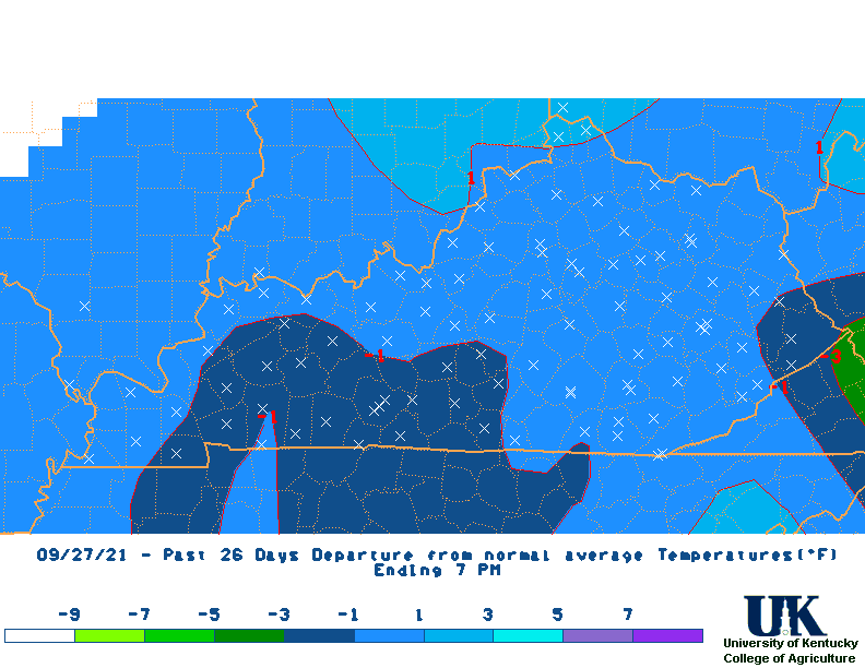
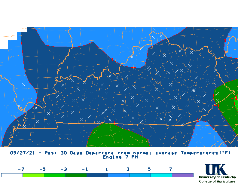
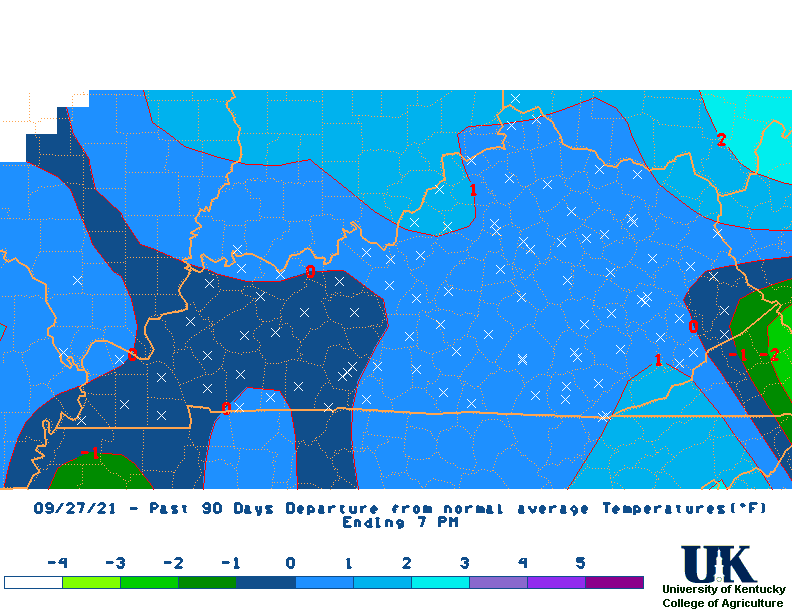
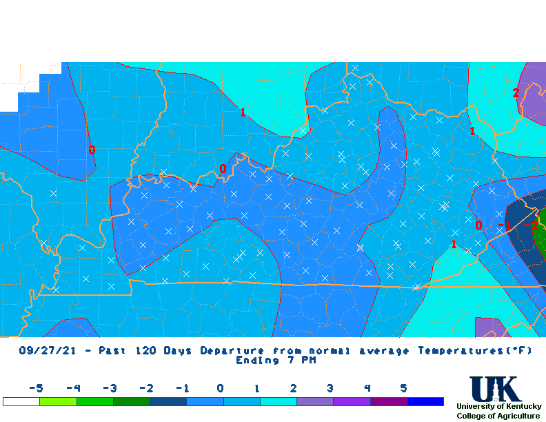
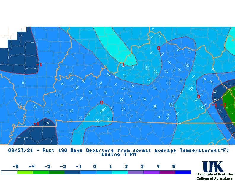
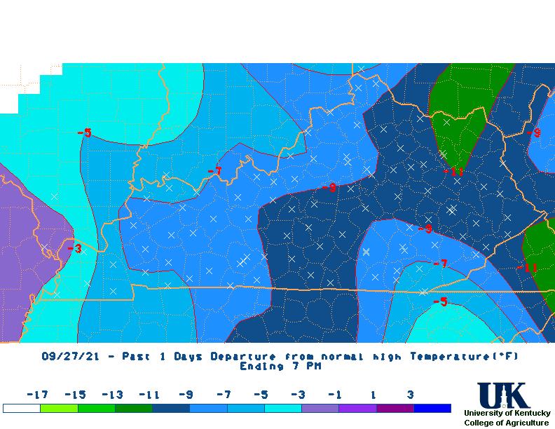
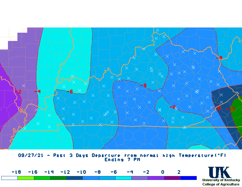
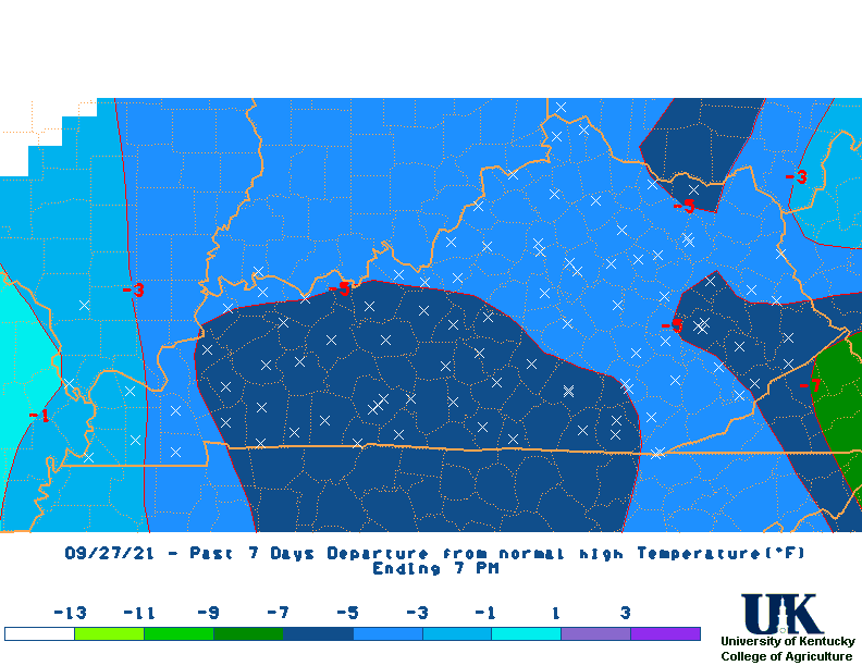
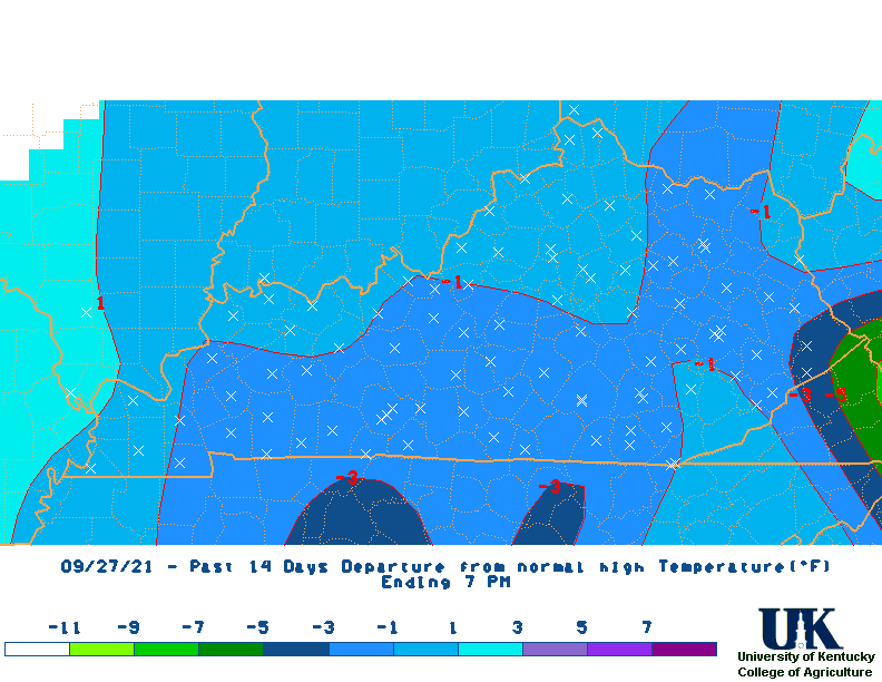
| Average Temperature Departure Maps | |||||||||||||
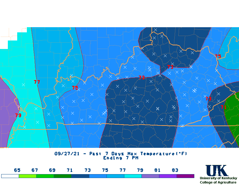
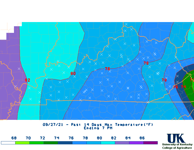
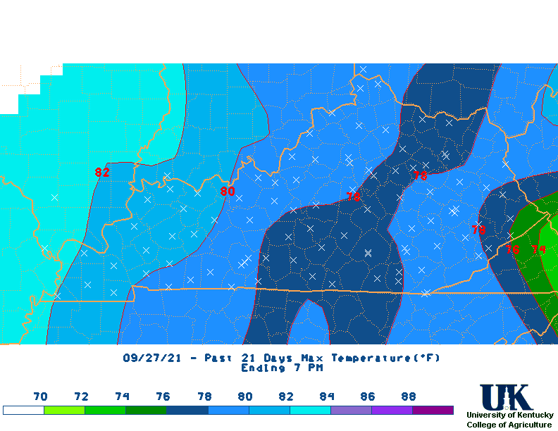
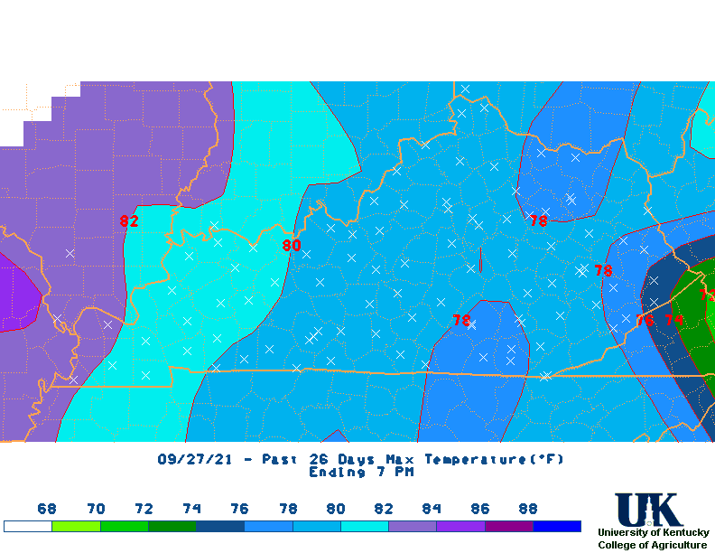
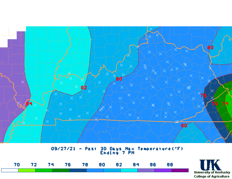
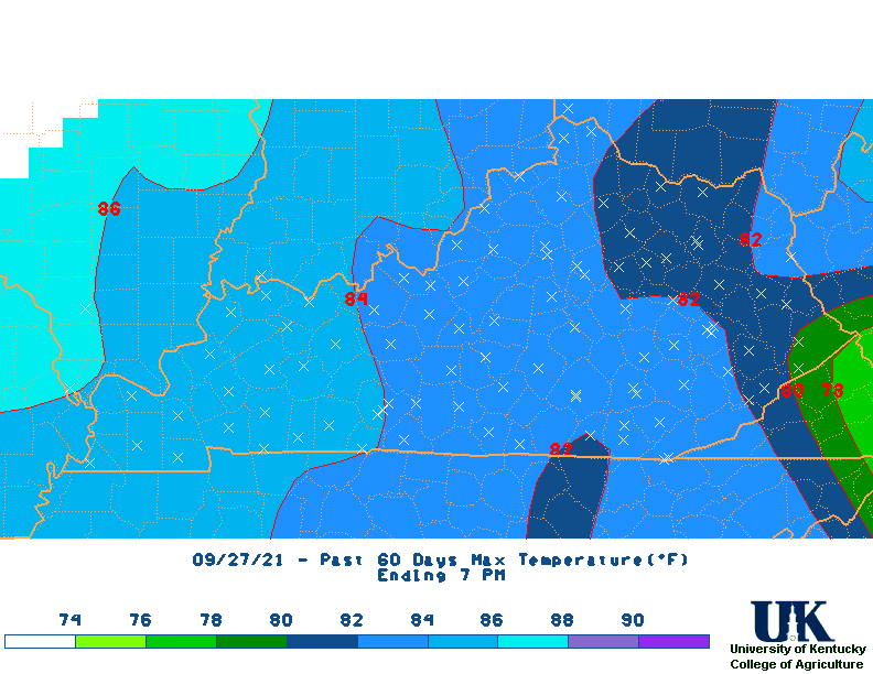
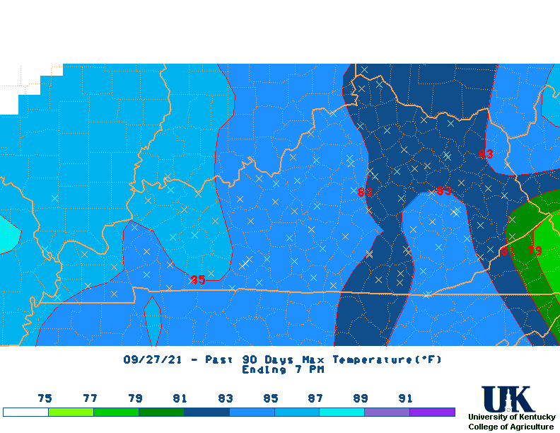
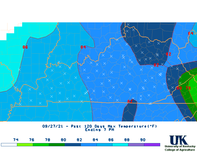
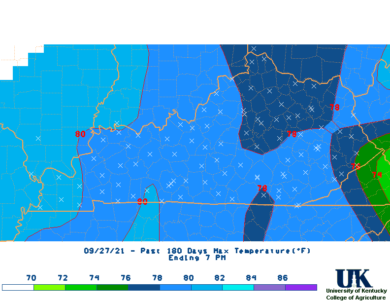
| Max Temperature Maps | |||||||||||||
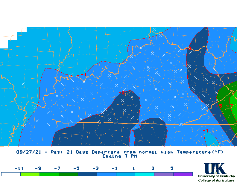
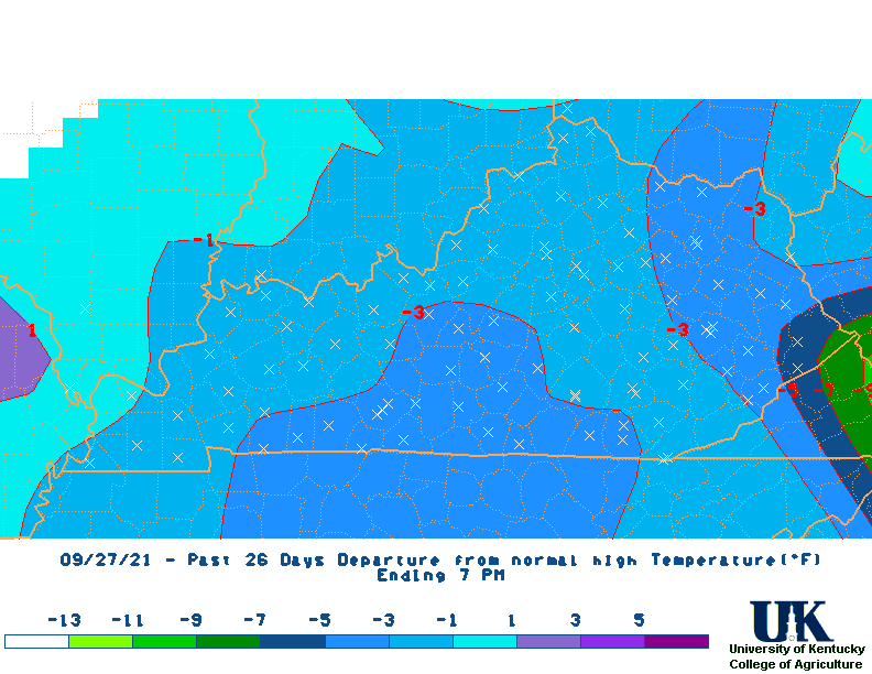
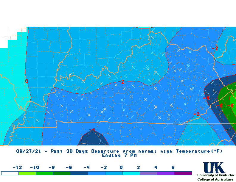
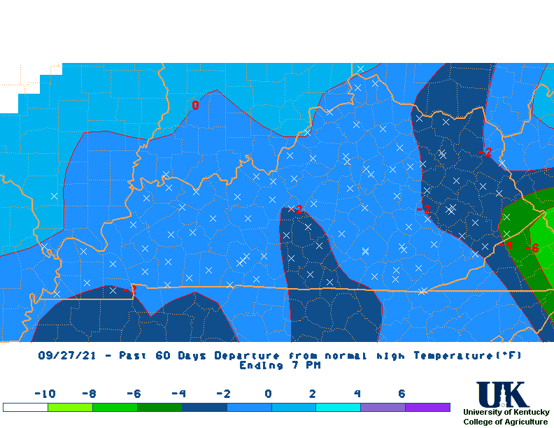
| Max Temperature Departure Maps | |||||||||||||
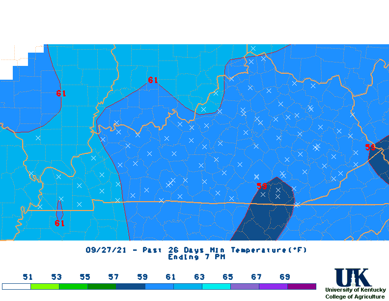
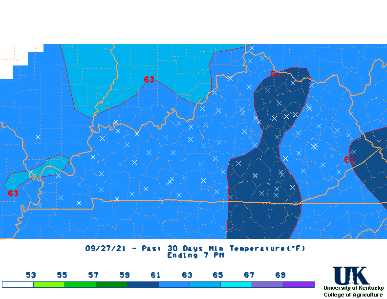
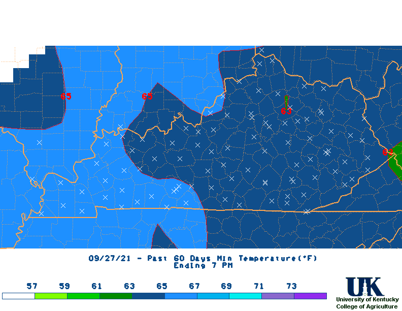
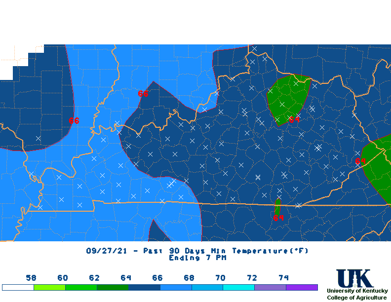
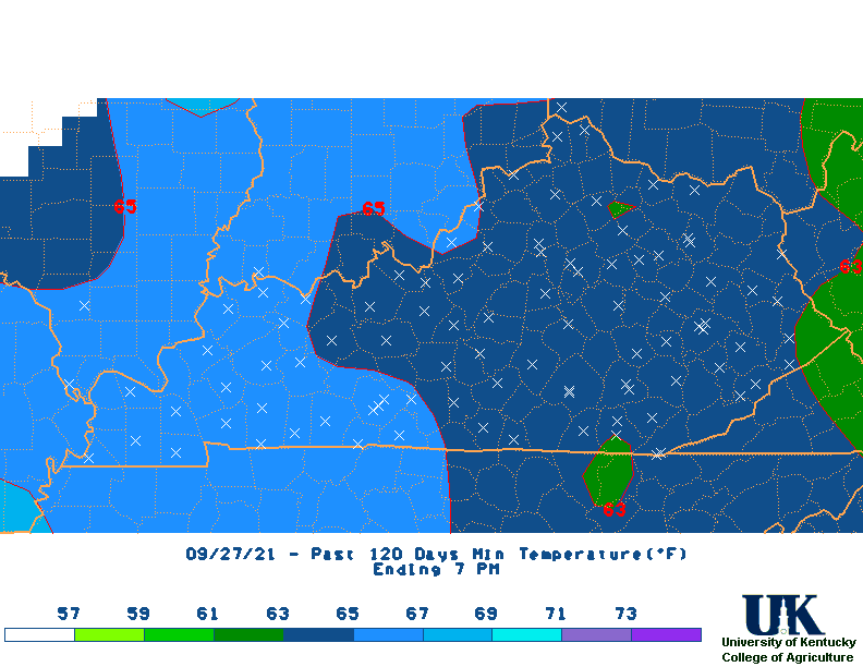
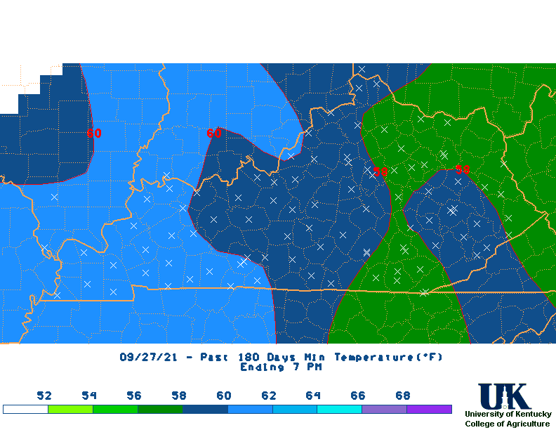
| Min Temperature Maps | |||||||||||||
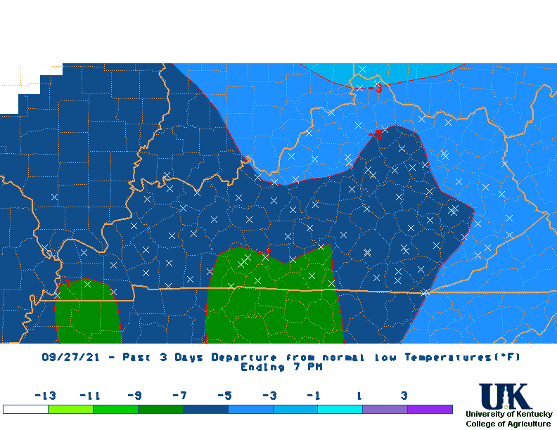
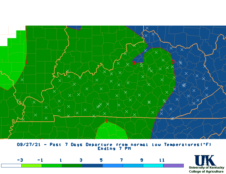
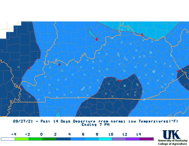
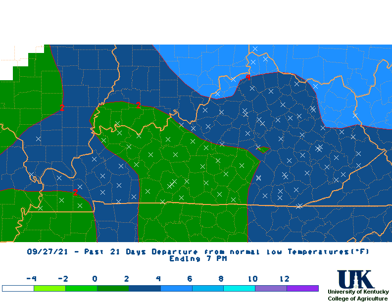
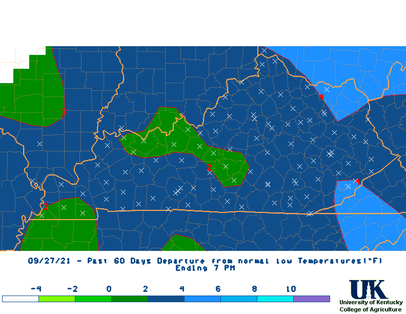
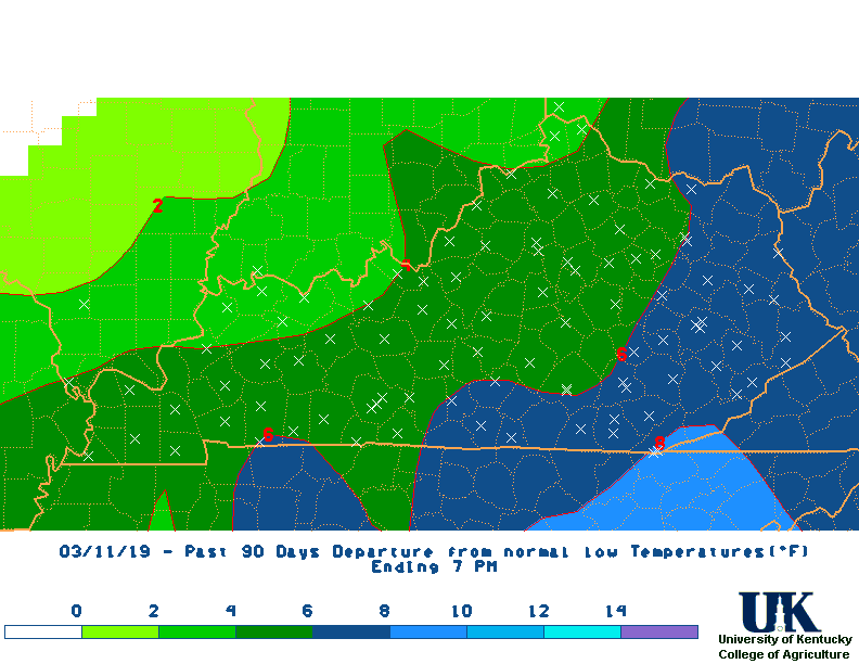
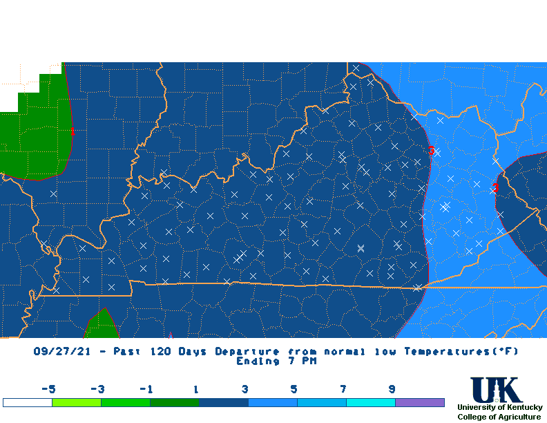
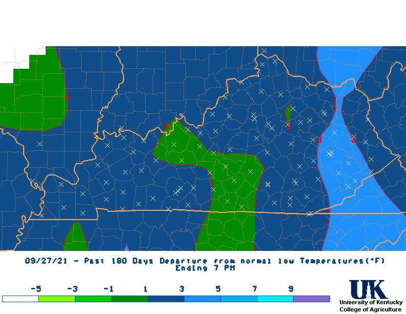
| Min Temperature Departure Maps | |||||||||||||
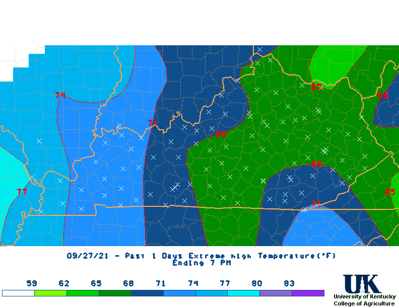
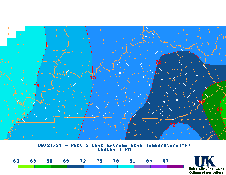
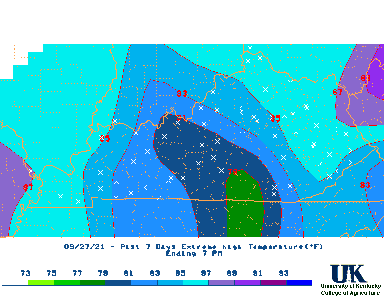
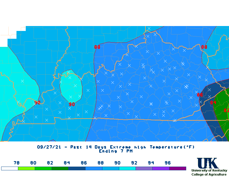
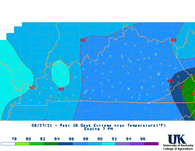
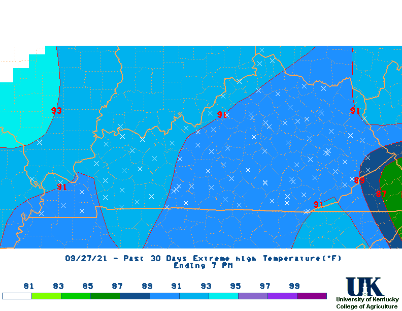
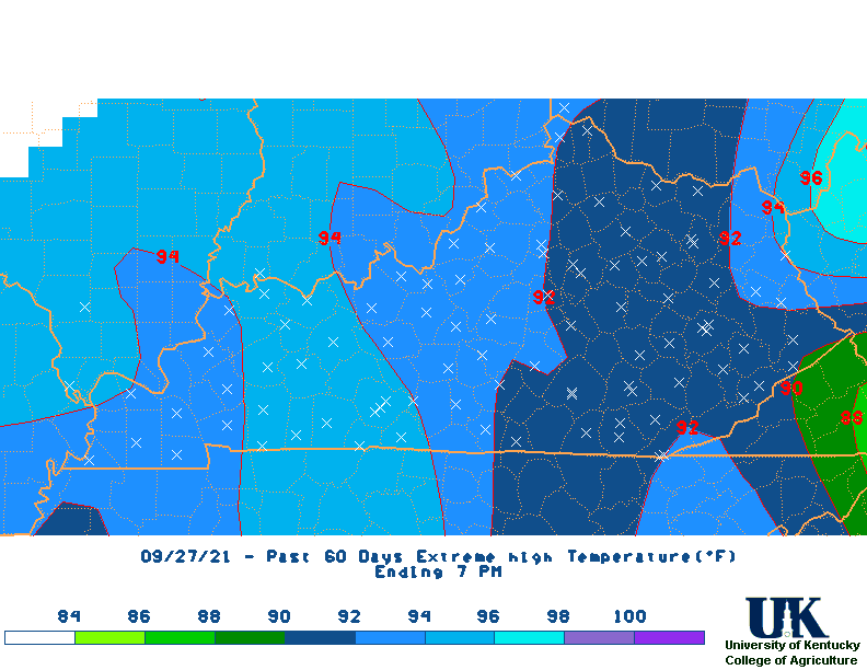
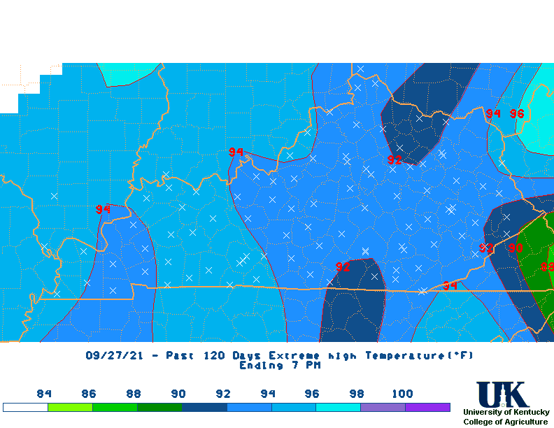
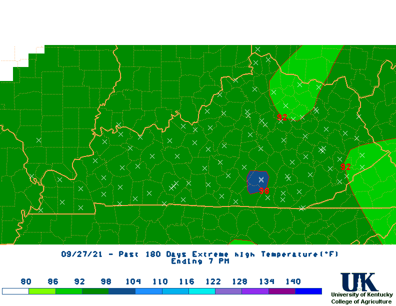
| High Max Temperature Maps | |||||||||||||
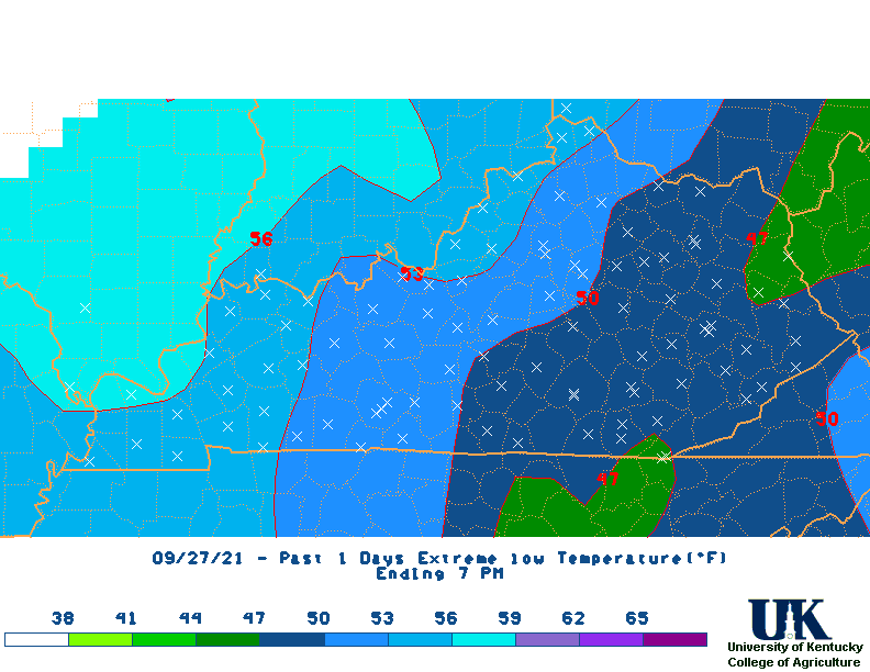
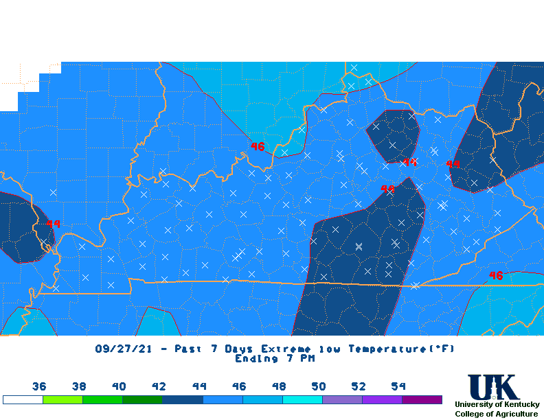
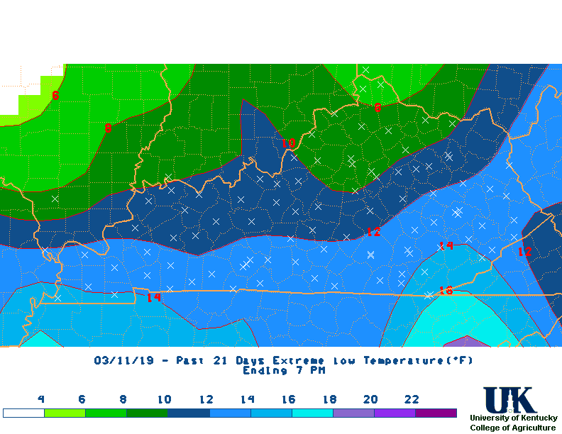
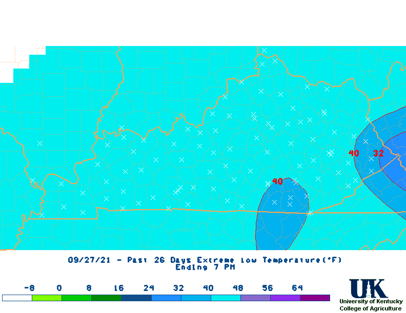
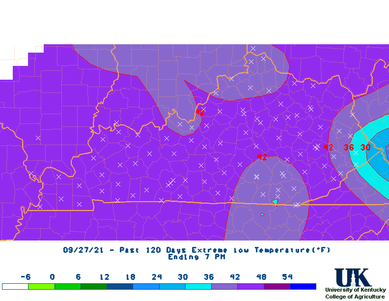
| Low Min Temperature Maps | All Maps |
* M2D = Month-to-Date