UKAWC WeatherWATCH (For Fast Connections):
Friday, April, 4, 2025, 20:28:24
Automatically Refreshes Every 10 minutes..Remember to clear your cache daily!
NOTE: Click to enlarge/zoom...In most cases...Left click will zoom to a regional view...Right click
will enlarge image!


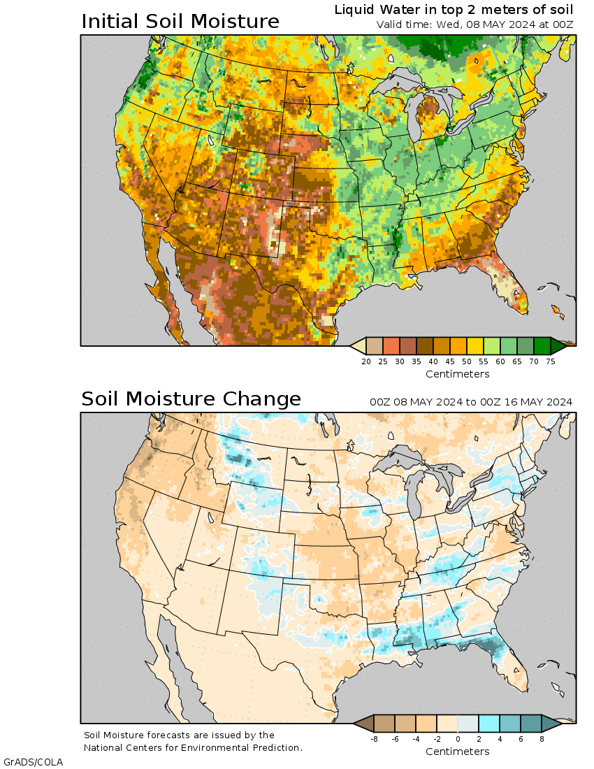


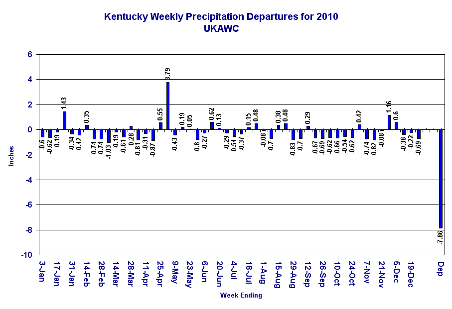
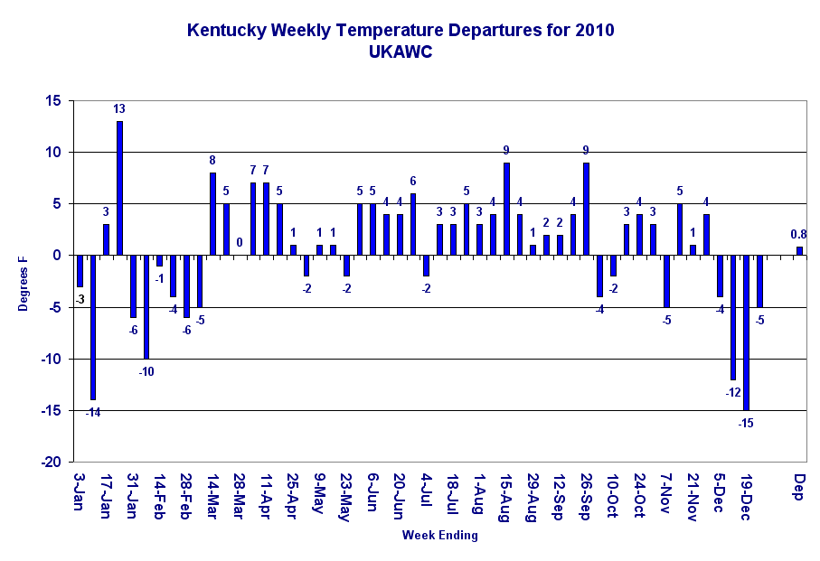


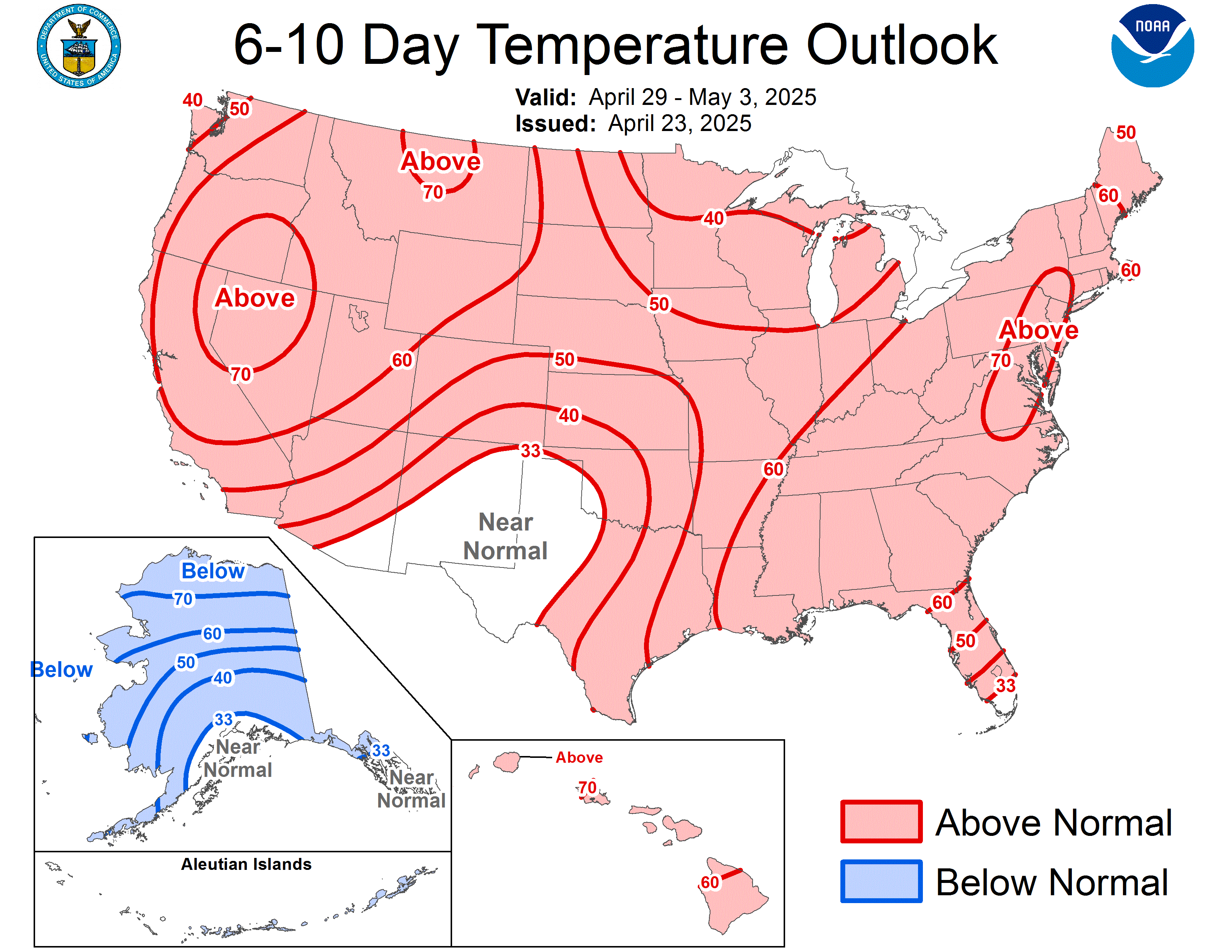
Kentucky Agricultural Weather Outlook
WESTERN KY AREA (including Paducah)
            CENTRAL KY AREA (including Lexington)


            EASTERN KY AREA (including Jackson)