Today's Weather
Current UTC Time:

Back to Weather Class page , Learning About Weather page , Class forecast form

Click here for the Rules of Thumb
AMS , AMS Glossary of Meteorology, NWS Glossary, 2nd Glossary, Haby's Hints, Haby's Wx Jargon, Tom's Wx Jargon, More Wx Jargon, LexCam , Tom's Working Page(s) , More Maps ,
UKAWC's WRF precip loop, Tom's Work page, Mike's Work page

Here are the local conditions for central Kentucky and Lexington...


Here are the regional conditions...Here.


..Stability Indices, ..Severe weather right now!, NWS Severe Desktop

UKAWC Stability Indices:
Lifted Index (LI) K-Index Cape CIN Showalter Index SWEAT Total Totals All


All KY Obs., All Obs
The Past Weather Observations Graghics (MesoWest/NWS):
12 hr 24 hr 36 hr 2 day 3 day 7 Day 14 day 28 day

Kymesonet data...


The Current Surface Weather Map shows the following...


Forecast Maps


Today:
Today:
Tomorrow:
Next Day:
Day 4:
Low-Track Circles:

Local Maps


Paducah Radar:
Louisville Radar:
Jackson Radar:
Charleston Radar:
Today's Max Temps:
Tonight's Min Temps:
Ohio Valley Radar:
U.S. Radar:
Tomorrow's Max Temps:
Next day's Min Temps:
Today's Forecast Map:
Tomorrow's Forecast Map:
Weather conditions:
Dew point Temps:
Cloud Forecast Map:
Wind Forecast Map:
Click image to zoom...


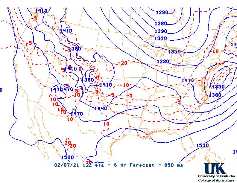
Click "Here" for Forecast Weather Conditions


UKAWC, LI, LI, K, K, Total Totals, Total Totals, Cape, Cape, Showalter Index, Sweat Index, SPC Radar/Convective Outlook Map, Stability Criteria, CIN, LI (NAM), Showalter (GFS), LEX MOS, Pad MOS, Upper air, ECMWF Upper air, Upper air soundings, Forecast maps, UK WRF maps
NCEP-Model Output Statistics (All Models):
BWG LOU CVG FTK FFT HOP EHR JKL LEX LOZ SDF PAH SME All HPC


Next 48

UKAWC Stability Indices:
Lifted Index (LI) K-Index Cape CIN Showalter Index SWEAT Total Totals All

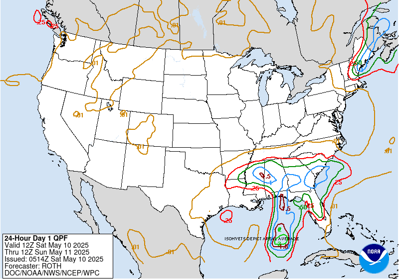
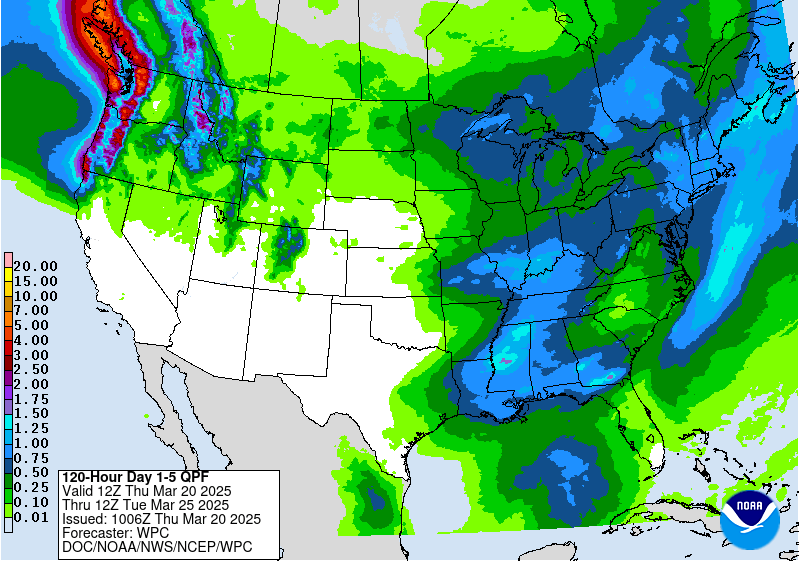
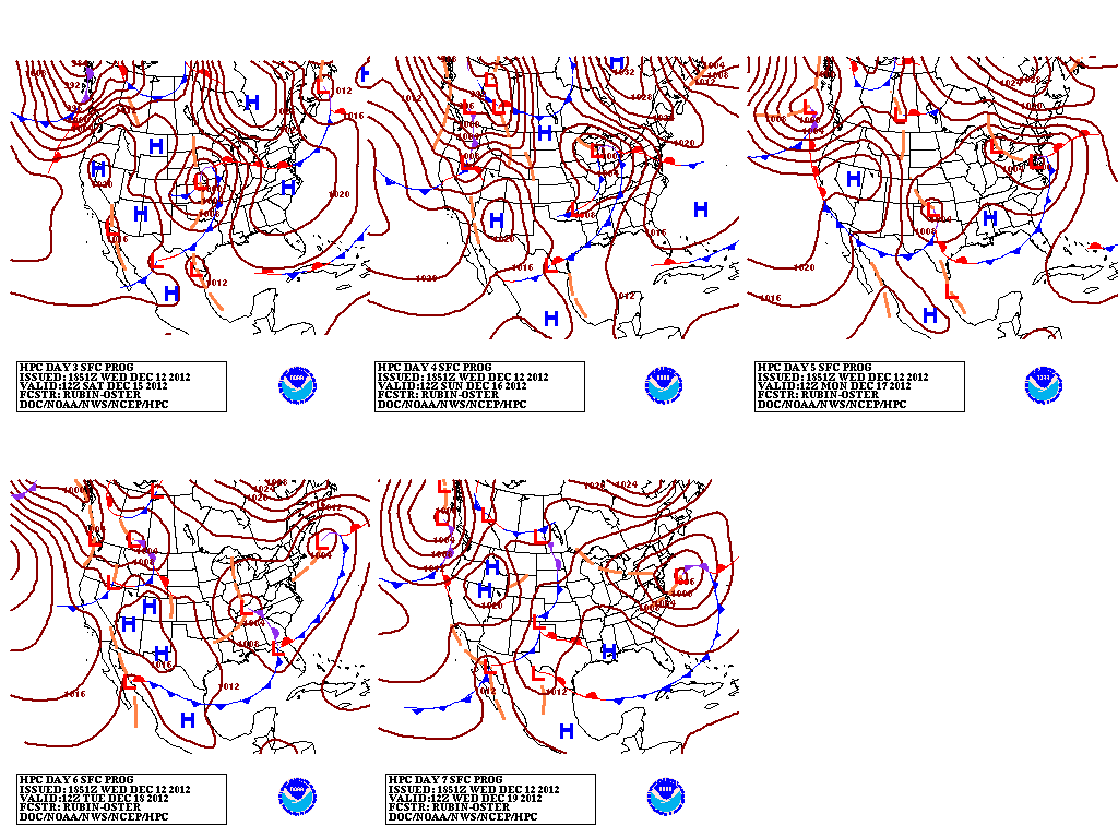
SFC Forecast map loop for 7 days... here.
UKAWC Stability Indices:
Lifted Index (LI) K-Index Cape CIN Showalter Index SWEAT Total Totals All

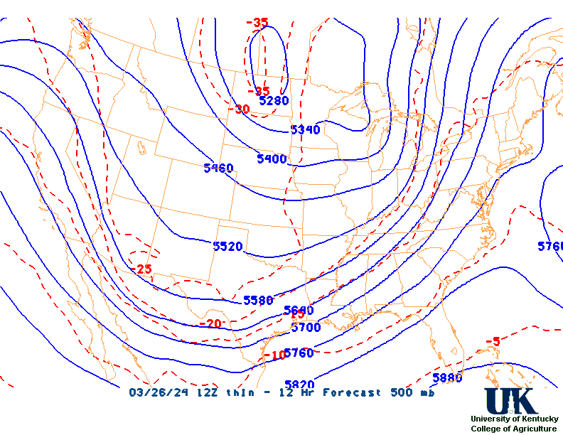
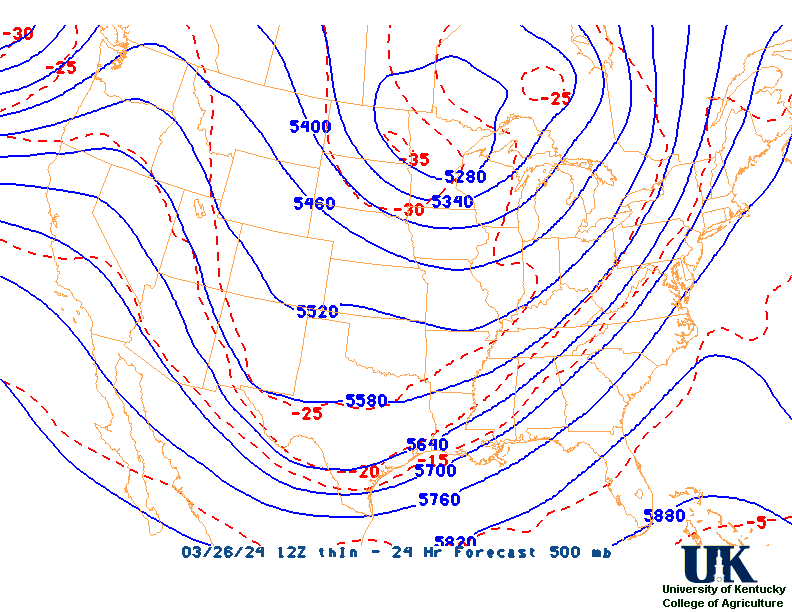
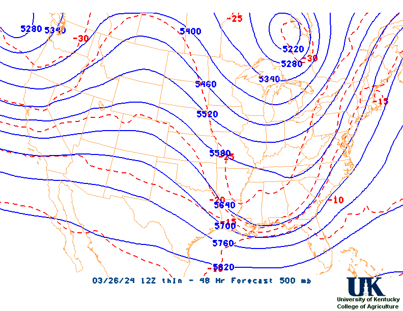
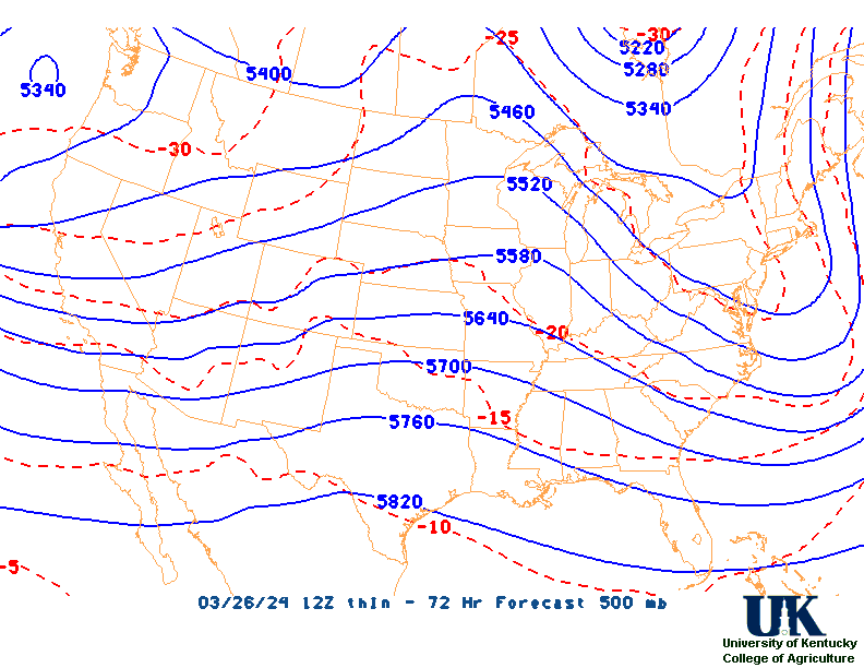
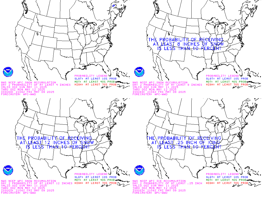
Why the surface weather map?


500 mb map
TWC Jetstream Maps
TWC Weather Trend maps
Day 2 Composite-Snow
All HPC Snow

NWS Forecast Maps (Click Here)


STOP! Write a brief synopsis now before completing the weather brief!
NWS Glossary, Haby's Hints
UCAR/RAP: GFS w/Loops, GFS 850, GFS 850 Loop, GFS 500, GFS 500 Loop,


NWS Discussions for: JKL, Paducah
All GFS Forecast Maps
Vertical Cross sections Maps


IR Sat loop
Why the 850 mb map
=======================================================================
Why the 500 mb map, GFS 500 Loop,

The 500 mb upper air analysis and forecast maps......


The 700 mb upper air analysis and forecast maps......


The 850 mb upper air map......


, GFS 850 Loop,

All UCAR/RAP:GFS Forecast Maps

UCAR/RAP: GFS w/Loops, GFS 850, GFS 850 Loop, GFS 500, GFS 500 Loop,
TWC Jet Stream, SPC's Levels of Risk, Evaluation of Stability, 7 day jet stream

The 1-day QPF map......& 5-day maps


5 day rainfall totals,

And here's the UK Ag, Lawn and Garden Forecast...


And here's the Central Kentucky Forecast...


And the Medium- and long-Range Outlook for Kentucky...


                             KENTUCKY                                                                     
                 ---------------------------------------------
                 6 TO 10 DAY  8 TO 14 DAY   30 DAY    90 DAY 
                 MAY 1-MAY 5  MAY 3-MAY 9    JUN       JUN-AUG                      
                 -----------  -----------  --------  ---------
   Temperature:      Above        Above                                            
 Precipitation:     Normal       Normal                                            

....  Medium and long range outlooks provided by NCEP/K. Thomas Priddy

Click here for the extended outlook across the Commonwealth.


All GFS Forecast Maps