
Over the years, I've used these simple rules-of-thumb (R.O.T.) on nearly a daily basis. Trying to forecast weather for Kentucky is a challenge. But when people ask me for weather information for Kentucky, Russia, Europe, ...anywhere, I've relied on these simple ROT's as the foundation to explore and forecast weather worldwide.
Are there exceptions to these rules? Of course! Every rule listed below has many exceptions. If not, then weather would be very boring. Yet...understanding these rules can lead to a much better understanding of why weather changes from day-to-day. But be careful! It's easy to get hooked on this stuff and it's just plain fun to try to figure what the weathers going to do.
So, take a look at these simple rules and try your hand at forecasting weather for your South 40. You just might be surprised.
1. "L"
2. "H"
3. How do weather systems move across China...Russia....USA?
4. What are the boundries between High pressure systems called?
One more point about Fronts. As an area of lower pressure deepens and the location of a warm and cold front
is drawn on the low center...the low pressure center gets a new name....becomes A LOW PRESSURE SYSTEM.
Now test your new skills. Click here to make a forecast.
5. POP?
6. What is the jet stream and its importance to weather?
Additional educational resources:
University of Illinois: Weather World 2010 (WW2010) here
List and describe ROT's (In your own words):
1)
2)
3)
4)
5)
6)
The L's on surface weather maps stand for Low air pressure. In the Northern Hemisphere...winds flow counter-clockwise and
are directed in and up toward the center of all Low pressure centers. This upward moving
air cools to the point that condensation occurs. We see this as clouds. If the air continues to rise...
then precipitation can occurr. So...the weather usually associated with Low pressure is cloudy and wet. Click here for the latest surface weather map from UKAWC.
Based on the above R.O.T...Where are clouds and precipitation occuring today? In Kentucky?
The H's on surface weather maps stand for High air pressure. In the Northern Hemisphere...winds flow clockwise and
are directed out and down away from the center of High pressure centers. This downward moving air
actually warms up as it is descending which is the opposite needed to create any clouds and precipitation. The weather usually associated with
High pressure is clear and dry.Click here for the latest surface weather map from UKAWC.
On today's surface weather map, and based on my R.O.T., where is the weather clear and dry today?
In the Northern Hemisphere....weather systems generally move from WEST to EAST...steered
by the upper air winds (25,000 to 30,000 feet). Click here for the latest surface weather map from UKAWC.
Fronts are boundries or fences between High air pressure systems. The weather associated with
fronts is cloudy and wet.Click here for the latest surface weather map from UKAWC.
The probability of precipitation, POP is one of the more confusing terms in meteorology. In the past,
you may have heard that a 50% POP meant that 5 times out of ten...under these same weather conditions
precip occurred. Boulderdash! That means very little and that defination really doesn't lend itself
to being very useful. But.... if POP is
considered the area of expected coverage of precip...it is easier to understand what the forecast
means. Click here for a graphic of an idealized
view of "area of expected coverage" from a Low Pressure System (NOTE: remember these are only rules-of-
thumb). POP decreases
as you move away from the center of Low pressure. Expected coverage of precipitation near the center
of the Low Pressure System is 70 to 90 percent. As you move away from the center and down the fronts
the "area of expected coverage" reduces to 50 percent...and so forth as shown in the above graph. So...a 50% chance of rain today can be translated
to imply 50 percent of the forecast area WILL receive rain...and 50% of the area will be dry.
Further...if the POP is for 20% chance of snow...that implies that 20% of the area will get snow
and 80% will be dry.
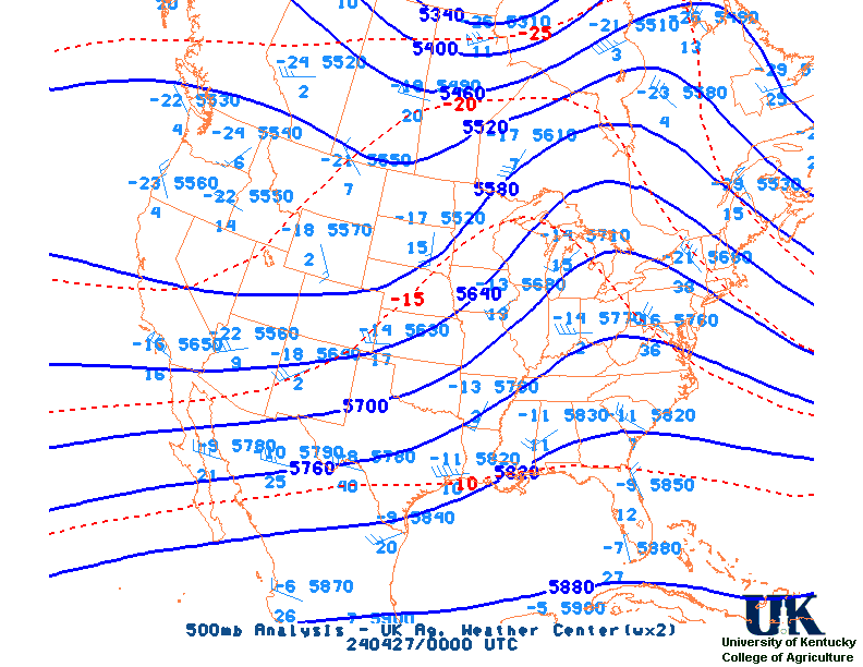
The jet stream is typically found near 25,000 to 30,000 feet and is the fastest winds aloft. It divides
cold, dry Polar air in the North and warm, tropical moist air in the South. In the summertime, the
jet stream is located far North of Kentucky, near the Canadian/U.S. border. During the winter, the
jet stream invades locations near and South of Kentucky, sometimes moving all the way to the
Southern states. "U" -shaped bends in
the jet are called troughs and provide cloudy, wet weather at the surface. In the trough of the jet
stream...max winds in the lower-right quidrent is unsually where severe weather occurrs. Inverted
"U" shapes in the jetstream are called ridges and provide clear, dry weather at the surface. The
best weather map to forecast the trend in weather at any given location is of the jet stream.
Click here for the 500 mb analysis ,
or here for 500 mb NAM model jet stream maps.
Click here for the WRF jet stream loop.
National Weather Service: JetStream - Online School for Weather here