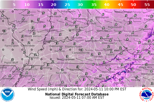
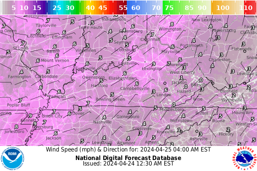
Fri Apr 26 22:06:46 EDT 2024 ... =-=-=-=-=-=->-=-=-=-=-=- What is UTC time? Click here to find out.... Mouseover to pause!......Kentucky Short-term forecast... Western KY .TONIGHT...Mostly cloudy with a slight chance of thunderstorms. A slight chance of showers this evening, then a chance of showers after midnight. Lows in the upper 60s. South winds 10 to 15 mph with gusts up to 25 mph. Chance of rain 30 percent. Central KY .TONIGHT...Warmer. Mostly cloudy then becoming partly cloudy late in the evening then becoming mostly cloudy. Lows in the upper 50s. South winds 10 to 15 mph. Eastern KY .TONIGHT...Mostly cloudy. A chance of showers this evening. Not as cool with lows in the mid 50s. South winds 5 to 10 mph. Chance of rain 20 percent. Detailed forecast information is available in your Precision Ag Weather forecast here... -=-=-=-=-=-=-=-=-=-=-=-=-=-=-=- Long-range outlooks here.
UKAWC Weather Map Carousel2
Last update: Fri Apr 26 22:06:46 EDT 2024
[US Rad], [IR Sat], [VIS], [WW], [NatRad], [Temps], [LSI], [Wind], [QPF], [5-day], [WCI], [DewP], [Sfc loop], [Sfc/Rad], [Today], [Tom.], [NextDay], [12Hr], [24Hr], [36Hr], [36Hr], [48Hr], [60Hr], [3-5 day], [7-day Threats] [850mb], [500mb], [Thick], ALL , wxcarousel , [Fast version]
Select radar by NWS office
To stop the weather map carousel, place the mouse over the map (Page will refresh every 10 minutes) :
Mouseover to pause! Click here to zoom!
Current Ag Weather Conditions

Based on observations at 1000pm EDT, Friday April 26, 2024

Across Kentucky...temperatures are near 77 degrees west, near 62 degrees central, and near 60 degrees east. Current sky conditions are mostly cloudy west, partly cloudy central, and partly cloudy east. In the west, relative humidity is near 48%, and the dew point is near 56 degrees. In the central part of the state, relative humidity is near 74%, and the dew point is near 54 degrees. In the east, relative humidity is near 77%, and the dew point is near 53 degrees. Current drying conditions are good west, fair central, and fair east. Winds are from the south at 8 mph west, where conditions are favorable for spraying. Winds are from the southeast at 9 mph central, where conditions are favorable for spraying. Winds are from the southeast at 5 mph east, where conditions are favorable for spraying. Based on current available observations, the highest temperature is 78 degrees at Hopkinsville. The lowest temperature is 60 degrees at London and Jackson.
Mouseover to pause!

423 
ASUS43 KLMK 270202
RWRKY 
KENTUCKY REGIONAL WEATHER ROUNDUP
NATIONAL WEATHER SERVICE LOUISVILLE KY
1000 PM EDT FRI APR 26 2024

NOTE "FAIR" INDICATES FEW OR NO CLOUDS BELOW 12,000 FEET
WITH NO SIGNIFICANT WEATHER AND/OR OBSTRUCTIONS TO VISIBILITY.

KYZ001>023-026-027-061>063-070>075-270300-
WESTERN AND SOUTH CENTRAL KENTUCKY
  
CITY           SKY/WX    TMP DP  RH WIND       PRES   REMARKS
PADUCAH        MOCLDY    77  56  48 S8        29.89R                  
HENDERSON      MOCLDY    72  61  68 SE10      29.93R                  
OWENSBORO      CLOUDY    71  61  70 SE14      29.96R                  
HOPKINSVILLE   MOCLDY    78  59  51 S9        29.94R                  
BOWLING GREEN  MOCLDY    72  58  61 SE9       30.00R                  
GLASGOW        NOT AVBL                                               
$$

KYZ024-025-028>034-038-045-046-053-270300-
NORTH CENTRAL KENTUCKY
  
CITY           SKY/WX    TMP DP  RH WIND       PRES   REMARKS
LOUISVILLE/SDF CLOUDY    66  54  65 SE13      30.02S                  
LOUISVILLE/LOU PTCLDY    64  55  72 SE13G21   30.02F                  
FORT KNOX      PTCLDY    65  56  73 E8        29.99F                  
$$

KYZ035>037-039>044-047>052-055>060-089>105-270300-
NORTHEAST KENTUCKY
  
CITY           SKY/WX    TMP DP  RH WIND       PRES   REMARKS
LEXINGTON      PTCLDY    62  54  74 SE9       30.09S                  
COVINGTON      CLOUDY    63  55  75 S15       30.06R                  
FRANKFORT      PTCLDY    62  54  74 SE8       30.07S                  
$$

KYZ054-064>069-076>088-106>120-270300-
SOUTHEAST KENTUCKY
  
CITY           SKY/WX    TMP DP  RH WIND       PRES   REMARKS
JACKSON        PTCLDY    60  53  77 SE5       30.16R                  
LONDON         PTCLDY    60  53  77 SE5       30.14R                  
SOMERSET       NOT AVBL                                               
MIDDLESBORO    NOT AVBL                                               
MONTICELLO     PTCLDY    63  56  78 VRB5      30.13R                  
$$


Mouseover to pause!...... -=-=-=-=-=-=-Severe Weather Safety Tips Click Here-=-=-=-=-=- Detailed forecast information is available in your Precision Ag Weather forecast here... -=-=-=-=-=-=-Severe Weather Safety Tips Here-=-=-=-=-=- Long-range outlooks here. =-=-=-=-

Temperature

Next 12 Hrs
Next 24 Hrs
Next 36 Hrs
Next 48 Hrs

Probability of Precipitation

Next 12 Hrs
Next 24 Hrs
Next 36 Hrs
Next 48 Hrs

Weather Conditions

Next 12 Hrs
Next 24 Hrs
Next 36 Hrs
Next 48 Hrs

Winds

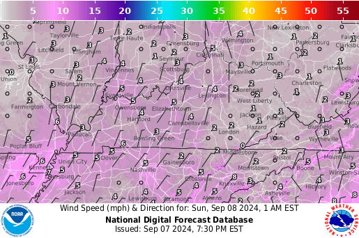
Next 12 Hrs
Next 24 Hrs
Next 36 Hrs
Next 48 Hrs

For the forecasted weather conditions in Kentucky this coming week, click here.
Kentucky Short-Term Summary


Error Openning File: [ /ldmdata/discussions/AWUS83.KLMK ]


957 
AWUS83 KJKL 070910
RWSJKL

KYZ044-050>052-058>060-068-069-079-080-083>088-104-106>120-080915-

Regional Weather Summary
National Weather Service Jackson KY
510 AM EDT Thu Jul 7 2022

08Z sfc analysis shows a wavy frontal boundary just to the north
of the JKL CWA placing the area firmly in the warm sector of a
larger weather pattern. This has made for another warm and muggy 
night with a few nocturnal storms ongoing just south of the
Tennessee border. The thicker clouds over the area last evening 
have thinned and cleared to the point that abundant sfc moisture 
in place has manifested in areas of fog with a few dense patches
noted - primarily on the ridgetops. Otherwise, temperatures (and 
dewpoints) are fairly uniform across the area in the upper 60s and
lower 70s, amid light winds. 

The models are in good agreement aloft through the short term 
portion of the forecast. They all depict the persistent mid level
ridge holding on for one more day before yielding to increasing
shortwave troughing to the north and shifting its core westward.
Even today, this ridge is insufficiently strong to keep energy
from dropping through northeast parts of the CWA likely helping to
spawn renewed convection through the area later today. 5h heights
then further decline aloft on Friday when a fairly strong impulse 
moves into the Ohio Valley - brushing by to the northeast during
that afternoon. Given the small model spread through the short
term did not deviate far from the blended NBM solution aside from
incorporating some mesoscale specifics from the CAMs consensus 
into the evening part of the forecast. 

Sensible weather will feature our warm, humid, and often stormy
period of weather continuing through the end of the work week.
Strong, and potentially severe, storms will probably develop later
this afternoon mainly over the Cumberland Valley. The storms will
be fueled by high levels of CAPE over the area and ample moisture.
Additionally, the DCAPE will be near 1000 j/kg over eastern
Kentucky this afternoon prompting a potential for damaging wind 
gusts while very high PW air supports the threat of excessive 
rainfall - especially where any cell training sets up. The 
instability will fade into the evening and with it the threat for 
severe weather by thunderstorm chances, diminished, remain. Strong
storm then likely return on Friday with a continued threat for 
heavy rainfall and slightly better upper level support. 

Temperatures will be quite warm again today and Friday with high 
humidities pushing heat indices toward 100 degrees, though the 
convection expectations make this far from a certainty for many 
places. Again tonight we can anticipate muggy and warm conditions 
with areas of fog developing and favoring the spots that see the 
best rain today. An SPS has been issued for the potential of high 
heat indices across the area this afternoon, as well. 

The main adjustments to the NBM starting point were to incorporate 
some enhanced details into the PoPs from the CAMs consensus into 
the evening - favoring the Cumberland Valley with the highest
values. 

$$

GREIF


Error Openning File: [ /ldmdata/discussions/AWUS83.KPAH ]


LMK


769 
FXUS63 KLMK 270137
AFDLMK

Area Forecast Discussion
National Weather Service Louisville KY
937 PM EDT Fri Apr 26 2024

...Forecast Update...

.KEY MESSAGES...

*   Warm and breezy this weekend, with gusts exceeding 30 mph out of 
    the southwest at times.

*   Rain chances return early next week, but above normal 
    temperatures persist.

&&

.UPDATE...
Issued at 937 PM EDT Fri Apr 26 2024

Looking for another quiet evening across the region with mild lows 
only dropping into the low and mid 60s for most under steady SE
winds and broken mid to upper clouds. A few gusts up in the 20 
to 25 mph range are possible at times overnight. Have backed off
the pops in our NW a bit as time heights really don't show much
saturation in the lower half of the column. Nevertheless, will 
still carry a small chance of a shower mainly across southern IN
overnight, where PWATs are a little higher (moisture is a 
little deeper). Outside of that, no other changes planned to the
forecast at this time.

&&

.SHORT TERM /THROUGH SATURDAY/...
Issued at 302 PM EDT Fri Apr 26 2024

Currently... Along surface troughing, a thin line of showers is 
moving through the region. Outside of the showers, there are 
scattered to broken mid-level clouds streaming overhead and 
temperatures in the upper 60s and mid 70s.


Tonight... As the low pressure system over the central Plains 
strengthens and propagates northeastward, pressure gradients will 
tighten over the Ohio Valley. The tightening gradients will lead to 
breezy sustained winds of 10-14mph and gusting up to 25mph. The warm 
front associated with this system will sweep through the region in 
the overnight hours, shifting winds to a southerly direction and 
allowing weak moisture advection. A 45-50kt LLJ will meander into 
the region supporting some light, dissipating showers along and east 
of I-65 in the early morning hours. Low temperatures will be in the 
low-mid 60s.


Saturday... The low pressure system will quickly move over the Great 
Lakes region, pulling most of the precipitation to the north of the 
region. Light showers will still be possible until the afternoon 
over southern Indiana. Gradient winds will continue to strengthen 
bringing breezy winds around 12-15mph and gusting up to 30mph. Skies 
will remain mostly cloudy, with some brief breaks towards the late 
afternoon. High temperatures are expected to be in the upper 70s and 
low 80s. Dew points will be in the upper 50s and low 60s, rendering 
Saturday a muggy day.

&&

.LONG TERM /SATURDAY NIGHT THROUGH FRIDAY/...
Issued at 305 PM EDT Fri Apr 26 2024

Saturday night into Sunday continue to look dry as upper level 
ridging promotes subsidence aloft and surface fields lack any sort 
of lifting mechanism. Breezy southerly to southwesterly winds will 
continue, particularly Sunday afternoon as the lower boundary layer 
mixes out. Gusts will likely be in the 20 to 30mph range during the 
day.

A slow moving frontal boundary will then begin to push toward the 
region on Monday before "fizzling" out with eastward extent. Showers 
and perhaps a few storms will be possible near the frontal boundary, 
and depending on how slow the frontal boundary progresses, 
precipitation could linger into Tuesday. There should be some brief 
drying behind the front before more active weather arrives by 
midweek ahead of another frontal boundary. We could see a couple 
rounds of showers/storms with this particular setup as the frontal 
boundary will likely be stalled from the Great Lakes region into the 
southern Plains before a shortwave ejects a low into the Plains and 
"kicks" everything eastward toward the end of the week. Model 
members and their respective ensembles have a bit of spread with the 
timing of features and/or rain and storm chances, so confidence in 
the forecast details as well as any severe weather potential for 
this timeframe remain low.

&&

.AVIATION /00Z TAFS THROUGH 06Z MONDAY/...
Issued at 736 PM EDT Fri Apr 26 2024

Things are dry and VFR across the area at this hour, and expect that 
to continue through the overnight. Look for mid to high clouds with 
some virga also possible at times. Steady to occasionally gusty SE 
winds will gradually veer to SSE later tonight. A strong low level 
jet around 45 knots at 2 K feet will overspread the region just 
before Midnight, and given around 30 degree of directional shear in 
addition to the speed shear we are just meeting LLWS criteria. 

LLWS diminishes around sunrise with stronger S to SSW wind taking 
hold around 10 to 20 mph, occasionally gusting 20 to 30 mph. 
Continued mid to high clouds are expected, with perhaps a few 
morning very light showers around HNB. Not expecting enough impact, 
if at all, to mention attm.

&&

.LMK WATCHES/WARNINGS/ADVISORIES...
KY...None.
IN...None.

&&

$$

UPDATE...BJS
SHORT TERM...SRM
LONG TERM...DM
AVIATION...BJS


JKL


179 
FXUS63 KJKL 270025 AAA
AFDJKL

AREA FORECAST DISCUSSION...UPDATED
National Weather Service Jackson KY
825 PM EDT Fri Apr 26 2024

.KEY MESSAGES...

- Becoming very warm this weekend and lasting at least through the  
  middle of next week.

- Showers and thunderstorms may occur at times during the upcoming
  workweek, with the highest probability being Monday night and
  Tuesday as an upper level disturbance and dying cold front
  approach.

&&

.UPDATE...
Issued at 825 PM EDT FRI APR 26 2024

00Z sfc analysis shows deep low pressure to the west of the state
while a warm front from this is lifting through eastern Kentucky
this evening. This boundary has brought plenty of clouds and a few
light showers to the area though with a weakening trend noted as 
the showers slip out of the state over the next hour or so. 
Currently, temperatures are fairly uniform in the low to mid 60s 
for most. Meanwhile, amid generally southeast winds of 5 to 10 
mph, dewpoints are running in the mid to upper 50s. Have updated 
the forecast to fine tune the ending of the showers through the 
rest of the evening as well as to include the current obs and 
trends for the T/Td/Sky grids. These minor adjustments have been 
sent to the NDFD and web servers along with a freshening of the 
zones and SAFs. 

&&

.SHORT TERM...(This evening through Saturday night)
Issued at 317 PM EDT FRI APR 26 2024

A poorly defined warm front was situated to our southwest this
afternoon. A band of clouds and showers was occurring in the
isentropic lift northeast of the boundary. The showers were  
persistent as they moved into our southern counties and are still
ongoing. However, models still show them diminishing later today
and early this evening as the band continues to shift northeast.
Will look for them to dry up by around 10 pm.

In the bigger picture, the warm front over TN extends northwest to
a deep, stacked low pressure system over NE. Sprawling high
pressure was centered off the East Coast. Aloft, ridging extends 
from eastern Ontario south to the eastern gulf. The NE low will
move slowly northeast into Ontario by late Saturday, while another
low pressure system develops over KS on Saturday and Saturday
night. The first low will pull the warm front further north,
placing us in the warm sector by Saturday. The large pressure
gradient between the western Atlantic high and the plains/Midwest
lows will bring us persistent southerly low level flow. However,
the best moisture feed off the gulf will be to our west and
northwest, and ridging aloft will be slow to budge. That being the
case, there won't be any significant feature to focus precip for
our area once the warm front shifts to our north, and dry weather
is forecast for Saturday and Saturday night. A warm air mass in
place beneath ridging aloft will result in high temperatures
nearing 80 for our warmest locations on Saturday.

.LONG TERM...(Sunday through Friday)
Issued at 321 PM EDT FRI APR 26 2024

An active pattern in store in the extended period of the forecast 
for residents of eastern Kentucky, as a series of weather systems 
move across the eastern half of the nation. The general upper level 
flow pattern will start off with a broad trough of low pressure 
aloft in place over the western half of the CONUS early Sunday, 
stretching from the west coast eastward into the Great Plains. 
Another trough is forecast to be moving away from the east coast and 
out into the Atlantic Ocean to start things off, with ridging 
building northward from the eastern Gulf of Mexico and up the 
eastern seaboard into southern New England. Our first rounds of 
showers and storms will begins moving into our area late Monday 
afternoon into early Monday evening, as a trough of surface low 
pressure begins ejecting northeastward out of the north central 
Plains, ahead of the eastward moving upper trough. The cold front 
trailing south from the surface low will begin pushing through the 
Ohio and Tennessee Valleys Monday night and Tuesday. Even though the 
surface feature will be weakening, there should still be enough 
instability, lift, and moisture present to fire widespread showers 
and scattered thunderstorms off along and ahead of the advancing 
surface front to begin the week. Based on the latest runs of the GFS 
and ECMWF models, our highest precipitation probabilities should 
occur from early Tuesday morning through Tuesday afternoon, as the 
cold front is passing through.

Showers and a few storms will linger behind the departed front 
Tuesday night, as moisture and lift left over in the wake of the 
upper low should be just enough to keep convection going for a bit. 
Based on current model trends, we will not see much of a break in 
the rain, as a second trough of low pressure aloft will be pushing 
onshore in the Pacific Northwest early Tuesday, and will be moving 
our way into the middle of the week. As the upper system moves east 
and strengthens, another area of low pressure is expected to form 
over the northern Plains, and will be our weather maker from mid-
week onward. This second low is forecast to intensify and then 
nearly stall our over south central Canada on Wednesday. As this 
trough spins its wheels just north of the border, another weaker 
area of low pressure is forecast to take shape over the western 
slopes of the Rocky's. As these two systems moves east, their energy 
will phase a bit, and will make for another period of wet weather 
that will first begin on Wednesday, and will last heading into the 
upcoming weekend. Several rounds of showers and storms are expected 
to move through the area during this time, as several pulses of 
energy aloft rotate around the southern Canada trough. A few weak 
frontal boundaries will also move through our are, further enhancing 
rain chances. Based on current forecast soundings, there should be 
enough instability present, day and night, to keep thunderstorms 
rolling to finish out the extended.

With persistent and increasing southerly and southwesterly flow 
expected across the area, plenty of warm, moisture Gulf of Mexico 
air will be advecting into the Tennessee and Ohio Valleys all week, 
and will allow for an extended period of well above normal 
temperatures for eastern Kentucky. Daily highs should max out in the 
upper 70s to mid 80s until Friday, when cooler air may finally 
filter in, giving way to highs in the low to mid 70s for our area. 
No weather concerns of note at this time, but we will keep a close 
eye on convective potential for later this week and see if any 
trends develop that could indicate the potential for strong 
thunderstorms for our area. We may also see very modest ridge valley 
temperature differences Sunday night and again Tuesday night, as 
skies briefly clear and winds become very light.

&&

.AVIATION...(For the 00Z TAFS through 00Z Saturday evening)
ISSUED AT 745 PM EDT FRI APR 26 2024

VFR conditions are expected through the period, but isolated to 
scattered showers and low end VFR ceilings will affect the region 
for a time this evening. During the night, low level flow will 
increase, particularly just off the surface. This raises concerns 
for low level wind shear overnight from the south at up to 45 kts
into Saturday morning. Sfc winds will be generally from the 
south to southeast at less than 10 kts tonight and up to 15 kts
from the south during the day, Saturday. 

&&

.JKL WATCHES/WARNINGS/ADVISORIES...
NONE.
&&

$$

UPDATE...GREIF
SHORT TERM...HAL
LONG TERM...AR
AVIATION...HAL/GREIF

      
PAH

	
006 
FXUS63 KPAH 262359
AFDPAH

Area Forecast Discussion
National Weather Service Paducah KY
659 PM CDT Fri Apr 26 2024

.KEY MESSAGES...

- Multiple chances of rain and storms forecast through next week
  with the most widespread rains expected late Sunday through
  Monday evening.

- Severe storms are possible mainly over southeast Missouri and
  southern Illinois late this afternoon into tonight and again
  late Sunday into Sunday night.

- South winds will gust up to 30 mph Saturday, and 30-40 mph
  Sunday.

&&

.UPDATE...
Issued at 659 PM CDT Fri Apr 26 2024

Updated aviation section for 00z TAF issuance.

&&

.DISCUSSION...
Issued at 234 PM CDT Fri Apr 26 2024

As of this afternoon an upper level shortwave was evident in WV
imagery moving into the northern plains while a surface low was
moving into NE. A warm front extends from this low across E KS,
C MO, and into portions of W KY. Visible imagery shows 
extensive clearing has taken place across W KY and W TN. This 
area seems to have a pocket of dry air aloft which should keep 
things clear this afternoon, albeit the increasing instability. 
The line of showers and embedded thunderstorms that was located 
across south central MO this morning has fallen apart as it 
moved away from better forcing parked to the west. Additional 
development was noted across NW AR and SW MO that is lifting 
northeast. This seems to be resolved well in the CAMs. 
Additional chances of showers and thunderstorms may be possible 
this afternoon and overnight mainly across SE MO and southern 
IL. The main threat from this activity would be damaging winds 
with the probability of strong/severe storms still low given 
that the better forcing is well west and meager instability. 

Another disturbance and associated low pressure center will develop 
across the plains this weekend and will gradually move north into 
the Great Lakes Sunday into Sunday night. A strengthening pressure 
gradient between the low situated in the plains, and a surface high 
off the East Coast will bring breezy south winds this weekend. A 
boundary is expected to move through the Quad State late Sunday into 
Monday and will bring widespread showers and thunderstorms to the 
area. At this time, the warm sector airmass looks to be 
characterized by meager instability. The southern end of an h50
jet max will likely bring increasing bulk shear through the 
region although this jet core will be lifting out rather 
quickly. Thus, the environment doesn't look overly impressive 
and favorable for severe weather across our area, and the 
current thinking remains the same that a line of storms will 
likely be moving through the region with a weakening trend. A 
damaging wind risk seems possible with any stronger convection. 
Heavy rains, especially in any convection, will be possible as 
the system moves through with PWAT values near 1.50 inches. Not 
expected any widespread flooding issues given the progressive 
nature of this system.

Guidance favors a more zonal upper level pattern taking shape 
Tuesday through Thursday. Additionally, we will remain a southerly 
flow regime through much of the week favoring a moist and warm 
airmass with temperatures climbing into the 80's. This pattern 
suggests chances of showers and storms at times which the NBM has a 
good handle on. With that said, models haven't been in solid 
agreement over the past few days leading to lower confidence during 
this time.

&&

.AVIATION /00Z TAFS THROUGH 00Z SUNDAY/...
Issued at 659 PM CDT Fri Apr 26 2024

At KCGI/KMVN, VFR conditions with scattered shra/isolated tsra 
between 02z-09z. KCGI could again see some isolated to scattered
shra/tsra between 15z-21z. MVFR vsbys possible with storms.  At
KPAH, VFR conditions expected with isolated/scattered shra
possible between 06z-14z. At KEVV/KOWB, conditions will be VFR
with potential LLWS between 05z-14z at 020/19040kt. At all 
sites, surface winds will be from the south to southeast at 
7-14kts with gusts of 18-23kts, increasing to 10-20kts with 
gusts around 25 kts after 13z.


&&

.PAH WATCHES/WARNINGS/ADVISORIES...
IL...None.
MO...None.
IN...None.
KY...None.

&&

$$


DISCUSSION...AD
AVIATION...RST


Current Agricultural Weather Conditions in Kentucky
Based on observations at 1000pm EDT, Friday April 26, 2024

Across Kentucky...temperatures are near 77 degrees west, near 62 degrees central, and near 60 degrees east. Current sky conditions are mostly cloudy west, partly cloudy central, and partly cloudy east. In the west, relative humidity is near 48%, and the dew point is near 56 degrees. In the central part of the state, relative humidity is near 74%, and the dew point is near 54 degrees. In the east, relative humidity is near 77%, and the dew point is near 53 degrees. Current drying conditions are good west, fair central, and fair east. Winds are from the south at 8 mph west, where conditions are favorable for spraying. Winds are from the southeast at 9 mph central, where conditions are favorable for spraying. Winds are from the southeast at 5 mph east, where conditions are favorable for spraying. Based on current available observations, the highest temperature is 78 degrees at Hopkinsville. The lowest temperature is 60 degrees at London and Jackson. Click here for the entire list of ag. weather observations across Kentucky.

  
Updated Thursday Evening, December 9, 2021

Severe weather on the table

It has been a rather active weather pattern to start December. Through the 8th, the state has averaged 1.39 inches. Attention now turns to another round of showers and storms tomorrow and Saturday. Altogether, another half to 1.5 inches will be on the table. Coverage will start tomorrow scattered in nature. Highs will jump into the 60s across much of the area behind breezy southerly winds. Shower/storm coverage and intensity then increases tomorrow night and into Saturday morning. A line of storms is expected with damaging winds as the main threat, but tornadoes also very much possible. Heavy rain also presents a flooding threat, especially for low lying areas. Now is the time to get animals out of those spots. Bottom line, this will present an overnight threat, so please have a way to get warning (highly suggest a NOAA Weather Radio).

After a brief cool down for the latter half of the weekend, temperatures go on the uphill climb next week. Outlooks hint the warm air will hang around the area through the third full week of December. Any additional rain chances look to hold off until late workweek.


 Across the Commonwealth...
Western KY .TONIGHT...Mostly cloudy with a slight chance of thunderstorms. A slight chance of showers this evening, then a chance of showers after midnight. Lows in the upper 60s. South winds 10 to 15 mph with gusts up to 25 mph. Chance of rain 30 percent. Central KY .TONIGHT...Warmer. Mostly cloudy then becoming partly cloudy late in the evening then becoming mostly cloudy. Lows in the upper 50s. South winds 10 to 15 mph. Eastern KY .TONIGHT...Mostly cloudy. A chance of showers this evening. Not as cool with lows in the mid 50s. South winds 5 to 10 mph. Chance of rain 20 percent.
Across the Commonwealth for the next week...

WESTERN KY AREA (including Paducah):

     
Fri Apr 26 21:34:12 EDT 2024

McCracken-
Including the city of Paducah
830 PM CDT Fri Apr 26 2024

.TONIGHT...Mostly cloudy with a slight chance of thunderstorms. A
slight chance of showers late this evening, then showers likely
after midnight. Lows in the upper 60s. South winds 10 to 15 mph
with gusts up to 25 mph. Chance of rain 70 percent. 
.SATURDAY...Mostly sunny with a slight chance of showers. A
slight chance of thunderstorms in the afternoon. Highs in the mid
80s. South winds 15 to 20 mph with gusts up to 30 mph. Chance of
rain 20 percent. 
.SATURDAY NIGHT...Partly cloudy in the evening, then clearing.
Lows in the upper 60s. South winds 10 to 15 mph with gusts up to
25 mph. 
.SUNDAY...Mostly sunny. Highs in the mid 80s. South winds 15 to
20 mph with gusts up to 30 mph. 
.SUNDAY NIGHT...Mostly cloudy. A chance of showers after
midnight. Lows in the mid 60s. South winds 10 to 15 mph with
gusts up to 25 mph. Chance of rain 50 percent. 
.MONDAY...A chance of thunderstorms. Showers. Highs in the mid
70s. Chance of rain 90 percent. 
.MONDAY NIGHT...Showers likely, mainly in the evening. Lows in
the lower 60s. Chance of rain 60 percent. 
.TUESDAY...Partly sunny in the morning, then sunny with a chance
of showers and thunderstorms in the afternoon. Highs in the lower
80s. Chance of rain 30 percent. 
.TUESDAY NIGHT...Mostly clear in the evening, then becoming
partly cloudy. Lows in the mid 60s. 
.WEDNESDAY...Mostly sunny. A chance of showers and thunderstorms
in the afternoon. Highs in the lower 80s. Chance of rain
40 percent. 
.WEDNESDAY NIGHT...Partly cloudy in the evening, then mostly
cloudy with a chance of showers and thunderstorms after midnight.
Lows in the lower 60s. Chance of rain 40 percent. 
.THURSDAY AND THURSDAY NIGHT...Mostly cloudy. A chance of showers
and thunderstorms. Highs in the lower 80s. Lows in the upper 50s.
Chance of rain 50 percent. 
.FRIDAY...Partly sunny. A chance of showers in the afternoon.
Highs in the mid 70s. Chance of rain 40 percent. 


--------------------------------------------------------------------

CENTRAL KY AREA (including Louisville and Lexington):


Fri Apr 26 21:36:23 EDT 2024

Fayette-
Including the city of Lexington
935 PM EDT Fri Apr 26 2024

.TONIGHT...Warmer. Mostly cloudy then becoming partly cloudy late
in the evening then becoming mostly cloudy. Lows in the upper
50s. South winds 10 to 15 mph. 
.SATURDAY...Mostly cloudy. Highs in the upper 70s. South winds
15 to 20 mph. 
.SATURDAY NIGHT...Partly cloudy. Lows around 60. South winds
10 to 15 mph. 
.SUNDAY...Sunny. Highs in the lower 80s. South winds 10 to
15 mph. 
.SUNDAY NIGHT...Mostly clear. Lows in the lower 60s. South winds
10 to 15 mph. 
.MONDAY...Mostly sunny. A 20 percent chance of thunderstorms in
the afternoon. Highs in the lower 80s. 
.MONDAY NIGHT...Mostly cloudy. Chance of thunderstorms in the
evening, then showers likely and chance of thunderstorms after
midnight. Lows in the lower 60s. Chance of precipitation
70 percent. 
.TUESDAY...Showers likely and slight chance of thunderstorms in
the morning, then showers likely and chance of thunderstorms in
the afternoon. Highs in the upper 70s. Chance of precipitation
70 percent. 
.TUESDAY NIGHT...Mostly clear. Chance of thunderstorms in the
evening, then slight chance of thunderstorms after midnight. Lows
in the upper 50s. Chance of thunderstorms 30 percent. 
.WEDNESDAY...Mostly sunny. Chance of showers and slight chance of
thunderstorms in the morning, then chance of thunderstorms in the
afternoon. Highs in the lower 80s. Chance of precipitation
30 percent. 
.WEDNESDAY NIGHT...Partly cloudy. Chance of thunderstorms in the
evening, then slight chance of thunderstorms after midnight. Lows
in the upper 50s. Chance of thunderstorms 30 percent. 
.THURSDAY...Mostly sunny. Chance of showers and slight chance of
thunderstorms in the morning, then chance of thunderstorms in the
afternoon. Highs in the upper 70s. Chance of precipitation
50 percent. 
.THURSDAY NIGHT...Partly cloudy in the evening then becoming
mostly cloudy. A 50 percent chance of thunderstorms. Lows in the
upper 50s. 
.FRIDAY...Partly sunny. Chance of thunderstorms in the morning,
then chance of showers and slight chance of thunderstorms in the
afternoon. Highs in the lower 70s. Chance of precipitation
40 percent. 


--------------------------------------------------------------------

EASTERN KY AREA (including Jackson):

  
Fri Apr 26 20:00:24 EDT 2024

Breathitt-
Including the city of Jackson
800 PM EDT Fri Apr 26 2024

.TONIGHT...Mostly cloudy. A chance of showers this evening. Not
as cool with lows in the mid 50s. South winds 5 to 10 mph. Chance
of rain 20 percent. 
.SATURDAY...Partly cloudy in the morning, then becoming mostly
cloudy. Highs in the upper 70s. South winds 10 to 15 mph. 
.SATURDAY NIGHT...Partly cloudy in the evening, then clearing.
Patchy valley fog late. Lows in the lower 50s valleys and and
around 60 ridges. South winds 5 to 10 mph. 
.SUNDAY...Patchy valley fog early. Mostly sunny. Highs
in the mid 80s. Southwest winds 5 to 10 mph. 
.SUNDAY NIGHT...Clear. Lows in the upper 50s. South winds 5 to
10 mph. 
.MONDAY...Sunny in the morning, then becoming partly sunny. Highs
in the mid 80s. 
.MONDAY NIGHT...Partly cloudy in the evening, then mostly cloudy
with a chance of showers with a slight chance of thunderstorms
overnight. Lows in the mid 60s. Chance of rain 40 percent. 
.TUESDAY...Showers likely with a slight chance of thunderstorms.
Highs in the upper 70s. Chance of rain 70 percent. 
.TUESDAY NIGHT...Partly cloudy with a slight chance of
thunderstorms. A chance of showers in the evening, then a slight
chance of showers overnight. Lows in the lower 60s. Chance of
rain 30 percent. 
.WEDNESDAY...Partly sunny with a slight chance of thunderstorms.
A slight chance of showers in the morning, then a chance of
showers in the afternoon. Highs in the mid 80s. Chance of rain
30 percent. 
.WEDNESDAY NIGHT...Partly cloudy with a slight chance of
thunderstorms. A chance of showers in the evening, then a slight
chance of showers overnight. Lows in the lower 60s. Chance of
rain 30 percent. 
.THURSDAY...Partly cloudy with a chance of showers. A slight
chance of thunderstorms in the morning, then a chance of
thunderstorms in the afternoon. Highs in the lower 80s. Chance of
rain 50 percent. 
.THURSDAY NIGHT...Partly cloudy with a chance of showers and
thunderstorms. Lows around 60. Chance of rain 40 percent. 
.FRIDAY...Partly cloudy with a chance of showers. A chance of
thunderstorms, mainly in the morning. Highs in the mid 70s.
Chance of rain 40 percent. 


Kentucky Medium & Long Range Outlook:

KENTUCKY --------------------------------------------- 6 TO 10 DAY 8 TO 14 DAY 30 DAY 90 DAY MAY 2-MAY 6 MAY 4-MAY 10 JUN JUN-AUG ----------- ----------- -------- --------- Temperature: Above Above Precipitation: Normal Normal .... Medium and long range outlooks provided by NCEP/K. Thomas Priddy
Click
here for the outlook maps.


And here's the UK Ag, Lawn and Garden Forecast...


WEST - Hazardous Weather
Fri Apr 26 15:56:13 EDT 2024 Jefferson-Wayne IL-Edwards-Wabash-Perry IL-Franklin-Hamilton- White-Jackson-Williamson-Saline-Gallatin-Union-Johnson-Pope- Hardin-Alexander-Pulaski-Massac-Gibson-Pike-Posey-Vanderburgh- Warrick-Spencer-Fulton-Hickman-Carlisle-Ballard-McCracken-Graves- Livingston-Marshall-Calloway-Crittenden-Lyon-Trigg-Caldwell- Union KY-Webster-Hopkins-Christian-Henderson-Daviess-McLean- Muhlenberg-Todd-Perry MO-Bollinger-Cape Girardeau-Wayne MO-Carter- Ripley-Butler-Stoddard-Scott-Mississippi-New Madrid- 256 PM CDT Fri Apr 26 2024 /356 PM EDT Fri Apr 26 2024/ This Hazardous Weather Outlook is for portions of southern Illinois, southwest Indiana, western Kentucky, and southeast Missouri. .DAY ONE...This Afternoon and Tonight Scattered thunderstorms will be possible mainly over southeast Missouri and southern Illinois late this afternoon and tonight. A few severe storms with a damaging wind and hail threat will be possible mainly over southeast Missouri and southern Illinois. .DAYS TWO THROUGH SEVEN...Saturday through Thursday More widespread thunderstorms will push eastward across the region beginning late Sunday and continuing through Monday. Some of the initial storms Sunday afternoon and evening could be severe over southeast Missouri and southern Illinois. Heavy rainfall and flooding will also be more of a concern Sunday night and Monday. South winds will gust 30 to 40 mph at times on Sunday. .SPOTTER INFORMATION STATEMENT... Spotter activation cannot be ruled out over southeast Missouri and southern Illinois late this afternoon into tonight, and again late Sunday afternoon through Sunday night.
CENTRAL - Hazardous Weather
Fri Apr 26 14:53:08 EDT 2024 Orange-Washington IN-Scott IN-Jefferson IN-Dubois-Crawford-Perry- Harrison IN-Floyd-Clark IN-Hancock-Breckinridge-Meade-Ohio-Grayson- Hardin-Bullitt-Jefferson-Oldham-Trimble-Henry-Shelby-Franklin- Scott KY-Harrison KY-Spencer-Anderson-Woodford-Fayette-Bourbon- Nicholas-Nelson-Washington KY-Mercer-Jessamine-Clark KY-Larue-Marion- Boyle-Garrard-Madison-Butler-Edmonson-Hart-Green-Taylor-Casey- Lincoln-Logan-Warren-Simpson-Allen-Barren-Monroe-Metcalfe-Adair- Russell-Cumberland-Clinton- 252 PM EDT Fri Apr 26 2024 /152 PM CDT Fri Apr 26 2024/ This Hazardous Weather Outlook is for Indiana, south central Indiana, east central Kentucky, north central Kentucky, northwest Kentucky and south central Kentucky. .DAY ONE...Tonight. No hazardous weather is expected at this time. .DAYS TWO THROUGH SEVEN...Saturday through Thursday. No hazardous weather is expected at this time. .SPOTTER INFORMATION STATEMENT... Spotter activation is not expected at this time. && More information, along with other weather, hydrological and climate information can be found, at weather.gov/louisville.
EAST - Hazardous Weather
Fri Apr 26 15:31:03 EDT 2024 Fleming-Montgomery-Bath-Rowan-Estill-Powell-Menifee-Rockcastle- Jackson-Pulaski-Laurel-Wayne-McCreary-Whitley-Knox-Bell-Harlan- Elliott-Morgan-Johnson-Wolfe-Magoffin-Floyd-Lee-Breathitt-Knott- Owsley-Perry-Clay-Leslie-Letcher-Martin-Pike- 330 PM EDT Fri Apr 26 2024 This Hazardous Weather Outlook is for a portion of eastern Kentucky. .DAY ONE...Tonight. No hazardous weather is expected at this time. .DAYS TWO THROUGH SEVEN...Saturday through Thursday. Thunderstorms are possible at times from Monday afternoon through Thursday. .SPOTTER INFORMATION STATEMENT... Spotter activation is not anticipated.