|
|
Welcome to EDEN's Next-48 Weather Pages
ENSO Alert System Status: ENSO...
Send comments to: priddy@uky.edu
|
 Desktop
PointAgCast
Rainfall@YourFarm
Mobile
CoCoRaHS
Mega Maps
County-by-county
Scroll
Desktop
PointAgCast
Rainfall@YourFarm
Mobile
CoCoRaHS
Mega Maps
County-by-county
Scroll
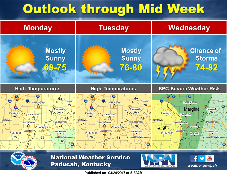
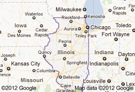
Over The Next 48 Hours in Illinois
(Click any thumbnail below to view full-sized image) or To Scroll click here
SPC National:
 |
NWS Northwest:
 |
NWS Northeast:
 |
NWS Central:
 |
NWS Southwest:
 |
NWS Southeast:
 |
NWS Water/Precip:
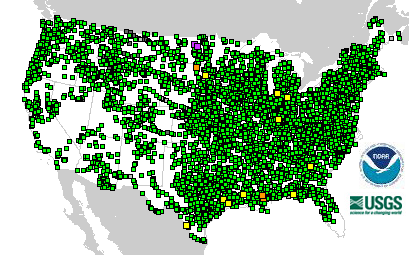
USGS River Obs:
 |
NWS River F-Casts:
 |
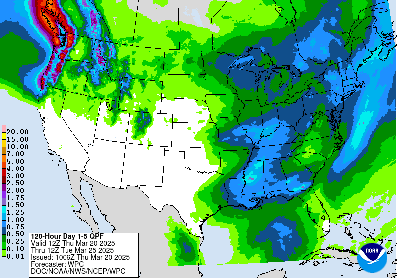
NWS 5-Day Precip Forecast:
 |
NWS Hazards:
 |
Forecast Maps
NWS Weather Story
NWS Northwest:
 |
NWS Northeast(Chicago)
 |
NWS Central:
 |
NWS Southwest:
 |
NWS Southeast:
 |
Temperature
Next 12 Hrs
 |
Next 24 Hrs
 |
Next 48 Hrs
 |
All
 |
Weather Conditions
Next 12 Hrs
 |
Next 24 Hrs
 |
Next 36 Hrs
 |
Next 48 Hrs
 |
All
 |
Convective Outlook
Next 12 Hrs
 |
Next 24 Hrs
 |
Next 36 Hrs
 |
Next 48 Hrs
 |
All
 |
Apparent Temperature
Next 12 Hrs
 |
Next 24 Hrs
 |
Next 36 Hrs
 |
Next 48 Hrs
 |
All
 |
Probability of Precipitation
Next 12 Hrs
 |
Next 24 Hrs
 |
Next 36 Hrs
 |
Next 48 Hrs
 |
All
 |
Winds
Next 12 Hrs
 |
Next 24 Hrs
 |
Next 36 Hrs
 |
Next 48 Hrs
 |
All
 |
Sky Condition
Next 12 Hrs
 |
Next 24 Hrs
 |
Next 36 Hrs
 |
Next 48 Hrs
 |
All
 |
Hazardous Weather
Next 12 Hrs
 |
Next 24 Hrs
 |
Next 36 Hrs
 |
Next 48 Hrs
 |
All
 |
Weather Conditions: National
Next 12 Hrs
 |
Next 24 Hrs
 |
Next 36 Hrs
 |
Next 48 Hrs
 |
All
 |
Forecast Maps
Now
 |
Next 12 Hrs
 |
Next 24 Hrs
 |
Next 36 Hrs
 |
All
 |
Event monitors
Hourly AQI
 |
Fluview
 |
Earthquakes
 |
CoCoRaHS
 |
East Pacific Marine Forecast
 |
Atlantic Marine Forecast
 |
U.S. Drought Monitor
 |
U.S. Climate Data
 |
Fire weather
 |
Soil Moisture
 |
Temperature Outlook
 |
Precipitation Outlook
 |
For All States and the US

NWS NDFD Forecast Maps (Conus & by State)...
OR Click Day 1
OR Click Day 2
OR Click Day 3
OR Click here for a Point Ag. Lawn & Garden Forecast

Ag Weather Center, Department of Biosystems & Agricultural Engineering, University of Kentucky