| NWS forecast for any "City, St" or Zipcode | |
Current Conditions
Forecasts
Satellite Imagery
Radar Imagery
Winter Wx
Fire Weather
Long Range Outlooks
Other
Kentucky Climate
Climatology
Pests/Disease
Ag/Wx Calculators
Hydrology Info.
Other UKAWC Sites
Severe Wx
Tropical Wx
Kentucky Ag Wx
Drought
National Wx
International Wx
Learning About Wx
About UKAWC
Sun, Moon & Planets UKAWC Home
 |
Kentucky Climate Summaries |
Home| Current Conditions| Forecasts| Satellite| Radar| Media| Outlooks| Drought| Severe| Tropical Wx| Winter Wx| Climatology| Calc| Fire| NWS| Historical| About Us| Spring Ag-Update| Glance| GlanceClim
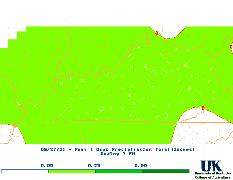
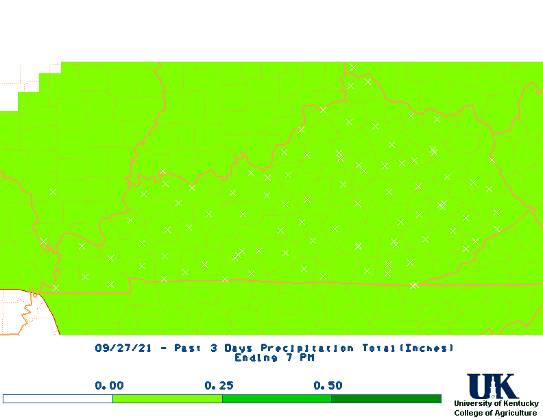
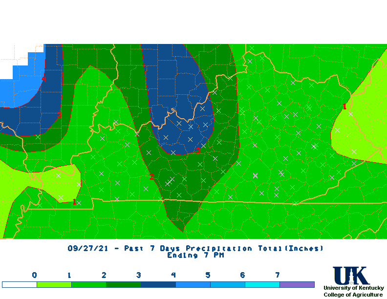
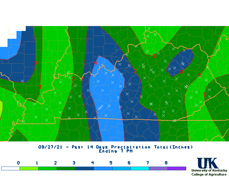
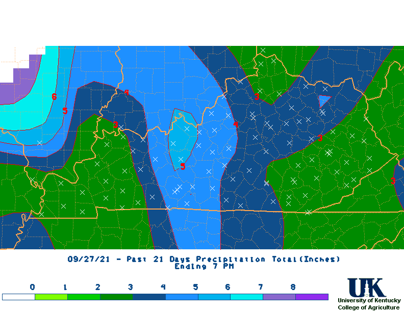
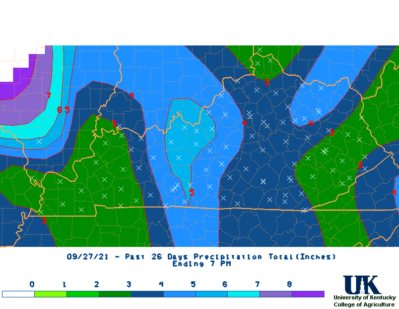
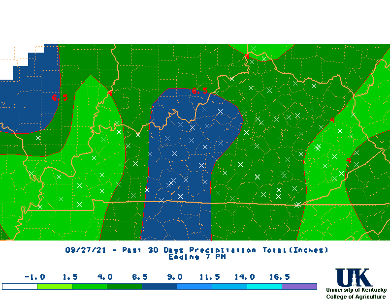
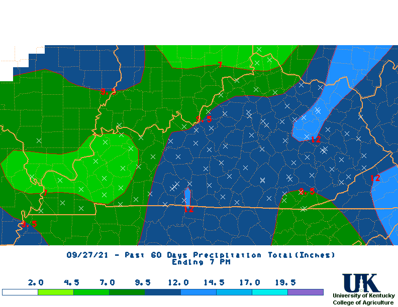
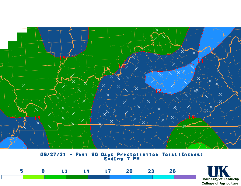
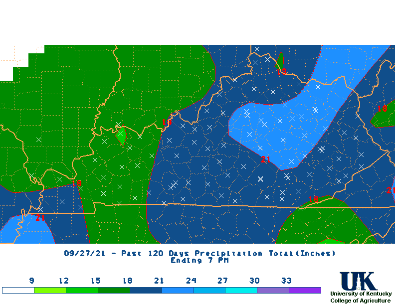
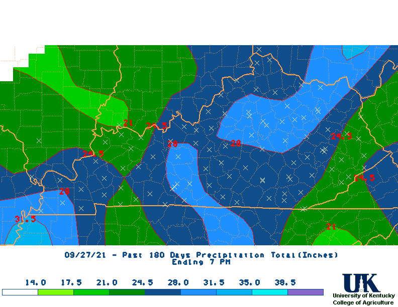
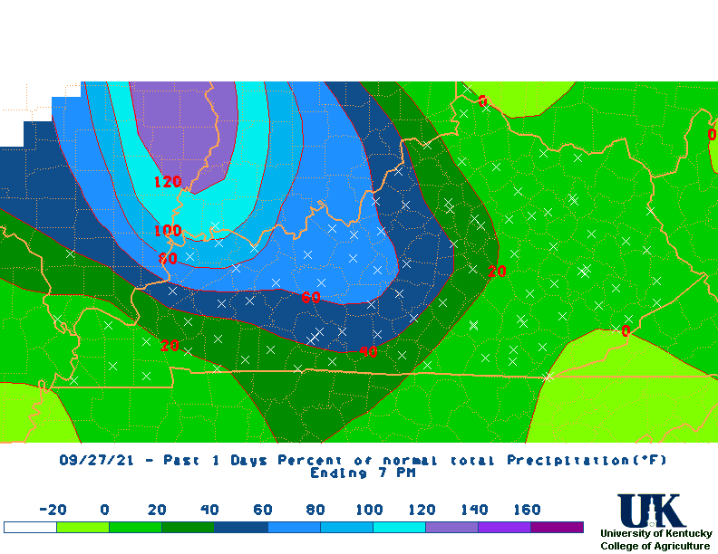
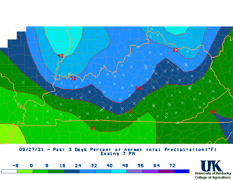
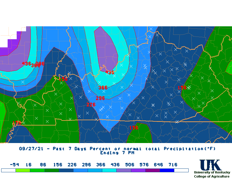
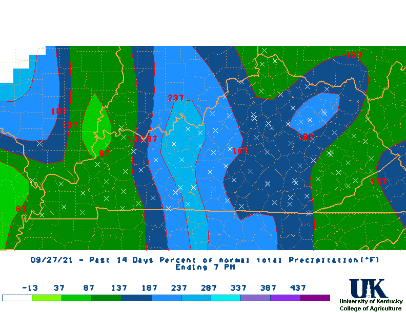
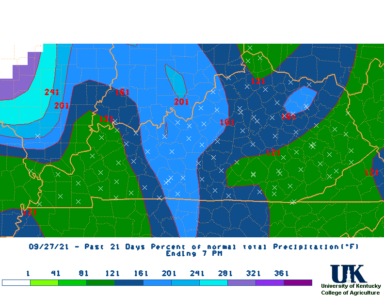
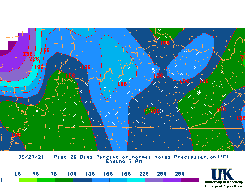
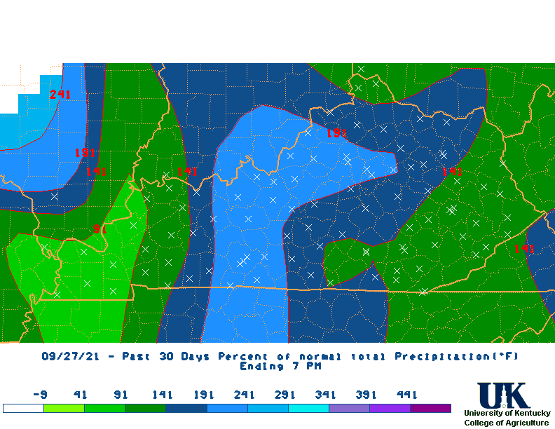
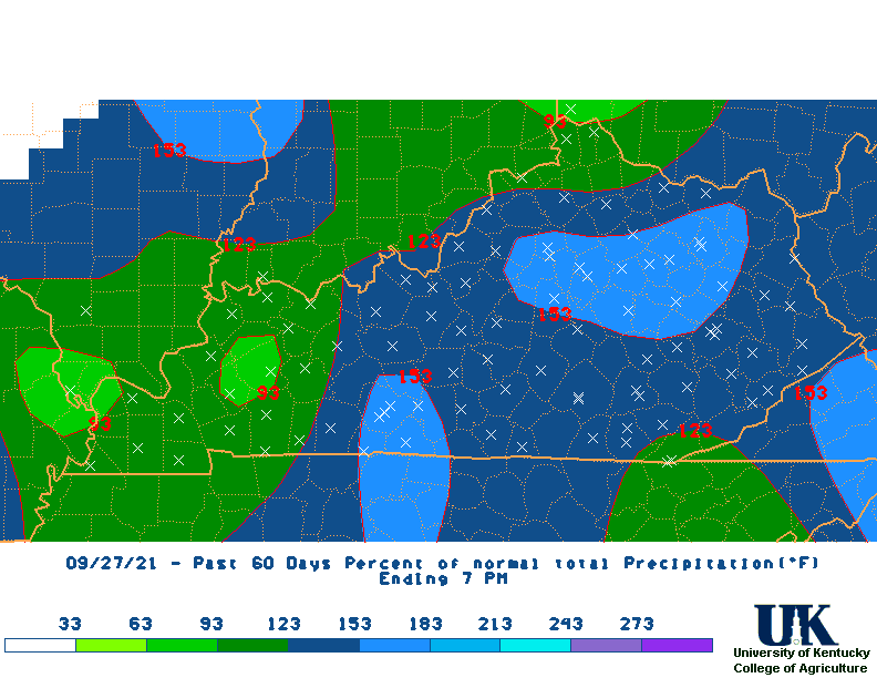
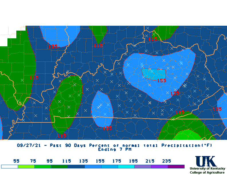
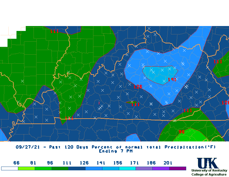
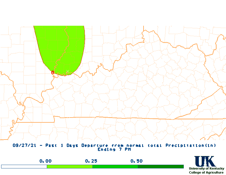
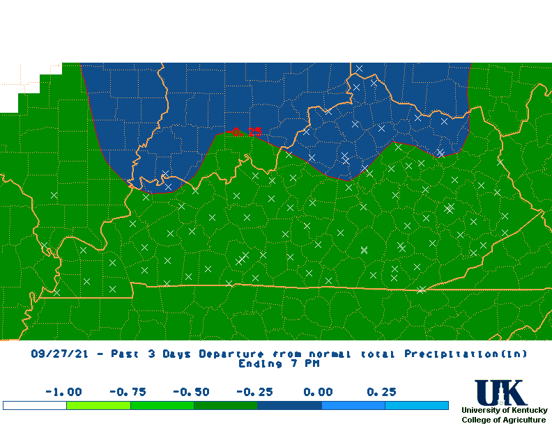
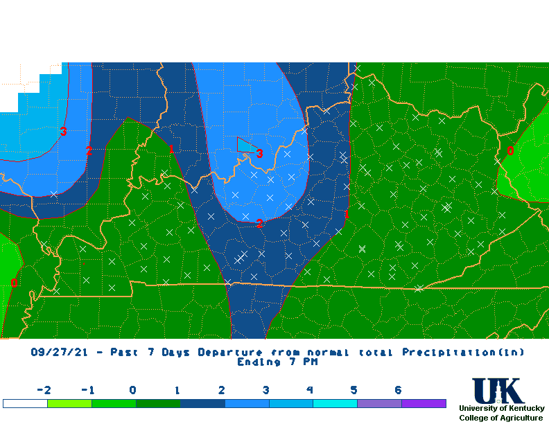
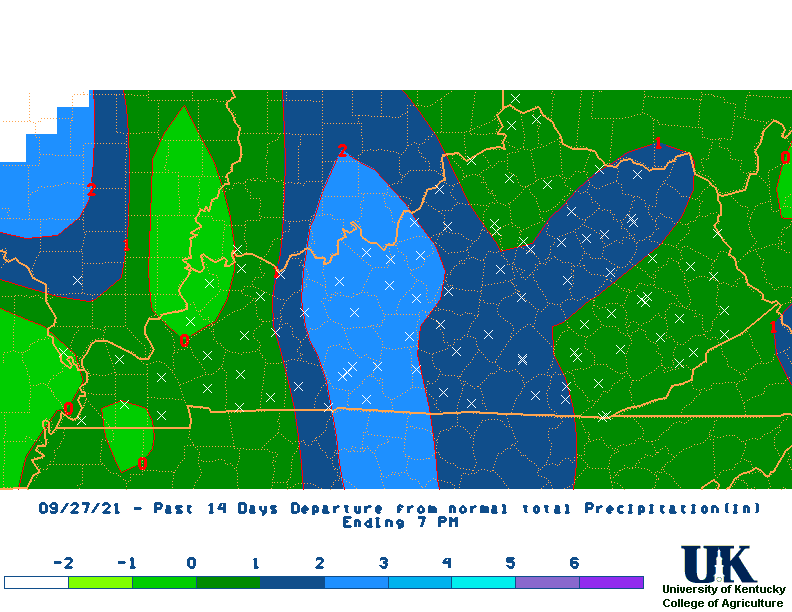
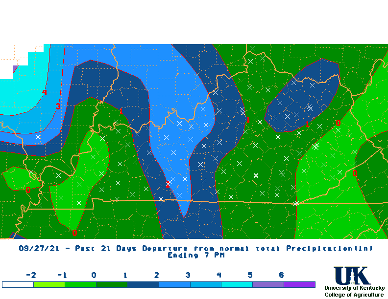
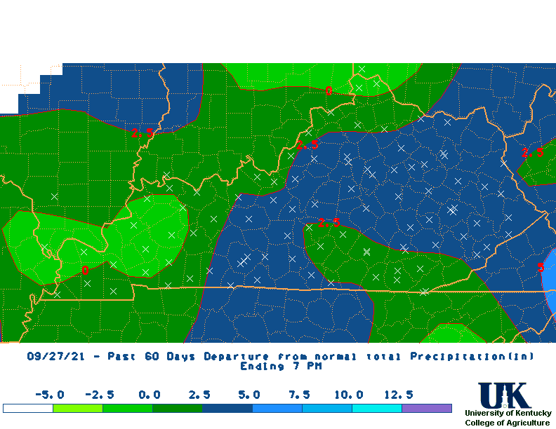
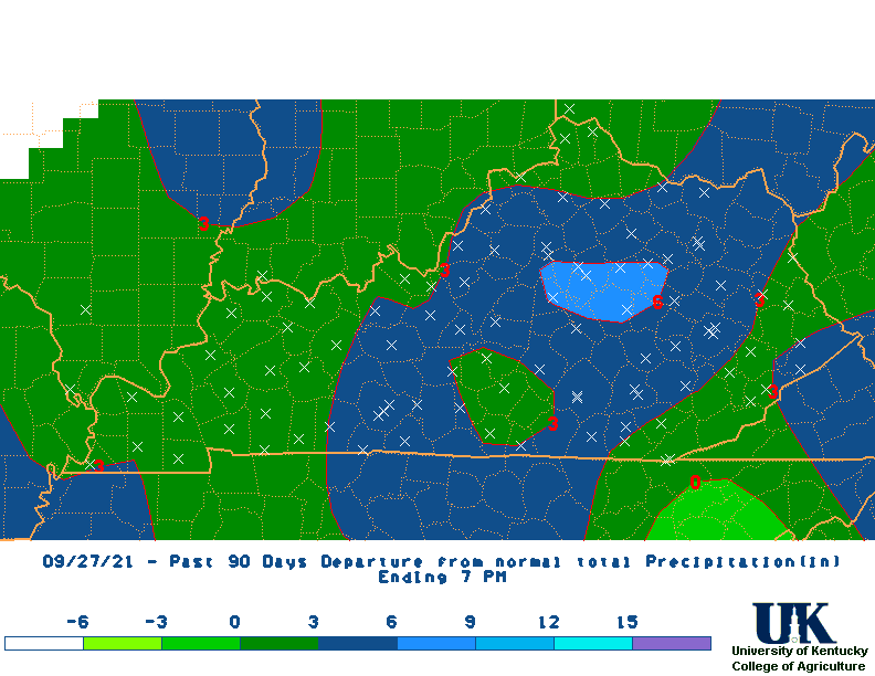
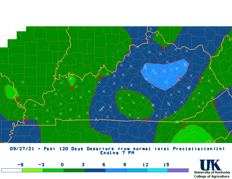
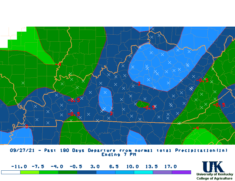
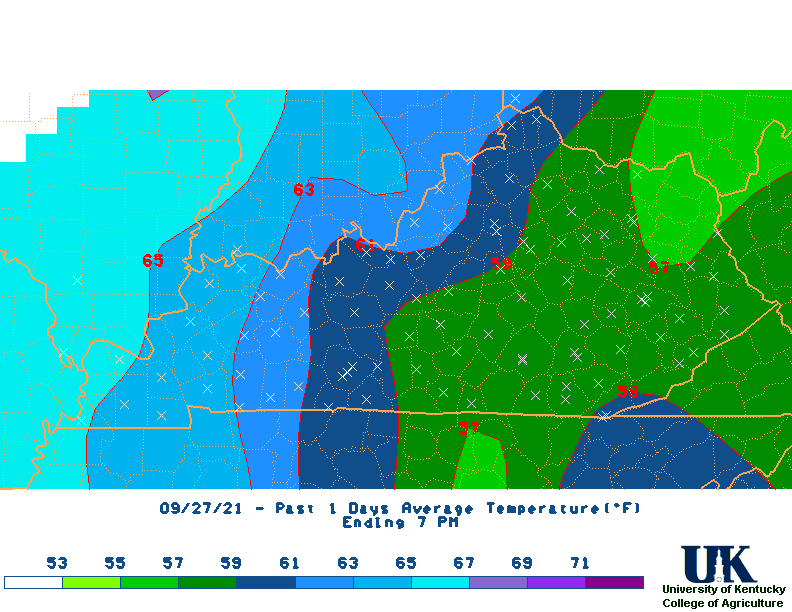
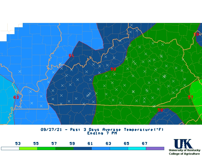
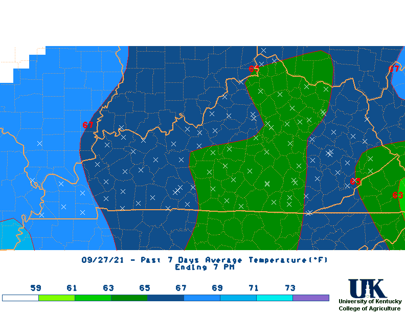
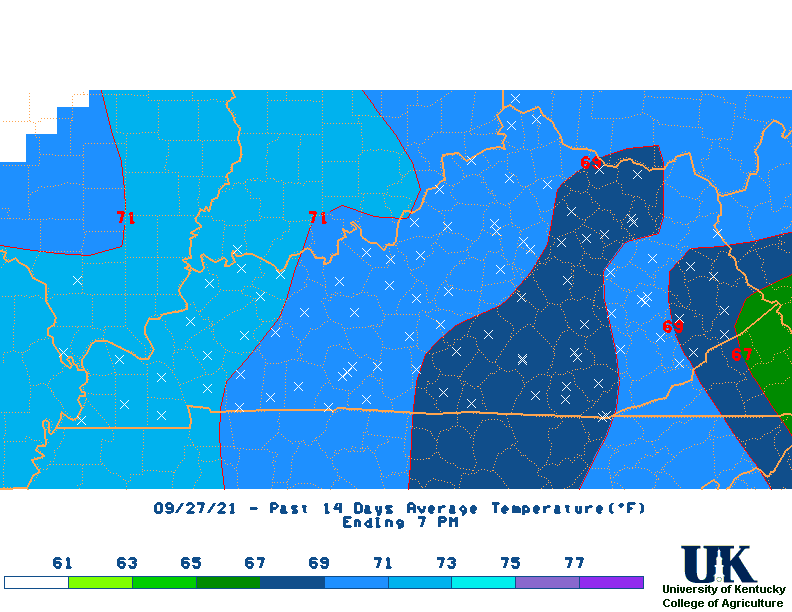
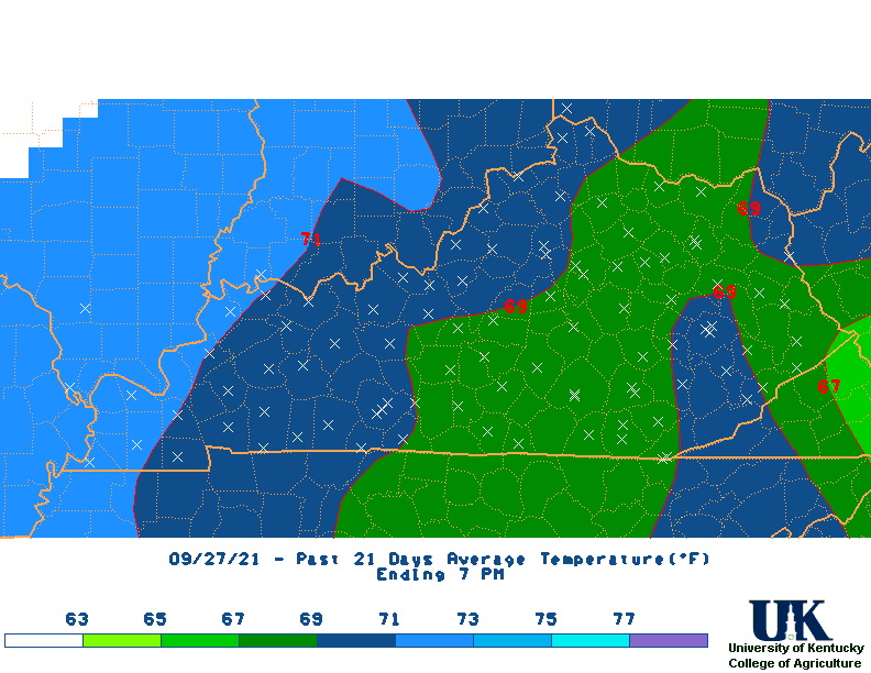
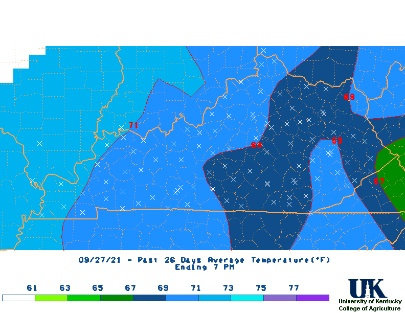
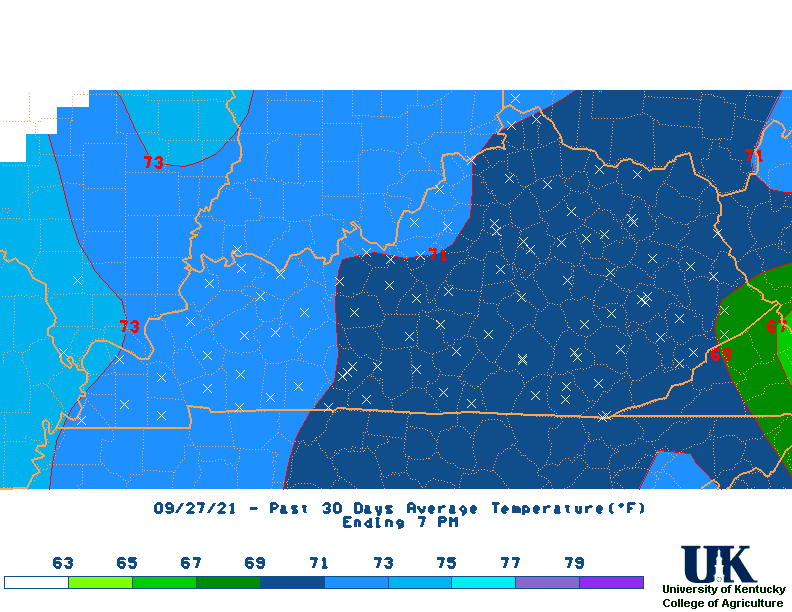
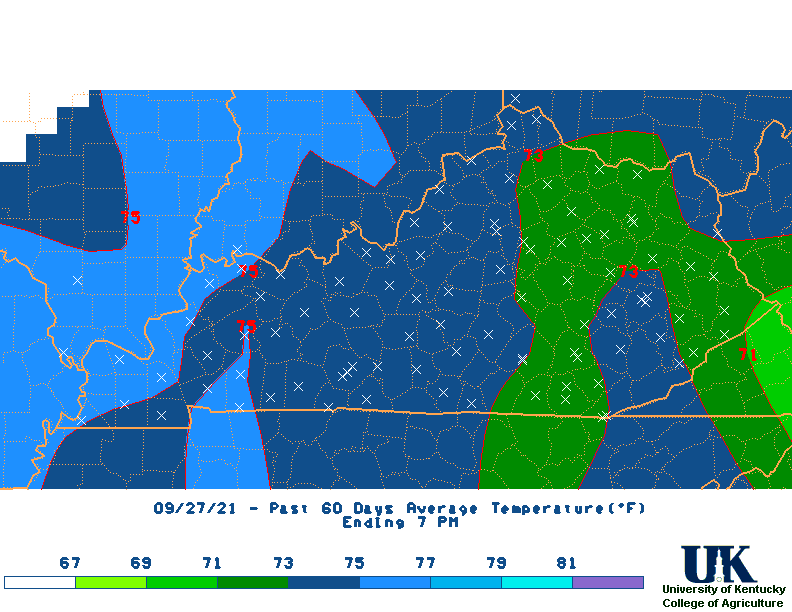
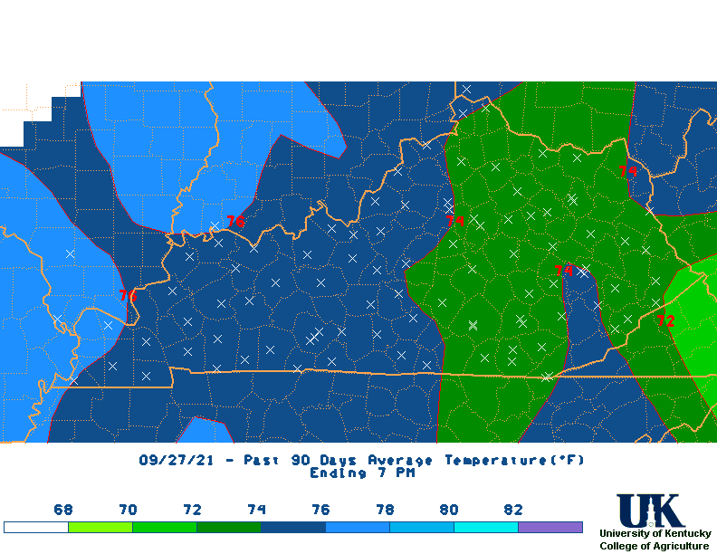
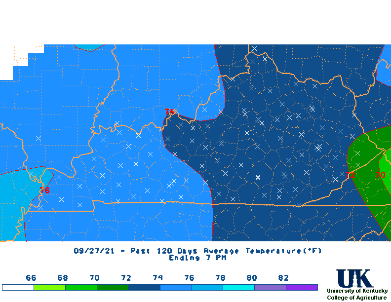
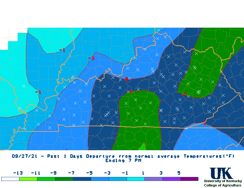
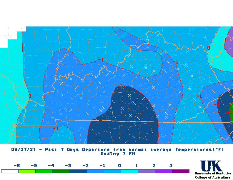
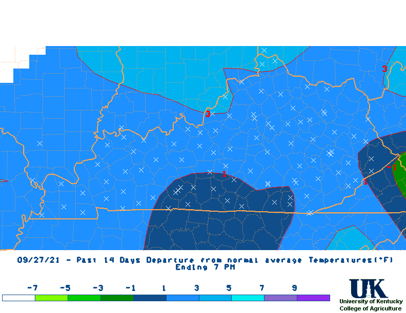
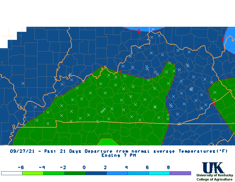
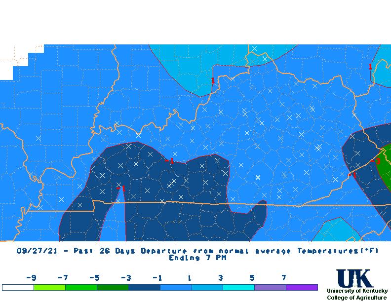
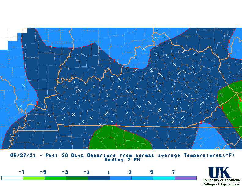
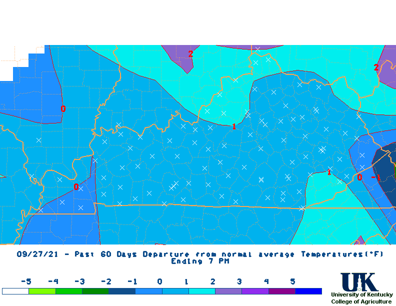
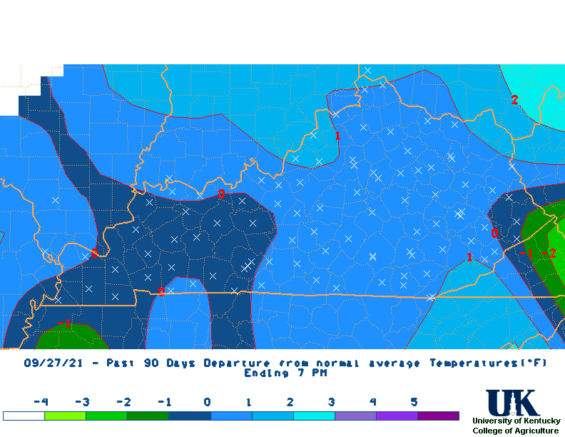
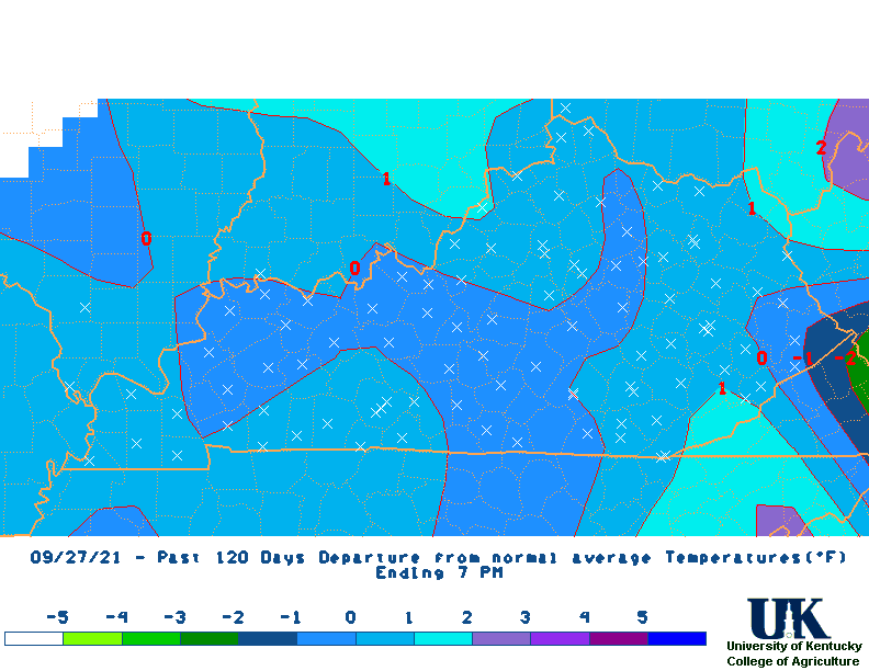
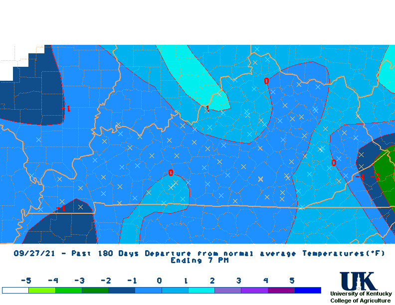
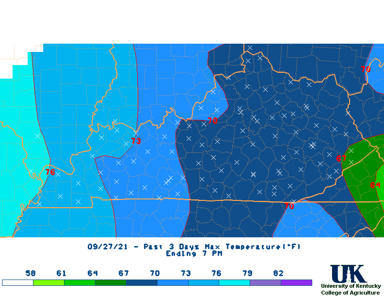
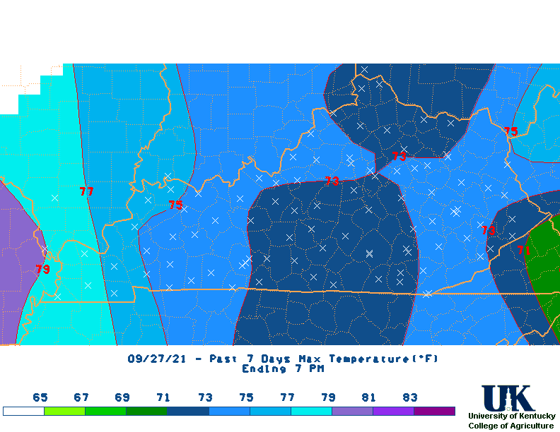
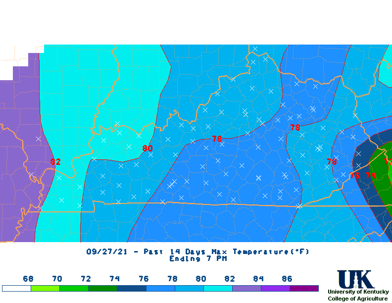
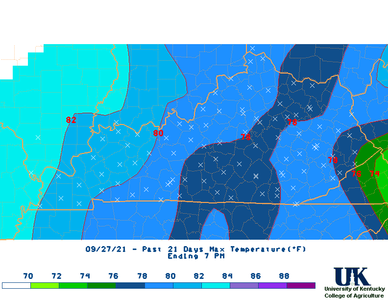
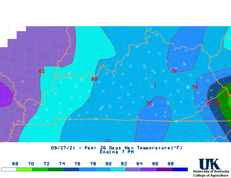
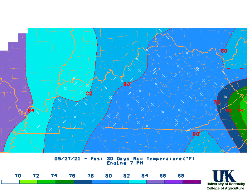
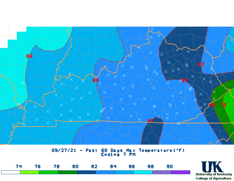
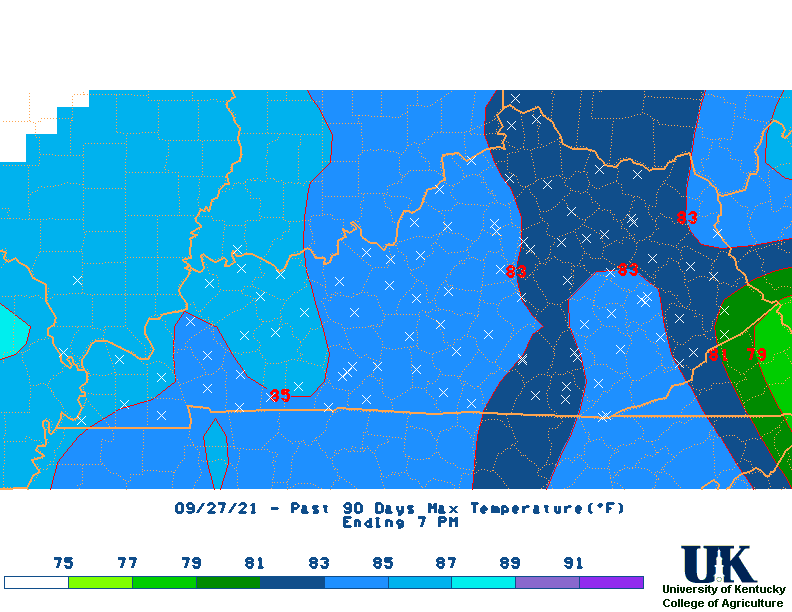
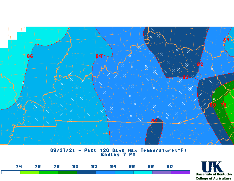
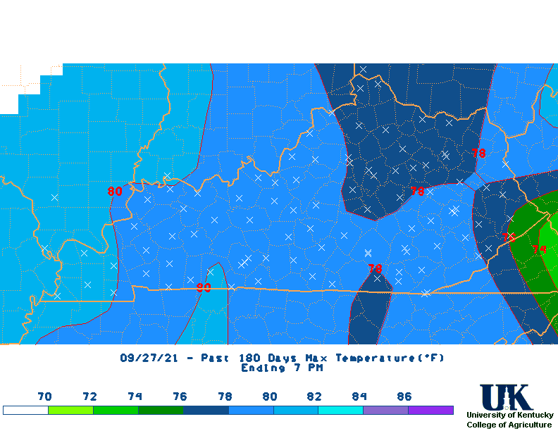
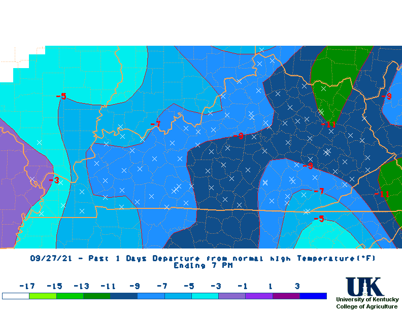
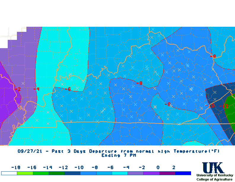
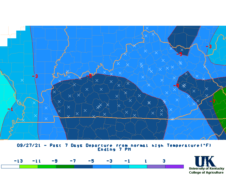
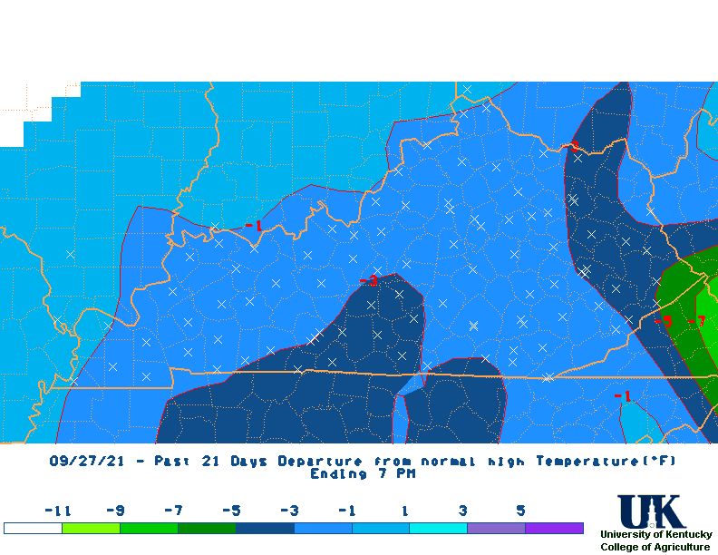
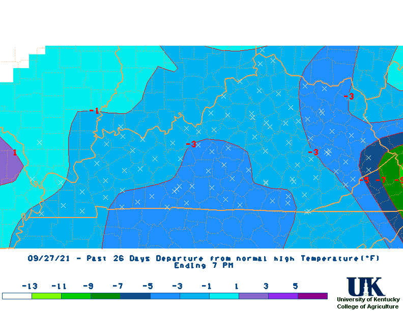
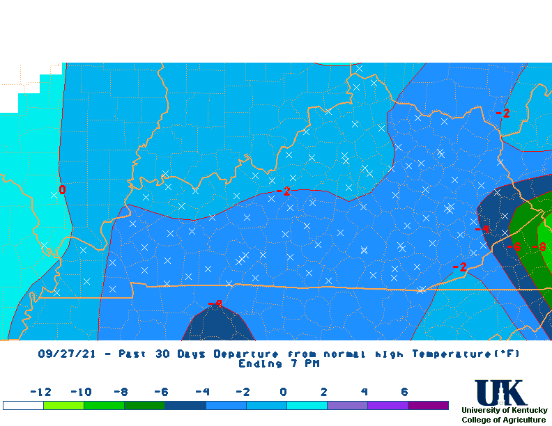
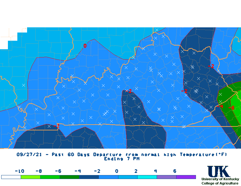
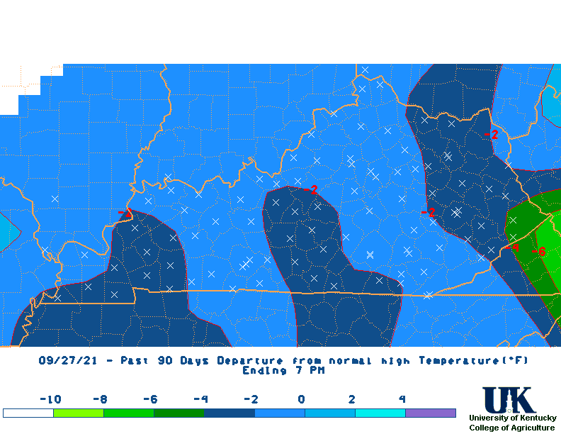
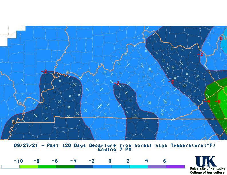
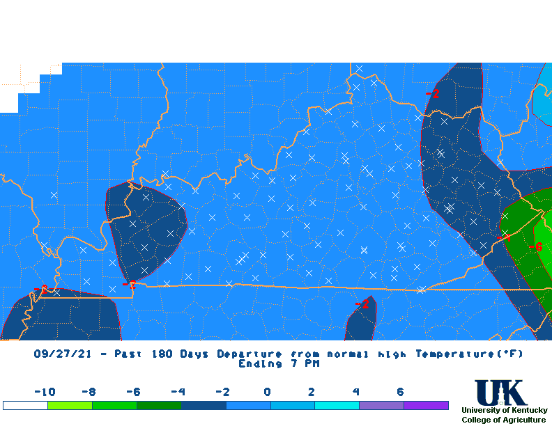
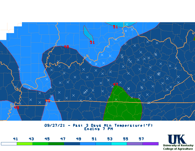
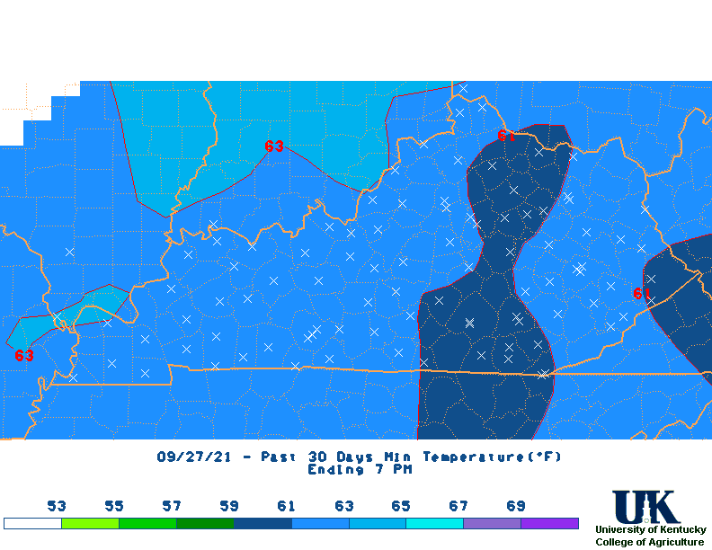
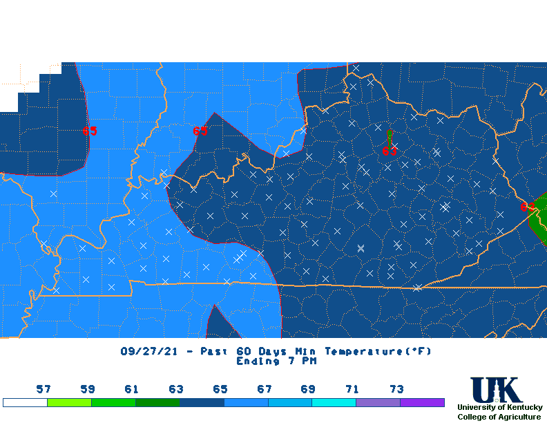
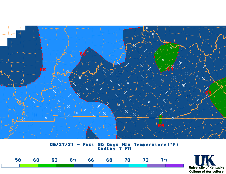
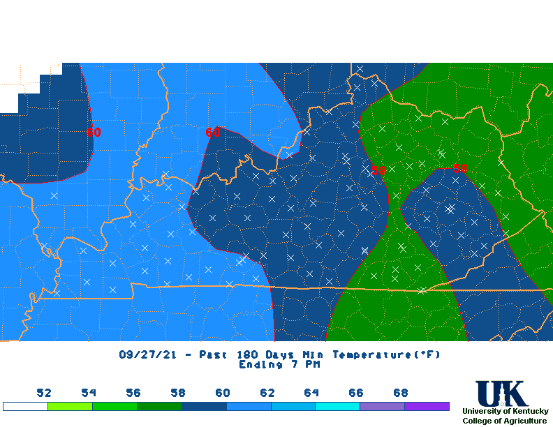
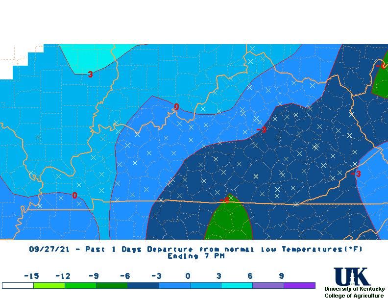
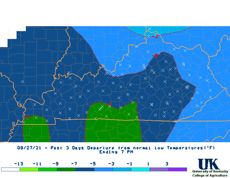
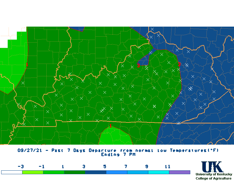
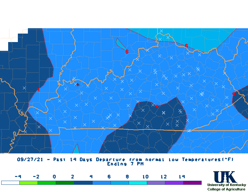
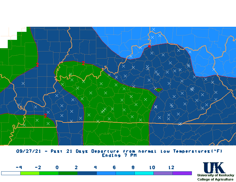
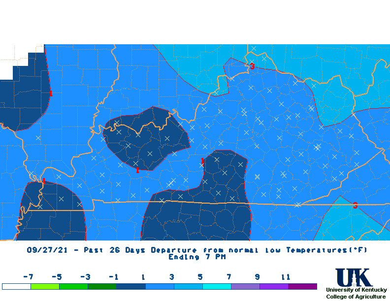
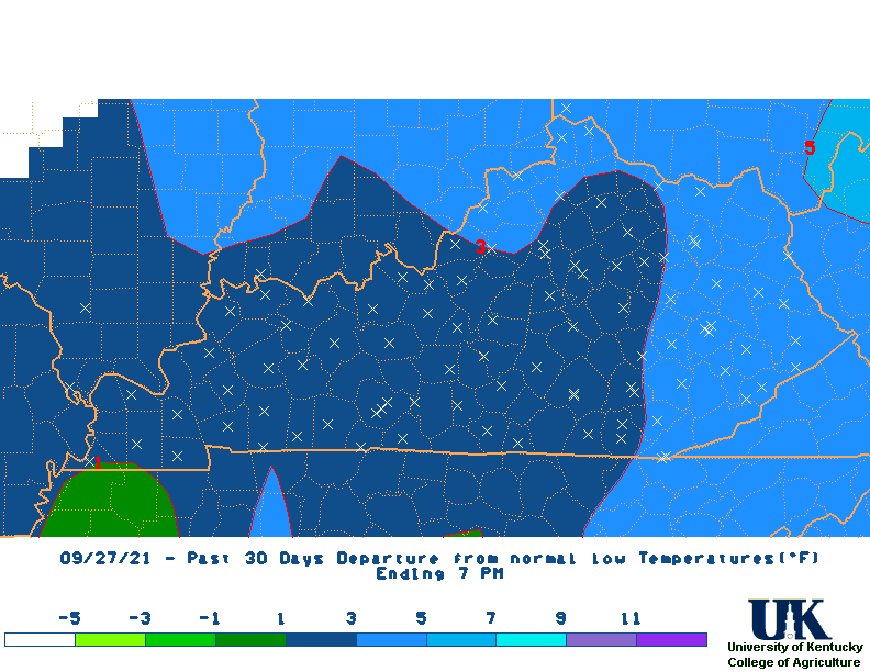
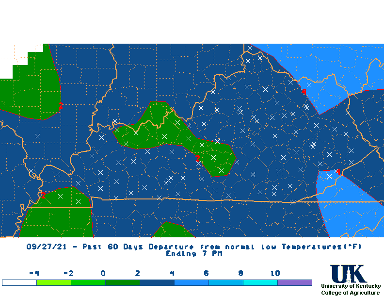
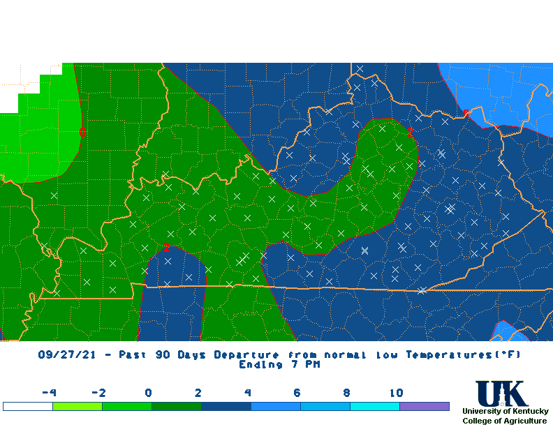
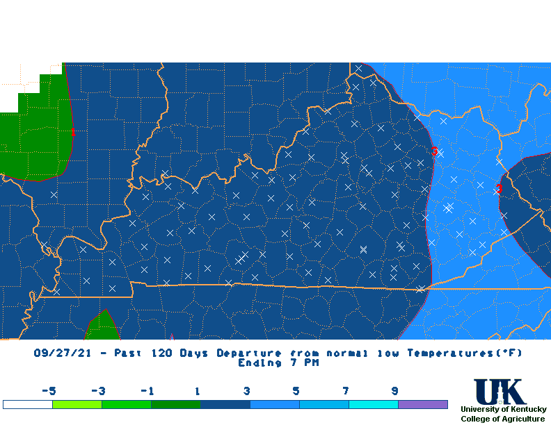
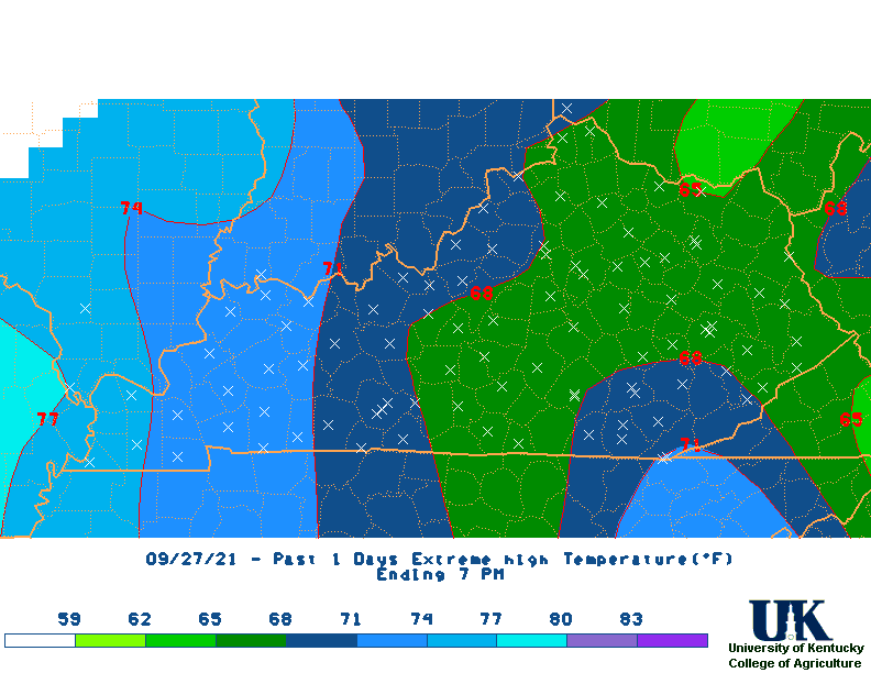
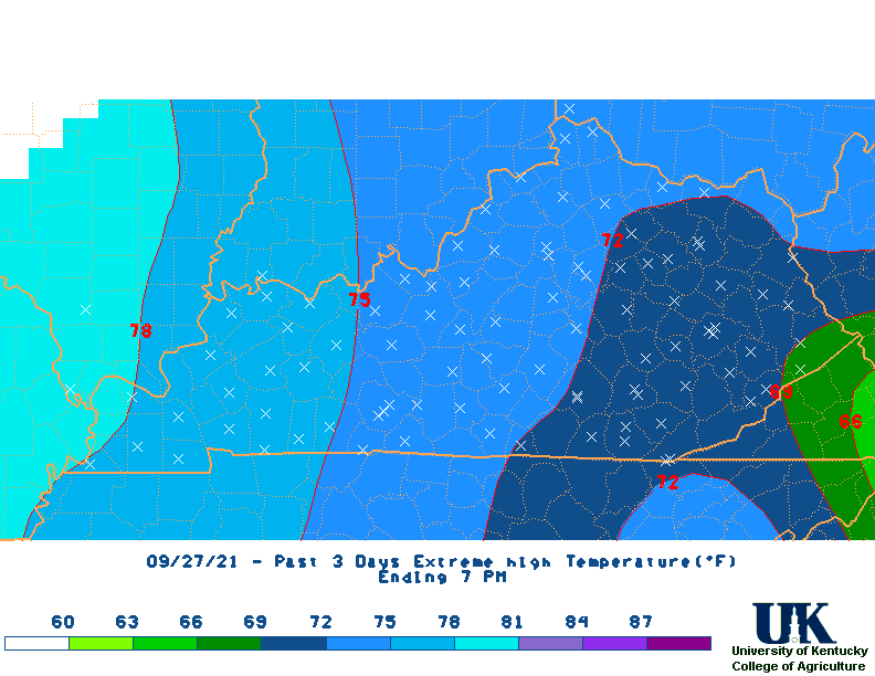
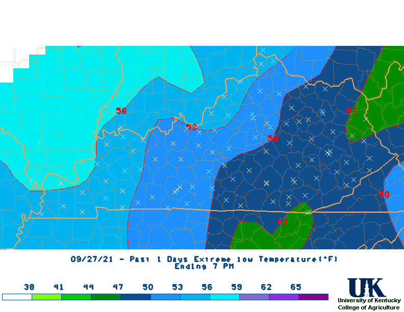
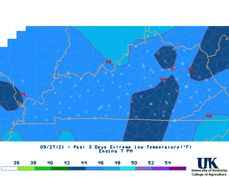
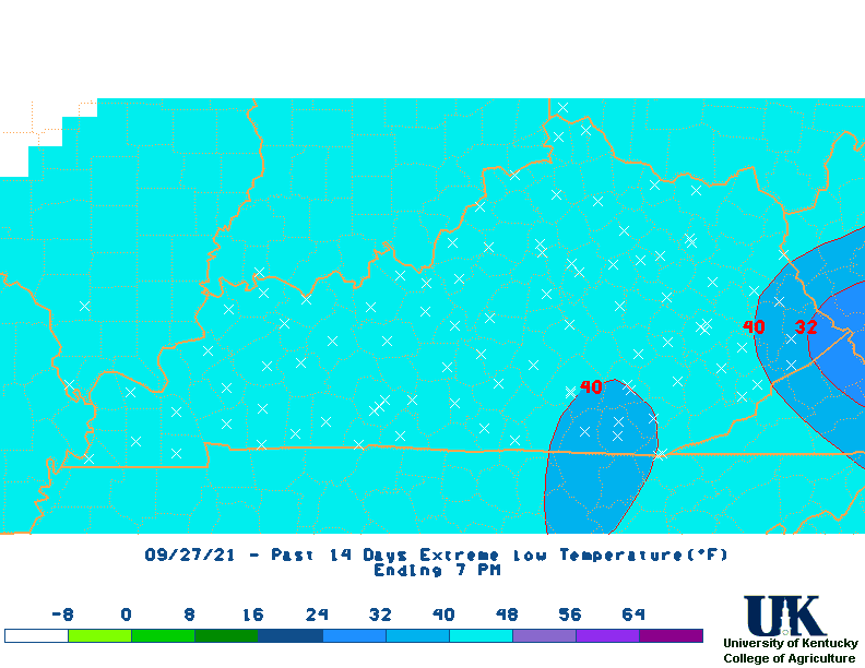
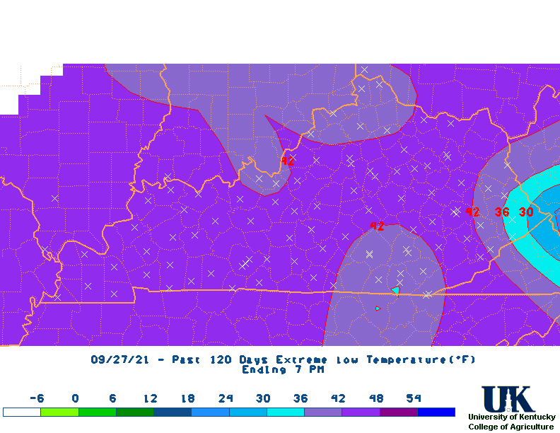
LAST n DAYS   1      3      7     14     21     30     60     90    120    180    360
AVE TEMP     72     70     68     67     68     65     61     58     54     49     58
DEPART.       6      4      2      2      4      3      4      5      5      4      1
PRECIP     0.00   0.37   1.19   3.75   5.17   5.36   9.59  12.70  16.89  22.79  42.39
DEPART.   -0.15  -0.10   0.04   1.38   1.56   0.18  -0.12  -1.51  -1.03  -3.11  -7.15
%NORM         0     79    104    158    143    103     99     89     94     88     86
West Climate Division:
LAST n DAYS   1      3      7     14     21     30     60     90    120    180    360
AVE TEMP     73     71     69     69     69     66     63     59     55     50     60
DEPART.       5      3      2      3      4      2      4      5      5      4      2
PRECIP     0.00   0.47   1.79   5.22   6.65   7.06  11.01  12.96  16.68  22.56  44.33
DEPART.   -0.15   0.01   0.67   2.85   2.95   1.64   0.83  -1.74  -1.61  -3.72  -5.14
%NORM         0    102    160    220    180    130    108     88     91     86     90
Central Climate Division:
LAST n DAYS   1      3      7     14     21     30     60     90    120    180    360
AVE TEMP     72     70     68     67     68     65     61     58     54     49     58
DEPART.       5      3      1      1      3      2      2      4      4      3      0
PRECIP     0.00   0.27   0.89   3.82   6.03   6.17  10.39  13.57  18.35  24.21  43.95
DEPART.   -0.16  -0.22  -0.32   1.32   2.21   0.71   0.32  -1.23  -0.53  -3.25  -7.77
%NORM         0     55     74    153    158    113    103     92     97     88     85
Bluegrass Climate Division:
LAST n DAYS   1      3      7     14     21     30     60     90    120    180    360
AVE TEMP     71     69     67     66     67     64     59     56     52     47     57
DEPART.       6      4      2      2      4      3      3      4      5      3      1
PRECIP     0.00   0.28   1.07   2.86   3.91   3.98   9.03  12.77  16.55  22.29  41.12
DEPART.   -0.15  -0.19  -0.08   0.48   0.32  -1.11  -0.47  -0.93  -0.58  -2.13  -6.29
%NORM         0     60     93    120    109     78     95     93     97     91     87
East Climate Division:
LAST n DAYS   1      3      7     14     21     30     60     90    120    180    360
AVE TEMP     71     68     66     66     67     64     60     57     54     49     58
DEPART.       6      3      2      3      5      3      4      5      6      5      2
PRECIP     0.01   0.45   1.00   3.10   4.11   4.21   7.92  11.50  16.00  22.11  40.17
DEPART.   -0.14  -0.01  -0.10   0.87   0.78  -0.56  -1.17  -2.12  -1.37  -3.32  -9.40
%NORM         7     98     91    139    123     88     87     84     92     87     81
| Climate Tables | |||||||||||||
| Climate Narratives | |||||||||||||
| Rainfall Total Maps | |||||||||||||
| Percent of Normal Rainfall Maps | |||||||||||||
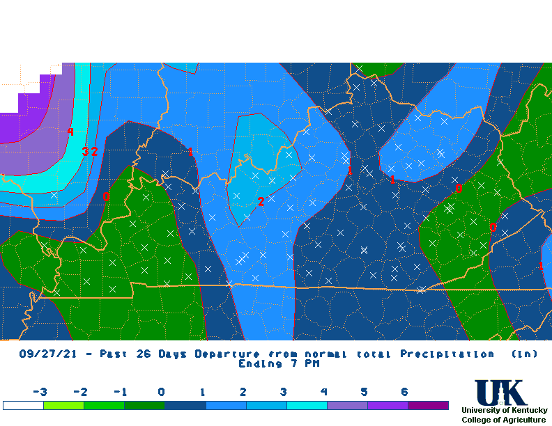
| Rainfall Departure Maps | |||||||||||||
| Average Temperature Maps | |||||||||||||
| Average Temperature Departure Maps | |||||||||||||
| Max Temperature Maps | |||||||||||||
| Max Temperature Departure Maps | |||||||||||||
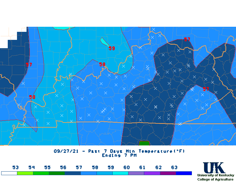
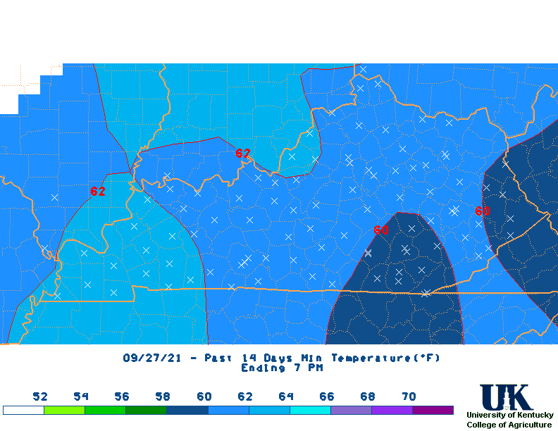
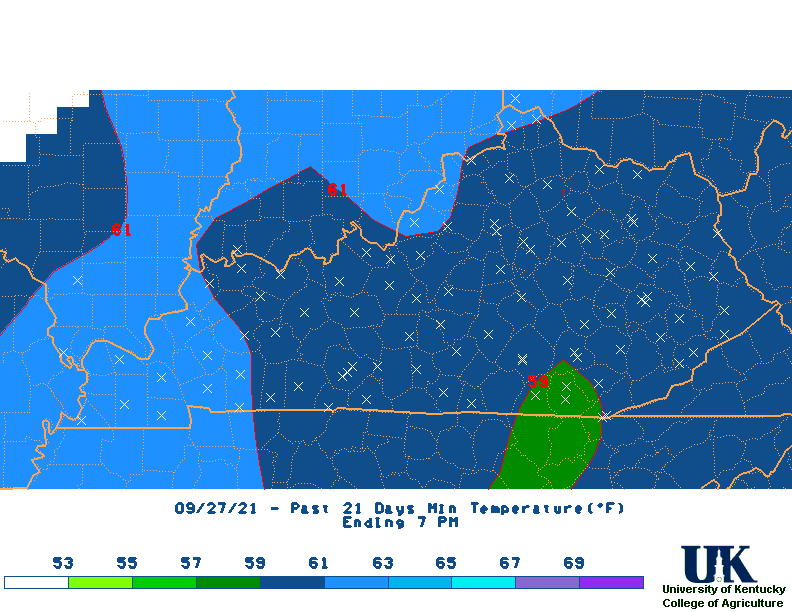
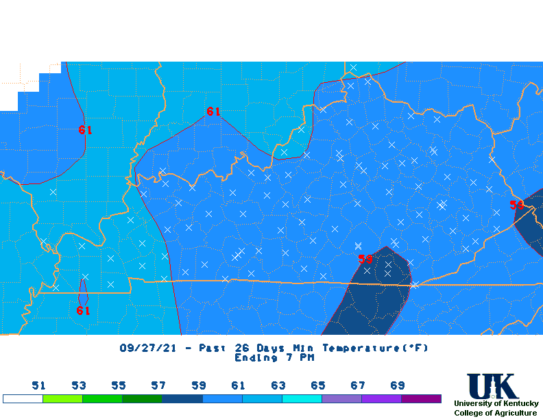
| Min Temperature Maps | |||||||||||||
| Min Temperature Departure Maps | |||||||||||||
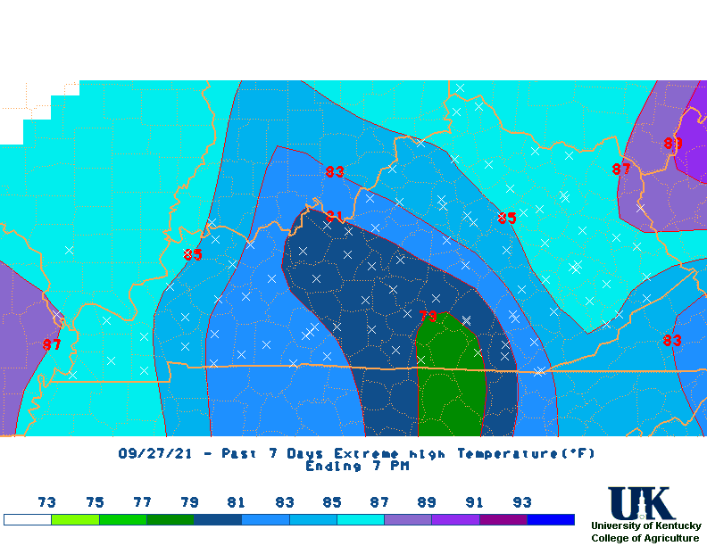
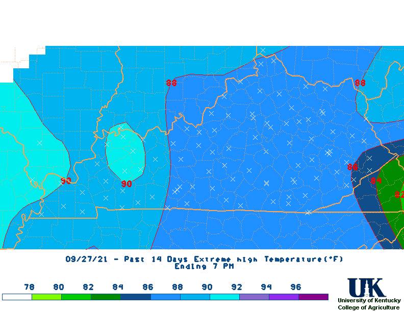
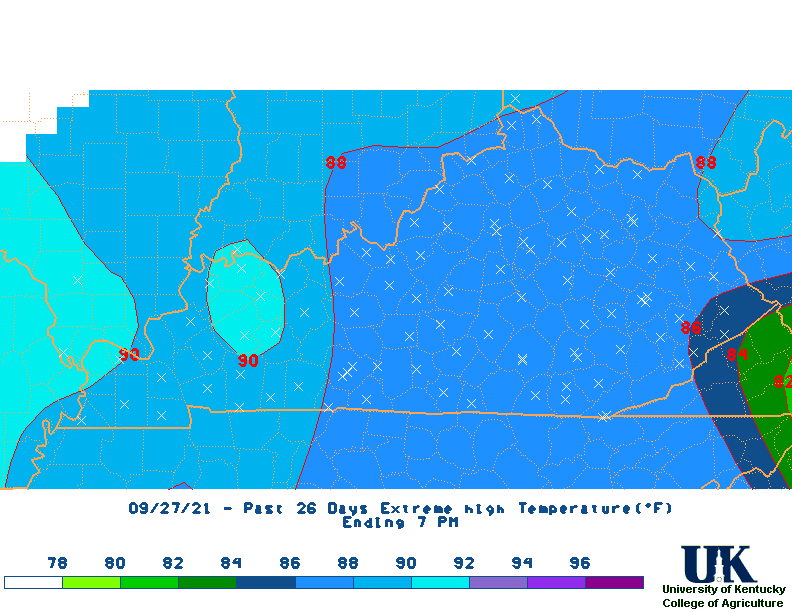
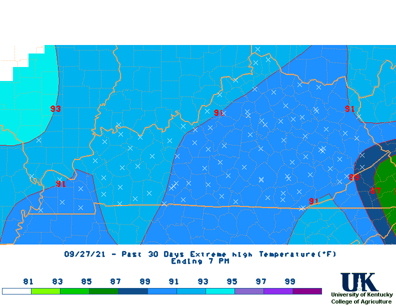
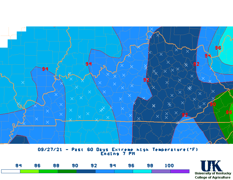
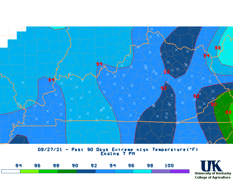
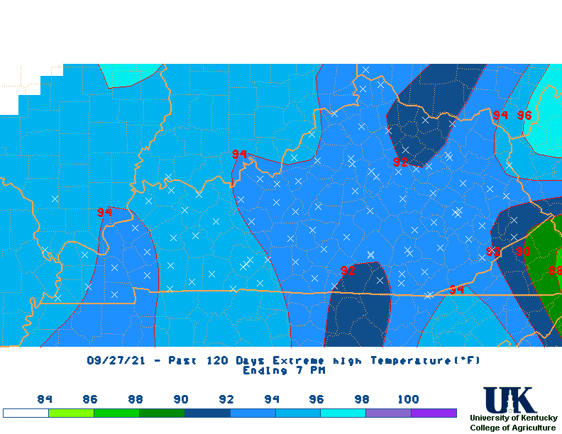
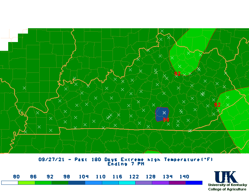
| High Max Temperature Maps | |||||||||||||
| Low Min Temperature Maps | All Maps |
* M2D = Month-to-Date